
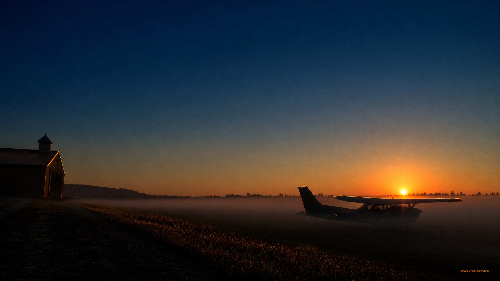
What Is Radiation Fog? Why Calm, Clear Nights Hide the Worst IMC
Radiation fog is a ground-based fog that forms on clear, calm nights when the earth radiates its heat away into space, the ground cools, and the air touching it chills down to its dew point so the moisture in it condenses into a shallow layer of fog. It needs three ingredients working together — clear skies, light or calm wind, and moist air near the surface — which is exactly why it loves the quiet hours just before sunrise. Pilots also call it ground fog, and it’s the kind most likely to surprise you on an otherwise perfect-looking morning.
- Radiation fog forms from the ground up. On a clear, calm night the ground radiates heat into space, cools, and chills the air in contact with it down to its dew point — so the fog grows upward from the surface rather than rolling in from somewhere else.
- It needs three ingredients. Clear skies (so heat can radiate away), light or calm wind (so the cooling stays near the surface), and moist air near the ground (a small temperature/dew-point spread). Take away any one and you usually don’t get it.
- The temperature/dew-point spread is your warning gauge. When temperature and dew point converge to within about 2°C (4°F) on a clear, calm evening, fog formation becomes likely overnight. A spread that’s shrinking at 8 PM is your bedside alarm for dawn conditions.
- It’s a land animal. Radiation fog forms over land, not water, because water doesn’t cool fast enough overnight to drive it. Low ground — valleys, river bottoms, that one end of the runway — collects the coldest, dampest air first.
- It usually burns off after sunrise. Once the sun heats the ground, the ground warms the air, the spread opens back up, and the fog lifts or dissipates — but “usually” and “on your schedule” are not the same thing.
- Wind is the wildcard. Dead calm keeps it shallow; a light wind of a few knots can stir it deeper and worse; a stronger wind mixes it out entirely. Don’t assume calm means safe.
- Fog type tells you whether to wait or scrub. Radiation fog burns off — plan to wait it out. Advection fog lasts as long as the wind keeps blowing — plan to divert or stay put.
WHAT’S IN THIS GUIDE
- 1What is radiation fog?
- 2How does radiation fog form?
- 3What three conditions does radiation fog need?
- 4Why does radiation fog only form over land?
- 5What’s the difference between radiation fog and advection fog?
- 6What are the other types of fog a pilot should know?
- 7How do you predict radiation fog before a flight?
- 8How do you read radiation fog in a METAR?
- 9When does radiation fog burn off?
- 10Why does radiation fog matter in the cockpit?
- 11PLT Study Guide
- 12Frequently Asked Questions
What is radiation fog?
Radiation fog is a ground-based fog that forms when the earth’s surface radiates its heat away on a clear, calm night, cools off, and chills the layer of air touching it down to its dew point — at which point the water vapor in that air condenses into a shallow blanket of fog. It is the most common type of fog pilots deal with, and the FAA describes its cause as “rapid ground cooling due to terrestrial radiation” (Pilot’s Handbook of Aeronautical Knowledge, FAA-H-8083-25C, Chapter 12). You’ll also hear it called ground fog.
The name throws a lot of students. “Radiation” here has nothing to do with anything nuclear. It refers to terrestrial radiation — the simple physics that the ground, after soaking up the sun’s heat all day, gives that heat back to the sky at night as infrared energy. On a clear night with no cloud blanket to trap it, that heat escapes freely into space and the ground cools fast.
Here’s the picture that makes it click. The ground is the refrigerator and the air right above it is the food. The ground gets cold, the air sitting on it gets cold by contact, and once that air can’t hold its moisture anymore — once it hits its dew point — the moisture comes out as tiny suspended water droplets. That’s fog. It starts as a thin film over the coldest ground and builds upward, which is why radiation fog so often shows up as a shallow layer you can see over from a hill or a tower while the surface sits socked in.
The PHAK covers fog formation in Chapter 12 (atmospheric stability and moisture), and the Aviation Weather Handbook (FAA-H-8083-28) goes deeper on each fog type. For a student pilot, the one-sentence version is the one to carry: clear, calm, and moist near the ground equals radiation fog by morning.
How does radiation fog form?
Radiation fog forms through a cooling process, not a moisture-adding process. The air doesn’t get wetter — it gets colder until the moisture it already holds has nowhere to go but out. On a clear, calm night the ground radiates heat to space, the ground cools, the air in contact with the ground cools by conduction, and when that air reaches its dew point the vapor condenses into fog. That’s the whole chain.
Walk it one link at a time. During the day the sun heats the ground and the ground heats the air. After sunset the engine reverses. With clear skies, terrestrial radiation pours off the surface unobstructed — clouds would act like a blanket and slow it down, but a clear sky lets the heat run. The ground temperature drops, sometimes well below the air temperature a few feet up.
Now the air does the cooling. The thin layer of air actually touching the cold ground loses its heat by conduction and chills. If the wind is dead calm, only that bottom film cools and you get a very shallow fog — or just heavy dew and frost, because calm air doesn’t stir the cooling through much depth. If there’s a light breeze — think five to ten mph — that gentle stirring mixes the cooling through a deeper layer of air without breaking it up, and you can get a thicker, more stubborn fog. The NWS documents that optimal fog-producing wind is roughly 5–10 mph; dead calm tends to produce dew or frost rather than true fog. That’s the counterintuitive part students miss: a little wind can make radiation fog worse, not better.
The trigger is the dew point. Cooling air can only get so cold before it’s saturated. The moment air temperature meets dew point, relative humidity hits 100% and condensation begins. Because the cooling is strongest right at the surface and weakens with height, the fog forms low and grows up — the opposite of a cloud, which forms when rising air cools at altitude.
There’s one more ingredient students overlook: condensation nuclei. Water vapor needs a tiny particle to condense onto — dust, soot, pollen, sea salt. Over land, especially near populated areas, nuclei are plentiful, which is another reason radiation fog is a land phenomenon. Once the temperature hits the dew point and nuclei are available, the fog comes fast.
What three conditions does radiation fog need?
Radiation fog needs three conditions present at the same time: clear skies, light or calm wind, and moist air near the surface. The PHAK (Ch. 12) frames the full set as “high humidity during early evening, cool cloudless night with light winds, and favorable topography.” Clear skies let the ground radiate heat away efficiently. Light or calm wind keeps the cooling concentrated near the ground. Moist air — a small temperature/dew-point spread — means the air doesn’t have to cool much before it saturates. Remove any one ingredient and radiation fog usually won’t form.
Think of it as a three-legged stool. Knock out one leg and the whole thing falls over, which is actually good news for prediction — you only need one missing ingredient to rule it out.
| Condition | Required state | Why |
|---|---|---|
| Sky cover | Clear (no clouds) | Clouds trap outgoing radiation; ground can’t cool fast enough |
| Wind | Light (5–10 mph); dead calm = dew/frost | Light wind keeps cooled surface air in place; strong wind mixes it out |
| Humidity | High (temp/dew-point spread ≤ 2°C) | Less cooling needed to reach saturation |
| Terrain | Valley, low-lying, river bottom | Cold air drains downhill and pools |
| Time | Night through dawn | Solar heating absent; ground radiates freely |
| Surface | Land (not open water) | Land loses heat fast; water moderates |
The wind leg is the subtle one. Calm gives you a shallow, patchy fog — or no fog at all if the air stays too dry at the surface. A light wind of five to ten mph stirs the cooled air upward and produces a deeper, denser fog that’s harder to see through and slower to clear. A stronger wind — generally above about fifteen knots — breaks up the surface temperature inversion and mixes the fog out, often lofting it into a low stratus deck. So when you see a forecast for clear skies, light winds, and a tight temperature/dew-point spread overnight, you’re reading a recipe for radiation fog at sunrise.
One more setup the NWS flags: if rain fell the afternoon before, fog probability jumps sharply. Saturated soil plus a clearing sky plus light overnight winds is about as reliable a radiation fog setup as you’ll ever see. A pilot who flew into a destination for an afternoon arrival could be fogbound the next morning without ever expecting it.
Why does radiation fog only form over land?
Radiation fog forms over land rather than water because land cools quickly at night while large bodies of water hold their heat. Water has a high heat capacity — it takes a lot of energy to change its temperature — so a lake or ocean stays roughly the same temperature overnight and can’t chill the air above it enough to drive radiation fog. Land sheds its daytime heat fast, gets cold, and chills the air in contact with it.
This is more useful than it sounds. It tells you where on your airport to expect the worst of it. Cold air is denser than warm air, so on still nights it drains downhill and pools in the lowest terrain available — valleys, river bottoms, drainage ditches, the low end of a sloped runway. That’s why radiation fog isn’t uniform. It forms first and thickest in the terrain that collects cold, moist air, and higher ground nearby might stay clear while the valley airport is zero-zero.
At Chris’s home airport in Homer, Alaska, the temperature/dew-point spread routinely sits at 4°C over 0°C or tighter — perpetually near saturation. River-bottom radiation fog on calm autumn mornings is a known reality, not an occasional surprise. Contrast that with Phoenix, where a spread of 19°C over -1°C means the air has to cool a long way before it saturates — radiation fog there is rare. The lesson: know your local airport’s typical spread pattern the way you know its runway length.
Fog that involves water moving over land — like the cold sea fog that rolls inland off a chilly coastal current — isn’t radiation fog at all. That’s advection fog, a different beast with a different cause.
What’s the difference between radiation fog and advection fog?
The core difference is the cause: radiation fog forms when the ground cools the air in place on a clear, calm night, while advection fog forms when warm, moist air moves horizontally over a colder surface and is chilled to its dew point. Radiation fog needs calm or light wind and forms over land; advection fog needs wind to keep moving the air and commonly forms over or near water. They look similar from the cockpit but behave very differently.
That behavioral difference is what matters operationally, and it drives the single most important fog decision a VFR pilot makes: wait or scrub?
Radiation fog burns off. Once the sun warms the ground and the surface air temperature climbs away from the dew point, the fog dissipates. When conditions are right — clear, still, cool morning — you can often plan to delay departure two or three hours and launch into clear air. Advection fog doesn’t work that way. It persists as long as the wind keeps pushing warm moist air over the cold surface. You can wait all day and the fog won’t move because the supply of fog-making air never stops. The Oregon coast is famous for exactly this — a wall of advection fog sitting one mile inland, going nowhere, no matter how long you wait.
The rule: if you’re fogged in and it’s radiation fog, “wait it out” is a legitimate plan. If it’s advection fog, make a different plan.
| Feature | Radiation fog | Advection fog |
|---|---|---|
| Cause | Ground cools air by radiation/conduction | Warm moist air moves over a colder surface |
| Wind | Calm to light (5–10 mph) | Needs wind (commonly up to ~15 kt) |
| Typical location | Over land, low ground, valleys | Over/near water, coastlines, snow |
| Time of day | Overnight into early morning | Any time, day or night |
| How it clears | Burns off after sunrise | Persists until wind or air mass changes — can last days |
| Operational decision | Usually wait | Scrub or divert |
If you’re standing on the ramp trying to name what you’re looking at: is the wind dead-still and the sky clear, with the fog sitting low over the cold ground? That’s radiation fog. Is there a steady breeze pushing damp air in off the coast or a cold surface? That’s advection fog. Look at the wind, because the two types treat wind in opposite ways.
What are the other types of fog a pilot should know?
Beyond radiation and advection fog, a private pilot should recognize upslope fog, precipitation-induced (frontal) fog, and steam fog. Each forms by a different mechanism, but all of them do the same dangerous thing — saturate the air near the surface and drop visibility. The FAA expects you to recall the types, how they form, and the weather they bring (PHAK Ch. 12; AIM 7-1-26).
Here’s the quick field guide. Upslope fog forms when moist, stable air is forced up rising terrain; as the air climbs it cools adiabatically, and if it cools to its dew point you get fog clinging to the slope. Unlike radiation fog, upslope fog needs wind to push the air uphill and can persist for a long time — wait it out only if the wind is expected to shift. Precipitation-induced fog (also called frontal fog) forms when relatively warm rain falls through cooler air below — the rain evaporates, saturates that cool air, and fog forms; it’s common ahead of a warm front. Wait for the precipitation to end. Steam fog (sometimes called sea smoke) forms when cold air moves over much warmer water, the water evaporates into the cold air and immediately recondenses, and you get wisps that look like steam rising off the surface.
| Fog type | How it forms | Operational rule |
|---|---|---|
| Radiation (ground) fog | Ground cools air on a clear, calm night | Usually WAIT — burns off with morning sun |
| Advection fog | Warm moist air moves over a colder surface | SCRUB or DIVERT — persists while wind blows |
| Upslope fog | Moist stable air forced up rising terrain | WAIT if wind shifts; otherwise scrub |
| Precipitation-induced (frontal) fog | Warm rain evaporates into cooler air below | WAIT for precip to end |
| Steam fog | Cold air over much warmer water | Situational — typically transient |
The point of knowing all five isn’t trivia — it’s the wait or scrub decision. When you see fog in a forecast or out the window, naming the type tells you what it will do: whether it’ll burn off, when, and what would make it worse. Students who treat all fog as “it’ll burn off” are wrong roughly half the time. Radiation fog burns off. Advection fog does not.
How do you predict radiation fog before a flight?
You predict radiation fog by watching three things in the forecast for an overnight or early-morning flight: clear skies, light or calm winds, and a temperature/dew-point spread that’s small and getting smaller. The long-standing rule of thumb is that once the spread closes to roughly 2°C (4°F) under clear, calm conditions, fog is likely by dawn.
The temperature/dew-point spread is your bedside alarm, and it’s printed right on the products you already read. In a METAR you get temperature and dew point as the two numbers separated by a slash — 08/05 means 8°C over 5°C, a three-degree spread that’s still closing. 04/03 is one degree from saturation on a clear, calm evening; that’s fog shouting at you. A TAF will often spell the fog out directly with FG (fog), BR (mist), or BCFG (patchy fog) as the forecast visibility tightens overnight.
Read the trend, not just the snapshot. A 10-degree spread at sunset that’s closing fast under clear skies is a different story than a steady 10-degree spread with a breeze. Ask the forecaster’s question: by the coldest hour of the night — usually right around sunrise — will the temperature have fallen to meet the dew point? If yes, and the wind is light, plan for fog.
Two more setup flags worth memorizing. First: if it rained the afternoon before, consider fog almost certain that night if skies clear and winds go light. Saturated soil removes the evaporation buffer — the dew point rises to meet the temperature that much faster. Second: favorable topography matters. A valley airport flanked by higher ground will fog in before the ridgetop field ten miles away does, even if both are reading the same temperature/dew-point spread.
Get a standard weather briefing through 1800wxbrief.com or ForeFlight and look specifically at the overnight low against the dew point, the sky cover, and the winds. Then build in a real margin. If the numbers say fog is likely at your departure or destination around sunrise, the smart move is often a later departure that lets the fog burn off — or an alternate plan entirely.
If you want to get genuinely fluent at reading weather like this — not just passing the test but making real go/no-go calls — our free Total Student Pilot course walks you through weather products step by step, and the full Private Pilot Ground School covers fog, stability, and the whole aviation-weather picture the way the FAA expects you to know it on day one.
How do you read radiation fog in a METAR?
A METAR communicates fog (and near-fog conditions) through three codes most students memorize but don’t fully understand until they need them on a real preflight.
FG means fog: reported visibility is less than 5/8 statute mile. The airport is IFR. No gray area.
BR means mist: visibility is 5/8 SM up to but not including 7 SM. The airport may be MVFR or still legal VFR, but marginal. Don’t mistake mist for “fine” — it means you’re watching conditions that could tip into FG rapidly if the temperature keeps falling.
VV/// (vertical visibility, usually followed by a three-digit height or slashes) indicates the sky is obscured and you can’t determine a ceiling layer. Fog creates an indefinite ceiling — the METAR doesn’t report a BKN or OVC layer, it reports VV/// because visibility straight up into the fog layer is limited. Students unfamiliar with this code can misread a fog-obscured METAR as “clear” because they’re looking for broken or overcast layer entries that aren’t there.
You may also see BCFG (patchy fog) or MIFG (shallow fog, less than 2 meters deep). Shallow fog is the “ground fog” scenario: runway visibility near zero while the tower overhead reports a ceiling of 1,000 feet or more. The airport is technically VFR overhead — and IFR on the surface. That is a real trap.
The predictive read is the temperature/dew-point spread in the remark section. A spread of 3°C at 8 PM on a clear, calm evening tells you the surface air is close to saturation. Watch it narrow across successive METARs. When it hits 2°C or less with calm winds and clear skies reported, start planning around fog at dawn.
When does radiation fog burn off?
Radiation fog usually burns off within a few hours after sunrise, because once the sun heats the ground, the ground warms the air above it, the temperature climbs away from the dew point, and the droplets evaporate. As a rough rule, expect it to start lifting an hour or two after sunrise on a normal day and to be gone by mid-morning — but density, wind, and how deep the fog got all push that timing around.
The mechanism is just the morning reversal of what made it. Sunlight reaches the ground, the ground heats up, conduction warms the air sitting on it, the spread between temperature and dew point opens back up, and the fog can no longer hold together. Thin radiation fog can vanish in minutes once the sun gets to work. Thick fog that built up under a light overnight breeze can stubbornly hang on past mid-morning.
Don’t bet a flight on “it’ll burn off by the time I’m ready.” A few things delay or defeat the burn-off: dense fog reflects sunlight back up so less heat reaches the ground; a fog layer thick enough can shade the surface and slow its own clearing; a light wind keeping moist air feeding in can offset the warming. And some radiation fog is stubbornly dense — California’s tule fog, which forms in the Central Valley each October through February, is a radiation fog subtype that can persist into the afternoon or all day. Tule fog regularly produces near-zero visibility for hours and is one of the most hazardous weather events in that region. “Burns off by mid-morning” is a guideline, not a promise.
The honest planning posture is to treat burn-off timing as an estimate, give yourself margin, and have a plan B if the field is still below minimums when you expected it clear.
Why does radiation fog matter in the cockpit?
Radiation fog matters because it is the single most common way a clear, beautiful morning turns into instrument conditions at the surface — and as a VFR pilot, that can trap you on the ground or, far worse, in the air. Visibility inside the fog can drop below VFR minimums while the sky directly above is severe-clear, which fools pilots into launching or pressing on toward a destination that’s quietly socked in.
The deadliest version of this is the VMC-into-IMC scenario, and the mechanism is gradual onset. Radiation fog doesn’t arrive like a wall — it thickens incrementally, a little lower, a little less visible with each pass. The pilot who departed VFR at first light when the sky looked clear, pressed lower to stay under the haze, and finally ran out of visual references didn’t get trapped by a sudden weather event. They got trapped by a series of small pushes, each one just inside what felt acceptable. The FAA flags low visibility from fog as a leading hazard precisely because the trap is comfortable right up until it isn’t.
There’s a specific scenario the brief notes that students often miss: radiation fog can form after you park for the night. Fly in for an afternoon arrival, clear skies and 5°C spread when you land. By 2 AM the sky has cleared completely, the wind has gone flat, and the spread has closed. You wake up to zero-zero and you’re not going anywhere. That’s not a weather forecasting failure — that’s a scenario you could have predicted the evening before by watching the spread tighten and the sky clear.
Keep one habit close. When tonight is clear and calm and the spread is tight, assume radiation fog by morning and plan around it: a later departure, a real alternate, and the discipline to not let a pretty sunrise override the weather you actually have at the surface. The sky being gorgeous tonight tells you almost nothing about whether you can see the runway at dawn.
I’ve been in aviation education since 2006 and have been a CFI since 2017, and I still treat a clear, calm evening with a tight spread as a near-certainty for morning fog. Knowing the mechanism isn’t enough — you have to let that knowledge change your behavior the night before, not the morning after.
The takeaway for a student pilot is a habit, not a number. When tonight is clear and calm and the spread is tight, assume radiation fog by morning.
PLT Study Guide
These are the FAA learning-statement codes that genuinely apply to radiation fog. Know the rule the FAA tests, not just a memorized number.
PLT226 — Recall fog: types / formation / resulting weather.
This is the core code for the topic. Know the five fog types and how each forms — radiation (ground cools air on a clear, calm night), advection (warm moist air over a colder surface), upslope (moist stable air forced up terrain), precipitation-induced/frontal (warm rain saturating cooler air below), and steam (cold air over warm water). For radiation fog specifically, recall the three required conditions — clear skies, light/calm wind, moist air near the surface — that it forms over land, and that it usually burns off after sunrise. The ACS cites PA.I.C.K1 as the knowledge element; PLT529 is a secondary code sometimes referenced for fog formation.
PLT512 — Recall weather conditions: temperature / moisture / dewpoint.
Radiation fog is fundamentally a dew-point story. Know that fog forms when air is cooled to its dew point and saturates (relative humidity reaches 100%), that the temperature/dew-point spread is the gauge for how close the air is to saturation, and that a small, converging spread under clear, calm conditions signals likely fog. The cloud-base estimation formula — (Temp °F − Dewpoint °F) × 220 = approximate cloud base AGL — reaches zero when you’re in fog; know it. Be able to read temperature and dew point off a METAR and judge the risk.
PLT263 — Recall hazardous weather: fog / icing / turbulence / visibility restriction.
Fog is a visibility restriction the FAA treats as hazardous weather. Know that radiation fog can drop surface visibility below VFR minimums while the sky above is clear, that it’s a primary cause of VFR-into-IMC situations, and that the corrective action is planning — delaying for burn-off, choosing an alternate, and refusing to launch into or toward conditions you can’t legally or safely handle.
PLT510 — Recall weather: causes / formation.
Use this for the broader mechanism: terrestrial (ground) radiation on clear, calm nights drives the cooling, water vapor condenses when air reaches its dew point, and the type of fog you get depends on what cooled or saturated the air. Understand fog as one outcome of the general process by which cooling air reaches saturation near the surface.
Frequently Asked Questions
What is radiation fog in simple terms?
Radiation fog is ground-based fog that forms on a clear, calm night when the earth radiates its daytime heat into space, the ground cools, and the air touching the ground chills to its dew point and condenses into fog. It grows upward from the surface and is also called ground fog. It usually burns off after sunrise.
What three conditions are needed for radiation fog?
Three conditions must occur together: clear skies, light or calm wind, and moist air near the surface (a small temperature/dew-point spread). The PHAK (FAA-H-8083-25C, Ch. 12) frames the full setup as “high humidity during early evening, cool cloudless night with light winds, and favorable topography.” Remove any one condition and fog usually won’t form.
What is the difference between radiation fog and advection fog?
Radiation fog forms when the ground cools the air in place on a clear, calm night over land. Advection fog forms when warm, moist air moves horizontally over a colder surface and is chilled to its dew point, commonly near water. Radiation fog needs calm or light wind; advection fog needs wind to keep the air moving and can last for days. Operational rule: radiation fog — wait it out. Advection fog — plan to divert or stay put.
Does radiation fog form over water?
No. Radiation fog forms over land because land cools quickly at night, while large bodies of water hold their heat and stay roughly the same temperature overnight. Water can’t chill the overlying air fast enough to drive radiation fog. Fog over water is usually advection fog or steam fog.
What is ground fog, and how thick does it get?
Ground fog is radiation fog less than 20 feet thick (PHAK Ch. 12). It can reduce runway visibility to near zero while the METAR still reports a ceiling of 1,000 feet or more — the airport is technically above VFR minimums overhead but the surface is fogbound. At the other extreme, radiation fog can grow to several hundred feet or more when a light overnight wind stirs the cooled air through a deep layer.
When does radiation fog usually burn off?
Radiation fog usually starts lifting an hour or two after sunrise and is often gone by mid-morning, because the sun heats the ground, the ground warms the air, and the temperature climbs away from the dew point so the droplets evaporate. Dense or wind-stirred fog can persist longer. Tule fog — the radiation fog of California’s Central Valley — can persist all day. Treat burn-off timing as an estimate, not a guarantee.
Why does a light wind make radiation fog worse?
Dead-calm air only cools the thin film of air touching the ground, producing shallow fog or just dew. A light wind of five to ten mph gently stirs the cooled air through a deeper layer without breaking up the surface temperature inversion, so the fog grows thicker and more widespread. A stronger wind — above roughly fifteen knots — mixes the surface air with warmer air aloft and prevents or disperses the fog.
How do I know if radiation fog will form tonight?
Check the forecast for clear skies, light or calm winds, and a temperature/dew-point spread that is small and shrinking overnight. When temperature and dew point converge to within roughly 2°C (4°F) under clear, calm conditions, expect fog around sunrise. If it rained that afternoon and skies are clearing, consider fog almost certain.
Is radiation fog dangerous for VFR pilots?
Yes. Radiation fog is a leading cause of VFR-into-IMC accidents because it can drop surface visibility below VFR minimums while the sky above looks perfectly clear. The onset is gradual — each push into worsening conditions feels marginal — until the pilot has no visual references and no instrument training. The defense is planning before the flight, not airmanship in the air.
What do FG, BR, and VV/// mean in a weather report?
FG means fog (visibility less than 5/8 statute mile) — the airport is IFR. BR means mist (visibility from 5/8 up to but not including 7 statute miles) — MVFR or low VFR. VV/// means the sky is obscured and the ceiling is indefinite — typically fog thick enough that you can’t determine a ceiling layer; students often miss this one because there’s no BKN or OVC entry. You may also see BCFG for patchy fog or MIFG for shallow fog.
Is radiation fog the same as ground fog?
Yes. “Ground fog” is the common name for radiation fog when it’s less than 20 feet thick. Both names describe the same clear-night, calm-wind, ground-cooling fog. You’ll hear pilots and forecasters use the terms interchangeably.
What is tule fog?
Tule fog is a regional radiation fog subtype that forms in California’s Central Valley, typically October through February. Cold, moist Pacific air pools in the valley, skies clear, winds go calm, and fog develops — sometimes to near-zero visibility that lasts all day. It’s one of the most extreme examples of radiation fog persistence, and a good reminder that “burns off by mid-morning” is a guideline, not a rule.
Radiation fog rewards the pilot who reads the sky the night before. The forecast that should make you cautious is the one that looks the most peaceful — clear, still, and dewy — because that’s the exact recipe that fills the valley with fog by dawn. Build the habit now of checking the temperature/dew-point spread on calm, clear evenings, and you’ll start calling the morning fog before it ever forms.
Master every system on your checkride — and on day one.
The Private Pilot Ground School breaks down every FAA subject area in the same plain-English, real-world way you just read — with quizzes, scenarios, and the explanations that finally make it click.
That’s the difference between checkride-ready and day-one ready: not just naming the five fog types for the written, but looking up at a perfect sunset and knowing — without thinking — that you’d better plan tomorrow’s dawn departure around the fog you can already see coming.


ON THE SAME TOPIC

IFR vs VFR: The Two Sets of Rules Every Pilot Flies By
IFR vs VFR: The Two Sets of Rules Every Pilot Flies By 19 min read Last updated June 2026 · Chris Palmer The difference between IFR and VFR is which set of rules you fly under. VFR — visual flight rules — lets you navigate by looking outside and staying clear of clouds in good […]
 Read more
ASOS vs AWOS vs ATIS: How to Pull the Right Weather Before You Fly
ASOS vs AWOS vs ATIS: How to Pull the Right Weather Before You Fly 13 min read Last updated June 2026 · Chris Palmer The difference comes down to who is talking and what the broadcast covers. ASOS and AWOS are automated, computer-generated weather observations of the conditions right at the field. ATIS is a […]
Read more 
What Is RNAV Navigation? Area Navigation for VFR Pilots
What Is RNAV Navigation? Area Navigation for VFR Pilots 17 min read Last updated June 2026 · Chris Palmer RNAV — Area Navigation — is a method that lets an aircraft fly any desired path within the coverage of ground- or space-based navigation aids, rather than being forced to fly directly to and from stations. […]
Read more 
NDB and ADF Explained: The Oldest Radio Nav System You Still Need to Understand
NDB and ADF Explained: The Oldest Radio Nav System You Still Need to Understand 16 min read Last updated June 2026 · Chris Palmer An NDB (non-directional beacon) is a ground-based radio transmitter that sends a signal in all directions, and an ADF (automatic direction finder) is the cockpit receiver whose needle points straight at […]
Read more 
Stay Connected
Be the very first to get notified when we publish new flying videos, free lessons, and special offers on our courses.
