
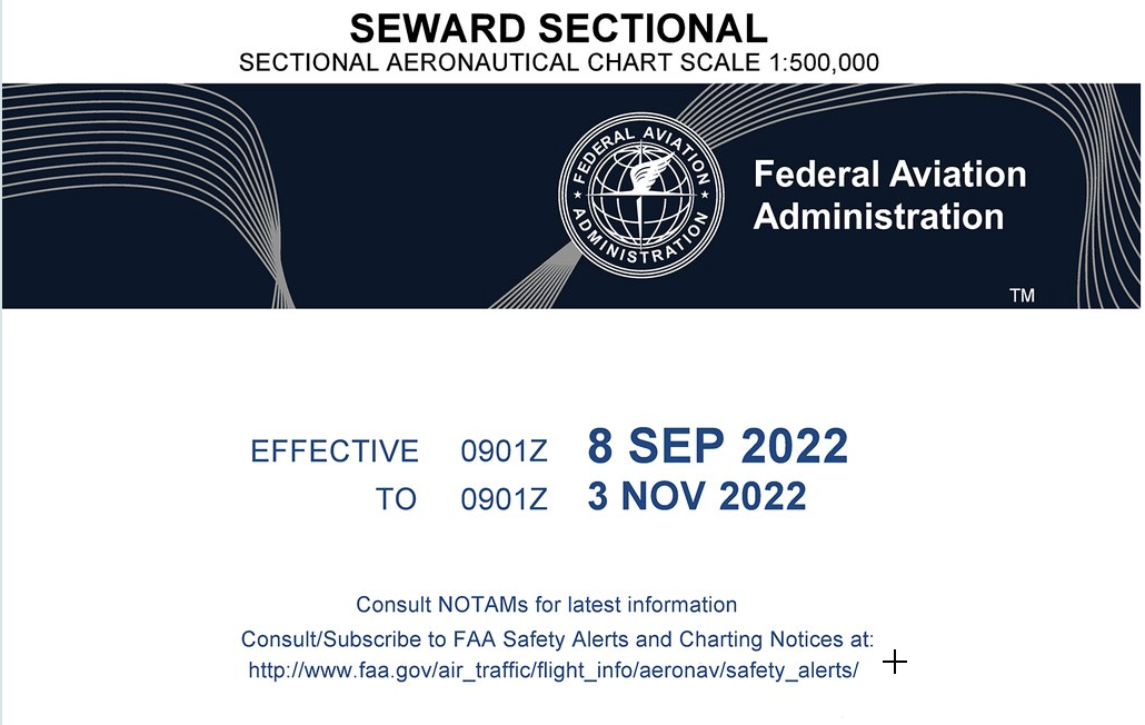
In the US particularly, there is a special aeronautical chart designed for pilots to fly under VFR. This chart’s primary purpose is to assist pilots in navigating, operating, finding obstacles, detecting radio frequencies, and more between airports. The sectional symbols are in the legend. These symbols give pilots insight into where to fly or not to fly. And thus, during their training period, the first thing a pilot does is to learn to read a sectional, a combination of several sectional symbols. However, new pilots often find it hard to read and understand this chart and its various confusing and complex symbols.
With practice, after understanding what each sectional symbol represents, you will be able to read it. Read the article to understand all the necessary details about the VFR sectional chart, sectional symbols, and how to read them.
What Is A Sectional Aeronautical Chart?
As aforementioned, sectional aeronautical charts are the primary navigation source used by the private license pilot and UAS operators community. They provide all the necessary information for navigation under the VFR and have been in service as navigation aids since 1930. A sectional aeronautical chart is mainly designed for slow to medium-speed aircraft.
The chart depicts the topographic features necessary for the pilots, such as rivers, dams, buildings, terrains, airports, railroads, beacons, drainage patterns and landmarks, etc. Besides, a sectional also represents information on radio frequencies, navigation routes, obstructions, ground-based navigation aids, restricted areas, navigation waypoints, longitude and latitude, and airspace classes. The National Aeronautical Navigation Services Group of the FAA publishes this chart, which is subject to a mandatory upgrade every 56 days.
There are three types of aeronautical charts used for VFR navigation. All of them are considered sectional charts. And a pilot should have an understanding of all these three charts. These are VFR Terminal Area Charts, Sectional Charts, and World Aeronautical Charts. You can get these charts at any renowned pilot shop or order them from online aviation stores. However, these charts are also available in electronic flight apps such as ForeFlight and Garmin Pilot.
Are Sectional Charts Similar To Maps?
No, sectional charts are different from maps. They are navigation aids, not maps. However, new pilots may get confused about differentiating between the two. In general, road maps represent landforms and other topographical information. On the other hand, sectional charts are navigation aids that show airspace information such as airspaces, airports, etc. The scale of FAA sectional charts is 1:500,000. It determines flight distances, true course, and distance between checkpoints or waypoints.
How To Read A Sectional Aeronautical Chart?
Reading a sectional aeronautical chart is essential for pilots to develop themselves. It gives them an understanding of airspace hazards, topography, airport data (for example, objectionable airports, classes, etc.), restricted airspaces, etc.
The Navigation and Airspace chapters of The Pilot’s Handbook of Aeronautical Knowledge are considered the best resources to understand how to read a sectional chart and its various symbols.
Sectional Chart Legend
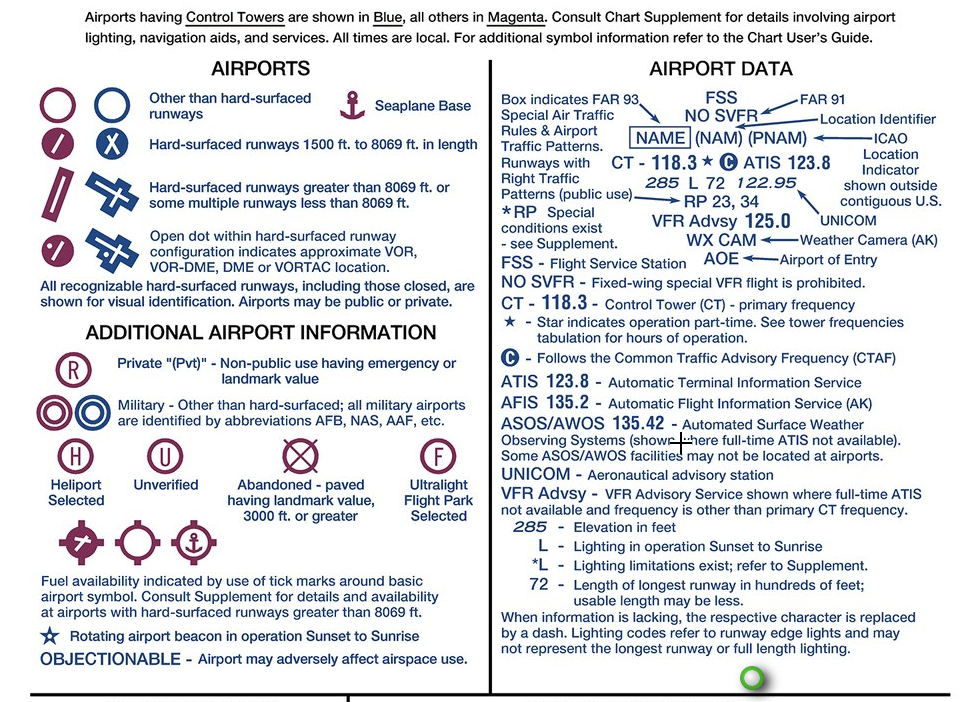
The sectional chart legend illustrates all the aeronautical symbols with detailed descriptions. The topographic information on VFR charts includes roads, shorelines, reservoirs, streams, railroads, lakes, and other cultural features. Many symbols of VFR charts are similar to TAC charts sectional and WAC charts.
Latitude And Longitude
Reading latitude and longitude is one of the basic skills of reading maps. Latitude and longitude are imaginary grids used to determine locations on a planet. Every location on Earth can be pinpointed by a pair of latitude and longitude readings. The sectional chart is divided into quadrants, every 30 minutes of latitude and each 30 minutes longitude.
These quadrants are areas separated by a boundary and serve as a reference while indicating particular but broad areas in the VFR chart. By referencing longitude meridians and latitude parallels, positions may be accurately located using the grid system.
Airports And Their Information
Airports are the most important point of interest in the sectional chart. Different types of airports are represented on the sectional chart, depending on whether they have a hard-surfaced runway, fuel availability, or control tower. Different sectional symbols are used to describe these airports, for example, civilian and military airports.
Military airports are represented by abbreviations such as NAV (Naval Air Facility) and AAF (Army Air Field), among others. Unverified, objectionable, restricted, and abandoned airports and landing areas are located for an emergency landing.
Terrain And Obstacles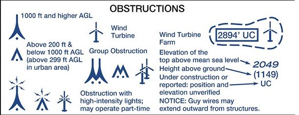
Terrains and obstacles are elevations that are critical to identify while planning flights. The sectional aeronautical chart also represents congested/populated regions (shaded yellow for quick recognition at night), shaded relief, cities, towns, and drainage areas (canals or irrigation ditches).
Rare Symbols You’ll Find On A Sectional Chart
While the common sectional symbols are easy to interpret, there are certain symbols that even an experienced pilot fails to understand. Here are the five of them.
- FAR Part 93 Areas
- Airports Below Sea Level (BSL)
- Special Military Activity Area (SMAR)
- Ocular Glare
- NDB With DME
So, here you go. Sectional charts are a critical tool for awareness and for planning flights. They have been a part of the aviation industry for ages and aren’t going anywhere. Whether you’re a student pilot or fly for fun, you need to learn how to read the sectional chart, as it is an essential preflight procedure that saves you from upcoming flying obstructions.
It is not just for your safety but also for the other aircraft and people on the ground. Initially, reading them all in one go might feel overwhelming, but with patience, time, and practice, you will learn it.

ON THE SAME TOPIC

What Is an MOA? Military Operations Areas & VFR Flight
What Is an MOA? Military Operations Areas & VFR Flight 16 min read Last updated June 2026 · Chris Palmer A military operations area (MOA) is a type of special use airspace established to separate certain military training activities — such as air combat maneuvers, aerobatics, and low-altitude tactics — from IFR traffic. Per the […]
 Read more
What Is an ILS Approach? How the Instrument Landing System Guides You to the Runway
What Is an ILS Approach? How the Instrument Landing System Guides You to the Runway 17 min read Last updated June 2026 · Chris Palmer An ILS (Instrument Landing System) approach is a precision instrument approach that uses two radio beams — a localizer for left/right alignment and a glide slope for vertical descent guidance […]
Read more 
What Is an ELT in Aviation? The Beacon That Brings Search-and-Rescue to You
What Is an ELT in Aviation? The Beacon That Brings Search-and-Rescue to You 15 min read Last updated June 2026 · Chris Palmer An ELT, or Emergency Locator Transmitter, is a battery-powered radio beacon installed in most general aviation aircraft that automatically switches on during a crash and transmits a distress signal so search-and-rescue can […]
Read more 
What Is an AIRMET? The Weather Advisory Pilots Underrate
What Is an AIRMET? The Weather Advisory Pilots Underrate 15 min read Last updated June 2026 · Chris Palmer An AIRMET (Airmen’s Meteorological Information) is an in-flight weather advisory issued by the FAA’s Aviation Weather Center that warns of weather hazardous to aircraft with limited capability — especially VFR pilots. It covers IFR conditions, mountain […]
Read more 
Stay Connected
Be the very first to get notified when we publish new flying videos, free lessons, and special offers on our courses.
