
What Are the Types of Clouds in Aviation? A Pilot’s Field Guide to Reading the Sky
Clouds in aviation are grouped into four families by their height in the sky — low, middle, high, and clouds with vertical development — and named by combining Latin terms for their shape and altitude. To a pilot, the cloud’s type is a free, real-time forecast: it tells you whether the air ahead is stable or unstable, and what weather is coming. A flat, layered deck is telling you one thing. A tall, cauliflower buildup is telling you something else entirely. Learn to name what you’re looking at, and the sky turns from scenery into information.
This guide breaks down the cloud-naming system the FAA uses, walks through each of the four families, and translates every cloud type into the question a student pilot actually cares about: should I be flying near that?
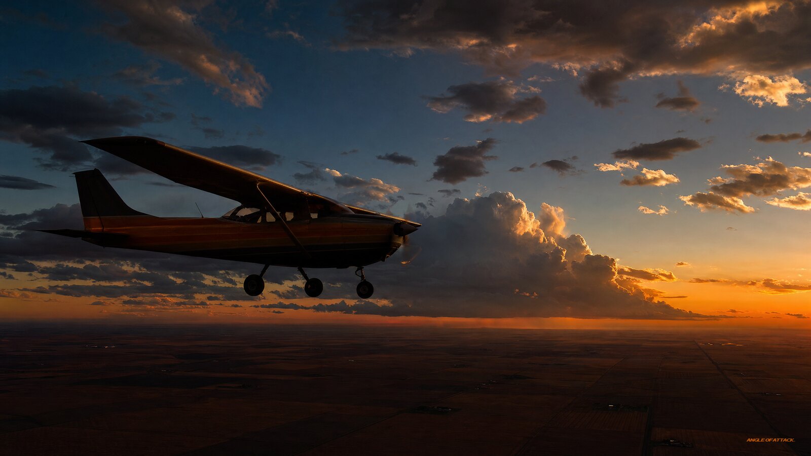
- Clouds form one way — moist air is lifted, cools to its dew point, and the water vapor condenses onto tiny particles into visible droplets.
- Aviation sorts clouds into four families by height — low (surface to ~6,500 ft), middle (alto-, ~6,500–20,000 ft), high (cirro-, above ~20,000 ft), and clouds with vertical development.
- Cloud names are Latin building blocks — cirro- (high), alto- (middle), strato- (layered), cumulo- (heaped), and nimbo-/-nimbus (rain-bearing) combine to describe a cloud’s shape and height.
- Cloud shape reveals air stability — flat, layered (stratiform) clouds mean stable air and smooth flying; puffy, vertical (cumuliform) clouds mean unstable air, turbulence, and storms.
- Cumulonimbus is the cloud to respect — the thunderstorm cloud, packing turbulence, hail, lightning, icing, and wind shear; pilots stay well clear of it.
WHAT’S IN THIS GUIDE
- 1How Do Clouds Form?
- 2How Are Clouds Classified in Aviation?
- 3What Are Low Clouds?
- 4What Are Middle Clouds?
- 5What Are High Clouds?
- 6What Are Clouds with Vertical Development?
- 7What Do Clouds Tell a Pilot About the Air?
- 8A Story From Alaska: The Cloud That Changed My Plan
- 9PLT Study Guide
- 10Frequently Asked Questions
How Do Clouds Form?
A cloud forms when moist air is lifted, cools to its dew point, and the water vapor condenses into tiny visible droplets. Three ingredients are required: water vapor in the air, a cooling process (almost always the air rising and expanding), and tiny particles called condensation nuclei for the moisture to cling to. Take away any one of the three and you get no cloud.
The cooling almost always comes from lift. As air rises it expands and cools, and the temperature at which it can no longer hold its moisture is the dew point. The closer the temperature and dew point are, the less lifting it takes to form cloud — which is exactly why a small temperature/dew-point spread is a fog and low-ceiling warning sign (PLT512). The Pilot’s Handbook of Aeronautical Knowledge (PHAK, FAA-H-8083-25C, Chapter 12) treats this as the foundation of all cloud weather. And the manner of the lifting — gentle and broad versus sharp and localized — is what decides whether you end up with a smooth layer or a churning buildup.
How Are Clouds Classified in Aviation?
Aviation classifies clouds into four families based on the height of their bases: low clouds, middle clouds, high clouds, and clouds with extensive vertical development. Within those families, individual cloud types are named by combining Latin root words that describe a cloud’s altitude and shape. Once you know the building blocks, you can decode almost any cloud name on sight.
The roots are simple. Cirro- marks high, wispy, ice-crystal clouds; alto- marks the middle layer; strato- means a flat, spread-out sheet; cumulo- means heaped up, like cotton balls; and nimbo- (or the suffix -nimbus) always means the cloud is producing precipitation. Stack them together and the name describes itself: cirrostratus is a high, thin layer; nimbostratus is a rain-producing layer; cumulonimbus is a heaped-up storm cloud.
| Family | Typical base height (temperate) | Prefix / root | Example clouds |
|---|---|---|---|
| Low | Surface to ~6,500 ft | strato- | Stratus, stratocumulus, nimbostratus |
| Middle | ~6,500 to 20,000 ft | alto- | Altostratus, altocumulus |
| High | Above ~20,000 ft | cirro- / cirrus | Cirrus, cirrostratus, cirrocumulus |
| Vertical development | Base low, tops to 60,000+ ft | cumulo- | Cumulus, towering cumulus, cumulonimbus |
Those altitude bands are approximate and shift with latitude and season, so treat the numbers as qualitative guides, not hard cutoffs (PLT192). The more important split is shape: layered (stratiform) versus heaped (cumuliform). That distinction — flat versus puffy — is the one your gut should reach for first, because it tells you about the stability of the air you’re about to fly through.
What Are Low Clouds?
Low clouds sit from the surface up to roughly 6,500 feet and are built mostly of water droplets. The main types are stratus (a flat, featureless gray sheet), stratocumulus (a lumpy layer with some structure), and nimbostratus (a thick, dark layer producing steady rain or snow). For a VFR pilot, low clouds are the family most likely to ruin a flight, because they’re the ones that put ceilings and visibility on the floor.
Stratus is the quiet troublemaker. It forms in stable air and brings low ceilings, gray flat light, and often reduced visibility — and when a stratus cloud forms right at the surface, we just call it fog (PLT226). It rarely produces turbulence, so the ride is smooth, but smooth doesn’t help if you can’t see. Nimbostratus is stratus with the rain turned on: thick, dark, and good for hours of steady precipitation and the structural-icing risk that comes with flying through visible moisture near freezing (PLT263).
The practical lesson is that low clouds are a visibility and ceiling problem more than a turbulence problem. They don’t toss you around; they simply lower the sky until VFR isn’t legal, or safe, anymore. When a briefing shows a broad, stable low-cloud deck moving in, the smart pilot is thinking about ceilings, fog, and ice.
What Are Middle Clouds?
Middle clouds carry the prefix alto- and typically have bases between roughly 6,500 and 20,000 feet. The two main types are altostratus (a gray or bluish sheet that veils the sun like frosted glass) and altocumulus (a layer of rounded, patchy, often gray-and-white “cotton ball” elements). They’re usually made of water droplets, ice crystals, or a mix, depending on temperature.
For a pilot, middle clouds are most useful as a heads-up. A spreading altostratus sheet often means a warm front and steady weather are moving in, while altocumulus — especially the castle-like altocumulus castellanus with little turrets on top — signals instability at that level and warns that afternoon thunderstorms could develop. Read the alto- clouds as a forecast: a smooth gray sheet says stable and gradual; lumpy, turreted patches say the air is getting restless.
What Are High Clouds?
High clouds carry the prefix cirro- (or the name cirrus) and form above roughly 20,000 feet, where the air is so cold they’re made almost entirely of ice crystals. The three types are cirrus (thin, wispy streaks often called “mares’ tails”), cirrostratus (a thin, milky veil that can produce a halo around the sun or moon), and cirrocumulus (small, rippled patches, the classic “mackerel sky”).
High clouds rarely affect a typical training flight directly — a Cessna 172 isn’t operating at FL250 — but they’re excellent forecasting tools. Thickening, lowering cirrus that spreads into cirrostratus is one of the oldest reliable signs that a warm front and deteriorating weather are on the way, often a day or so out. So while you won’t be dodging cirrus on a discovery flight, notice it: when high wispy clouds start filling in and dropping, the clear day you launched into may not be the day you land into.
What Are Clouds with Vertical Development?
Clouds with vertical development are heaped, cumulo- clouds that grow upward through the cloud layers, and they’re the family pilots watch most closely because they form in unstable, rising air. The progression runs from fair-weather cumulus (small, flat-bottomed, cotton-ball clouds) to towering cumulus (taller, cauliflower buildups) to cumulonimbus — the thunderstorm cloud, which can climb past 60,000 feet (PLT192).
Cumulus tells you the air is unstable and convective. Fair-weather cumulus on a sunny afternoon is usually harmless, just a sign of bumpy thermals and rising air. But when those puffs keep building vertically into towering cumulus, the atmosphere has the moisture and instability to make storms — and the next stage is the one to fear. Cumulonimbus packs essentially every hazard aviation worries about in one package: severe turbulence, hail, lightning, structural icing, and violent wind shear (PLT263).
The rule with cumulonimbus isn’t “fly carefully.” It’s “stay away.” FAA guidance is to avoid a thunderstorm by a wide margin and never fly through, under, or close beneath one, because the turbulence and wind shear reach well outside the visible cloud. A line of these is the most dangerous weather a light airplane can meet, and the only safe answer for a student pilot is distance.
What Do Clouds Tell a Pilot About the Air?
The shape of a cloud reveals the stability of the air, and stability is what decides whether your flight is smooth or rough. Flat, layered, stratiform clouds form in stable air, which resists vertical motion — you get smooth flying, but also low ceilings, poor visibility, and steady precipitation. Puffy, vertical, cumuliform clouds form in unstable air, which wants to rise — you get good visibility between the clouds but turbulence, gusty winds, showers, and the threat of storms (PLT173).
That single read — stratiform versus cumuliform — is the most useful weather skill a new pilot can build, and it costs nothing but looking up. Layered means stable, smooth, and “watch your ceilings.” Lumpy and building means unstable, bumpy, and “watch for storms.” Add the nimbus test on top: if the cloud is producing precipitation, its name carries nimbo- or -nimbus, and you should be thinking about ice, reduced visibility, and what’s hiding inside it.
The best way to drill this until it’s automatic is also the cheapest: every time you’re outside, name the clouds you see and say out loud what kind of air made them and what weather they imply. That habit of turning sky into information is exactly what we build early in the Total Student Pilot course — free — so you’re reading weather long before a checkride examiner asks you to.
A Story From Alaska: The Cloud That Changed My Plan
Years ago, flying a Cessna 172 out of a gravel strip in Alaska, I’d planned a hop through a mountain pass on a morning that started picture-perfect — blue sky, a few flat little fair-weather cumulus drifting by. Textbook good day. But by the time I’d finished my preflight, those flat cotton balls had grown taller. Their tops were stacking up into cauliflower, and over the ridge toward my pass one had a dark, hard base and was clearly reaching for the anvil stage.
Nothing on the official forecast had screamed cancel. But the clouds had. Fair-weather cumulus turning into towering cumulus in under an hour is the sky telling you the air is unstable, the moisture is there, and the afternoon is going to make storms — right over the terrain I needed to cross. I shut the airplane back down and flew the next morning instead. By that afternoon the pass was buried in convection.
That’s the whole reason cloud types matter. The chart told me the day was legal; the clouds told me it was changing. When those two disagree, the clouds in front of you are the more honest forecaster.
PLT Study Guide
These are the FAA Learning Statement Codes (PLT codes) tied to cloud knowledge on the Private Pilot and other airman knowledge tests. Knowing the cloud families, formation, and what they reveal about stability covers the heart of this group.
| PLT Code | FAA Topic | How This Article Covers It |
|---|---|---|
| PLT192 | Recall clouds — types / formation / resulting weather | The four families, the naming system, and the weather each cloud produces |
| PLT173 | Recall atmospheric conditions — measurements / pressure / stability | Stable vs. unstable air, and how stratiform vs. cumuliform shape reveals it |
| PLT512 | Recall weather conditions — temperature / moisture / dewpoint | How lifting, cooling, and the temperature/dew-point spread create clouds |
| PLT226 | Recall fog — types / formation / resulting weather | Stratus at the surface as fog, and the low-ceiling and visibility hazard |
| PLT263 | Recall hazardous weather — fog / icing / turbulence / visibility restriction | The icing and turbulence inside nimbostratus and cumulonimbus |
Frequently Asked Questions
What are the four main types (families) of clouds in aviation?
Aviation groups clouds into four families by the height of their bases: low clouds (surface to about 6,500 feet), middle clouds with the alto- prefix (to about 20,000 feet), high clouds with the cirro- prefix (above that), and clouds with vertical development like cumulus and cumulonimbus that grow upward through all the layers.
What do the cloud name prefixes like cirro-, alto-, and nimbo- mean?
They’re Latin building blocks. Cirro- means high and wispy, alto- marks the middle layer, strato- means a flat layered sheet, cumulo- means heaped or piled up, and nimbo- (or the suffix -nimbus) means the cloud is producing precipitation. Combine them and the name describes the cloud’s height and shape.
Which cloud type is the most dangerous for pilots?
Cumulonimbus, the thunderstorm cloud. It packs severe turbulence, hail, lightning, structural icing, and violent wind shear, and its hazards extend well outside the visible cloud. FAA guidance is to avoid thunderstorms by a wide margin and never fly through, under, or close beneath one. For a student pilot, the only safe answer is distance.
How do clouds tell you whether the air is stable or unstable?
Cloud shape is the giveaway. Flat, layered, stratiform clouds form in stable air that resists rising, meaning smooth flying but low ceilings and poor visibility. Puffy, vertical, cumuliform clouds form in unstable air that wants to rise, meaning turbulence, gusty winds, showers, and the potential for thunderstorms.
What is the difference between stratus and cumulus clouds?
Stratus clouds are flat and layered, forming in stable air and bringing low ceilings, smooth air, and reduced visibility. Cumulus clouds are puffy and heaped, forming in unstable, rising air and bringing turbulence and the potential to build into storms. Stratus is a visibility problem; cumulus is a turbulence and convection problem.
Is fog considered a cloud?
Yes. Fog is simply a stratus-type cloud that forms at or very near the surface when the air cools to its dew point. It forms the same way any cloud does, just at ground level, and it’s a leading cause of low-visibility accidents. A small temperature and dew-point spread is one of the clearest warning signs that fog is likely.
How high do clouds go in aviation?
It depends on the type. Low clouds top out around 6,500 feet, middle clouds reach about 20,000 feet, and high cirrus clouds form above that in the cold upper atmosphere. The exception is cumulonimbus, which can build vertically through every layer and reach above 60,000 feet in a mature thunderstorm.
Why do pilots need to know cloud types for the checkride?
Identifying clouds is risk management. The type tells you the stability of the air, the likely turbulence, the icing and precipitation risk, and what the weather is about to do — often before official products update. The FAA tests this knowledge (PLT192) because reading clouds is a core skill for safe go/no-go decisions.
Reading clouds is one of those skills that turns a nervous beginner into a confident pilot, because it puts the forecast right in front of your windscreen. If you want every weather concept on the knowledge test laid out this same plain-English way, that’s exactly what our Private Pilot Ground School is built to do.
Master every system on your checkride — and on day one.
The Private Pilot Ground School breaks down every FAA subject area in the same plain-English, real-world way you just read — with quizzes, scenarios, and the explanations that finally make it click.
Name the cloud, read the air, and you’ll make better go/no-go calls than the pilot who only trusts the printout. Angle of Attack has been in aviation education since 2006, and Chris Palmer has been a CFI since 2017. Keep looking up — the sky will start telling you its plans before the weather brief does.


ON THE SAME TOPIC

What Do Airport Signs Mean? A Student Pilot’s Guide to Reading the Taxiway
What Do Airport Signs Mean? A Student Pilot’s Guide to Reading the Taxiway 15 min read Last updated June 2026 · Chris Palmer Airport signs are the color-coded panels along taxiways and runways that tell you where you are, where you can go, and where you must stop. The FAA groups them into six types […]
 Read more
What Do Airport Identifier Codes Mean? Decoding KJFK, JFK, and Everything In Between
What Do Airport Identifier Codes Mean? Decoding KJFK, JFK, and Everything In Between 16 min read Last updated June 2026 · Chris Palmer Airport identifier codes are the short letter-and-number tags that uniquely name an airport so pilots, controllers, and computers all point to the same field. There are three systems you will meet: the […]
Read more 
What Are Weather Fronts? A Pilot’s Guide to Cold, Warm, Stationary & Occluded
What Are Weather Fronts? A Pilot’s Guide to Cold, Warm, Stationary & Occluded 18 min read Last updated June 2026 · Chris Palmer A weather front is the boundary where two air masses of different temperature, humidity, and density meet — and because air masses don’t blend easily, that boundary is where most flyable weather […]
Read more 
Visual Illusions in Flight: The Tricks That Fool Every Pilot’s Eyes
Visual Illusions in Flight: The Tricks That Fool Every Pilot’s Eyes 17 min read Last updated June 2026 · Chris Palmer Visual illusions in flight are false impressions of your aircraft’s attitude, altitude, or position caused by misleading visual cues — sloping terrain, runway width, a featureless black-hole approach, or the absence of a clear […]
Read more 
Stay Connected
Be the very first to get notified when we publish new flying videos, free lessons, and special offers on our courses.
