
What Are Weather Fronts? A Pilot’s Guide to Cold, Warm, Stationary & Occluded
A weather front is the boundary where two air masses of different temperature, humidity, and density meet — and because air masses don’t blend easily, that boundary is where most flyable weather is made. As a pilot, you care about fronts because clouds, precipitation, wind shifts, turbulence, and icing cluster along them. Learn to read the front and you can see the weather coming.
Weather doesn’t happen at random. It happens where two air masses collide. A warm, moist air mass from the Gulf bumping into a cold, dry mass sliding down from Canada — that meeting line is a front, and it’s the single most useful thing a student pilot can learn to picture. Once you understand the four front types and what each one does to the air you fly through, a surface analysis chart stops looking like a coloring book and starts reading like a forecast.
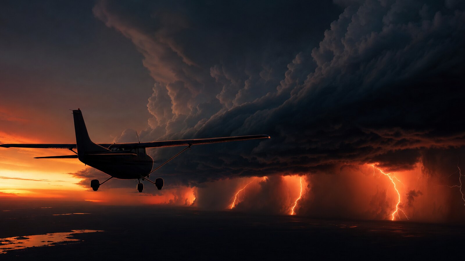
- A front is a boundary, not a wall — it’s the transition zone between two air masses with different temperature, moisture, and pressure.
- Cold fronts move fast and hit hard — steep lifting, narrow bands of heavy weather, gusty winds, and the risk of squall lines and thunderstorms.
- Warm fronts move slow and linger — gradual lifting, widespread low cloud and steady precipitation, and a real icing and low-visibility threat.
- A stationary front sits and stalls — neither air mass wins, so weather hangs over the same area for days.
- An occluded front is a catch-up — a fast cold front overtakes a warm front, lifting the warm air off the surface and blending both fronts’ hazards.
- Wind always shifts across a front — expect a heading and crosswind change the moment you cross the boundary.
- The danger pilots underestimate is what hides in the front — embedded thunderstorms, structural icing, and visibility that drops to nothing.
WHAT’S IN THIS GUIDE
- 1What Is a Weather Front?
- 2What Is a Cold Front, and What Weather Does It Bring?
- 3What Is a Warm Front, and How Does It Differ from a Cold Front?
- 4What Is a Stationary Front?
- 5What Is an Occluded Front?
- 6How Do You Read a Weather Front on a Surface Analysis Chart?
- 7What Should Pilots Do When Crossing a Front?
- 8A Story From Alaska: The Front That Beat Me to the Pass
- 9PLT Study Guide
- 10Frequently Asked Questions
What Is a Weather Front?
A weather front is the boundary between two air masses that have different temperatures, moisture content, and densities. Air masses resist mixing, so instead of blending, they push against each other along a sloped surface. That sloped boundary is the front, and the lifting that happens there is what builds the clouds, rain, wind shifts, and turbulence you fly into.
An air mass is a large body of air — hundreds of miles across — that picks up the temperature and humidity of the region it formed over. A mass that sat over the Gulf of Mexico is warm and wet. One that built over northern Canada is cold and dry. When they migrate and meet, the denser (colder) air wedges under the warmer air and forces it to rise.
Rising air cools, and cooling air can hold less moisture. That’s the whole engine. The Pilot’s Handbook of Aeronautical Knowledge (PHAK, FAA-H-8083-25C, Chapter 12) frames every front the same way — it’s about which air mass is doing the pushing and how steeply the warm air is forced to climb. Get that picture, and the four front types are just variations on one idea.
There are four front types you’ll meet on the knowledge test and in the cockpit: cold, warm, stationary, and occluded. Let’s take them one at a time.
What Is a Cold Front, and What Weather Does It Bring?
A cold front is where a colder, denser air mass advances and shoves underneath a warmer air mass. Because cold air is heavy, it stays low and wedges in steeply, forcing the warm air to rise fast. That rapid lifting builds tall cumulus and cumulonimbus clouds, and the weather it produces tends to be violent but narrow — a short, intense band rather than a long, gray slog.
Cold fronts move faster than warm fronts. When that fast-moving boundary plows into warm, unstable, moist air, you get the classic cold-front signature: heavy rain showers, gusty and shifting winds, a sharp temperature drop, and the real possibility of thunderstorms. In the worst case, a line of storms forms ahead of the front — a squall line — and that’s some of the most dangerous weather a small airplane can encounter (PLT475).
The flip side of all that violence is that it doesn’t last long. Cold-front weather is usually over in a hurry. The front passes, the wind veers (shifts clockwise), the pressure rises, and behind it you often get cooler, drier, gin-clear air. Some of the best flying days come right after a cold front clears through.
Here’s the catch for a VFR student pilot: the towering buildups along a cold front can hide embedded storms, and they can outrun a forecast. If you see a solid line of dark, vertical cloud marching toward your route, that front isn’t an obstacle to thread — it’s a wall to wait out.
What Is a Warm Front, and How Does It Differ from a Cold Front?
A warm front is where a warmer air mass advances and overrides a retreating mass of cooler, denser air. The warm air can’t push the cold air out of the way easily, so it rides up and over it along a shallow slope. That gentle lifting produces wide, layered stratus-type clouds and steady, widespread precipitation that can stretch for hundreds of miles ahead of the surface front.
The difference between a warm front and a cold front comes down to slope and speed. A cold front is steep and fast, so its weather is intense and brief. A warm front is shallow and slow, so its weather is gentle but stubborn — low ceilings, reduced visibility, drizzle, and fog that can sit over an airport for a long time.
| Feature | Cold Front | Warm Front |
|---|---|---|
| Air mass advancing | Cold, dense air pushing in | Warm, less-dense air pushing in |
| Slope of the boundary | Steep | Shallow |
| Speed | Faster | Slower |
| Clouds | Towering cumulus / cumulonimbus | Layered stratus, gradual buildup |
| Precipitation | Heavy showers, brief | Steady, widespread, long-lasting |
| Hazards | Thunderstorms, squall lines, gusts, wind shear | Low ceilings, fog, poor visibility, icing |
| Wind shift after passage | Veers (shifts clockwise) | Veers, more gradually |
| After it passes | Cooler, drier, clearing | Warmer, hazier, may stay murky |
For a student pilot, the warm front’s quiet danger is the part that catches people. The flying isn’t dramatic — it’s just slowly closing in. Ceilings sink, visibility fades into haze, and if the air ahead of the front is below freezing, the steady moisture becomes a structural-icing problem (PLT226, PLT263). A warm front is how a clear morning turns into a “should I have launched?” afternoon.
What Is a Stationary Front?
A stationary front is a boundary between two air masses where neither one is strong enough to move the other. The front essentially stalls in place. Because the boundary isn’t advancing, the weather it produces — clouds, light precipitation, restricted visibility — tends to park over the same region and linger for days rather than passing through in hours.
Think of two equally matched air masses leaning against each other. Neither pushes the other back, so the front sits. The weather along a stationary front often resembles a mild warm front: low clouds, drizzle, and reduced visibility, but spread out over a long time.
For flight planning, a stationary front is a patience problem. You can’t just wait an hour for it to clear the way you might with a fast cold front. If a stationary front is sitting across your route, the smart play is often to delay the trip or pick a route that goes around it — not to assume it’ll be gone by lunch.
What Is an Occluded Front?
An occluded front forms when a fast-moving cold front catches up to and overtakes a slower warm front ahead of it. The cold front lifts the warm air mass completely off the ground, sandwiching it aloft between two cooler air masses. Because an occlusion mixes the characteristics of both a cold front and a warm front, the weather can carry hazards from each.
There are two flavors. In a cold occlusion, the air behind the cold front is colder than the air ahead of the warm front, so it wedges under both. In a warm occlusion, the advancing air is milder than the cold air ahead, so it rides up over it. You don’t need to predict which one you’ll get in flight — what matters is the takeaway: an occluded front is mature, complex weather, often wrapped around a low-pressure center, and it can combine the heavy precipitation of a warm front with the thunderstorm and turbulence threat of a cold front.
Occlusions show up in the later life of a low-pressure system. By the time a system has occluded, it’s a fully developed weather machine. For a VFR pilot, that’s a clear signal: this is not a system to try to outsmart. Treat an occluded front like the most hazardous front you might fly near, because it can behave like one.
How Do You Read a Weather Front on a Surface Analysis Chart?
You read a front by its symbols. On a Surface Analysis Chart, each front type has its own line: a blue line with triangles for a cold front (triangles point the way it’s moving), a red line with half-circles for a warm front, alternating blue triangles and red half-circles facing opposite directions for a stationary front, and a purple line with alternating triangles and half-circles for an occluded front (PLT287).
The symbols even hint at the weather. The triangles are sharp and pointed, like the steep, aggressive cold front. The half-circles are rounded and gentle, like the slow, gradual warm front. See it that way once and the symbols stop being something you memorize.
Fronts almost always pivot around a low-pressure center, marked with a large L on the chart. Pressure lines called isobars crowd together near fronts and lows, and tightly packed isobars mean stronger winds (PLT517). So a single glance at a surface chart tells you where the boundaries are, which way they’re moving, and where the wind is going to be doing the most work.
Want to get fluent fast? Pull up a current Surface Analysis Chart on the Aviation Weather Center (aviationweather.gov), find the fronts, and say out loud what weather each one should be producing. Then check it against the METARs and PIREPs along that line. That feedback loop is how front-reading goes from memorized to instinctive — and it’s exactly the kind of practice we build into the Total Student Pilot course, free, so you’re working real charts long before your checkride.
What Should Pilots Do When Crossing a Front?
When you cross a front, expect change — and plan for it before you’re in it. Every front marks a shift in temperature, wind, pressure, and often visibility and ceiling. The single most reliable thing that happens crossing any front is a wind shift, so brief yourself on a new heading correction and a possible crosswind change before the boundary, not while you’re fighting it.
The biggest mistakes student pilots make around fronts are launching into one, and underestimating what’s embedded in it. Cold fronts can hide thunderstorms and serious turbulence. Warm fronts can hide ice and visibility that drops below VFR minimums while you’re already airborne. Before any cross-country, find the fronts on the chart, figure out which ones your route crosses, and decide on the ground whether the trip still works.
If a front is going to give you anything worse than a benign wind shift, get a full weather briefing and lean on the products that show hazards in motion — AIRMETs and SIGMETs flag the icing, turbulence, and IFR conditions that ride along fronts (PLT290). Frame your go/no-go around being day-one ready, not just legal: the question isn’t only “can I” but “should I, with the skills I have today?”
There’s no shame in waiting out a front. Cold fronts move through fast. Warm and stationary fronts you wait on longer. Either way, the airplane is far happier sitting on the ramp than punching into convection or ice. Calm is a skill — and choosing not to launch is one of the calmest, most professional skills you can train.
A Story From Alaska: The Front That Beat Me to the Pass
Down here in Homer, fronts come off the Gulf of Alaska like they’re on a schedule, and one fall morning I learned exactly how fast a cold front can rewrite a forecast. I’d planned a short hop in the 172 over toward the mountains — clear at departure, a cold front forecast to arrive that evening. Plenty of margin, or so the chart said.
About forty minutes out, I watched the horizon ahead of me go from blue to a hard, dark line. That front wasn’t waiting until evening. The leading edge was already building towering cloud over the pass I’d planned to cross, and the air around me started getting bumpy in that restless, pre-front way you learn to feel in your seat. The wind on the surface had already begun to shift.
I didn’t try to beat it. I turned the airplane around and went home, landed, and watched the front blow through an hour later with rain and gusts that would have made the pass a genuinely bad place to be. Nothing dramatic happened — and that was the point. The lesson stuck because it was boring on the ground and could have been ugly in the air.
That’s the thing about fronts: they don’t read your flight plan. A forecast gives you the front’s likely timing, but the sky gives you the truth in real time. Learn the picture — steep and fast for cold, shallow and slow for warm — and you’ll start reading that truth a long way off, with plenty of room to make the easy decision.
PLT Study Guide
The FAA tags knowledge-test questions with PLT (Pilot Learning Statement) codes. These are the ones that map directly to weather fronts and air masses. Study the idea behind each one — not the wording — and you’ll have these locked.
| PLT Code | FAA Learning Statement | What to Know for Fronts |
|---|---|---|
| PLT511 | Recall weather associated with frontal activity / air masses | The core code for this topic. Know what weather each front (cold, warm, stationary, occluded) produces and how air masses interact. |
| PLT510 | Recall weather — causes / formation | Why weather forms at all: air masses of differing temperature and moisture meeting and lifting. |
| PLT512 | Recall weather conditions — temperature / moisture / dewpoint | The temperature-moisture relationship that drives cloud and fog formation as warm air is lifted and cooled. |
| PLT226 | Recall fog — types / formation / resulting weather | Warm fronts and stalled boundaries are prime fog producers; know why steady moisture plus cooling makes fog. |
| PLT263 | Recall hazardous weather — fog / icing / turbulence / visibility restriction | The four front-related hazards in one code: low visibility, structural icing, turbulence, and reduced ceilings. |
| PLT344 | Recall precipitation — types / characteristics | Heavy showers along cold fronts vs. steady, widespread precipitation along warm fronts. |
| PLT475 | Recall squall lines — formation / characteristics / resulting weather | The line of thunderstorms that can form ahead of a fast cold front — the most violent frontal weather. |
| PLT287 | Recall information on a Surface Analysis Chart | Reading the front symbols, the low-pressure center, and isobars on the chart. |
If you can teach each of these out loud to a friend, you’re ready for the front questions on the knowledge test — and, more importantly, ready to make smart go/no-go calls on a real cross-country.
Want the whole weather block taught this way — picture first, regulation second, decision-making throughout? That’s exactly how we built the weather lessons in the Private Pilot Ground School, so you walk into your checkride and your first solo cross-country actually understanding the sky, not just memorizing answers.
Frequently Asked Questions
What are the four types of weather fronts?
The four types are cold, warm, stationary, and occluded fronts. A cold front is fast and steep with intense, brief weather. A warm front is slow and shallow with widespread, lingering weather. A stationary front stalls in place. An occluded front forms when a cold front overtakes a warm front.
Which front is the most dangerous for pilots?
Cold fronts and occluded fronts carry the highest hazard for small aircraft. Cold fronts can spawn squall lines and embedded thunderstorms with severe turbulence and wind shear. Occluded fronts, being mature systems, can combine cold-front storms with warm-front icing and low visibility, making them especially complex to fly near.
What happens to the wind when you cross a front?
The wind always shifts when you cross a front. After a frontal passage the wind typically veers — it shifts clockwise — and the speed often increases, especially where isobars are packed tightly. Brief a new heading correction and expect a crosswind change before you reach the boundary, not after.
How fast do weather fronts move?
Cold fronts generally move faster than warm fronts, which is why cold-front weather is intense but brief and warm-front weather is gentle but long-lasting. A stationary front, by definition, is barely moving at all. Exact speeds vary widely, so always check current charts and forecasts rather than assuming a fixed rate.
Can a private pilot fly through a weather front?
A VFR private pilot can sometimes cross a benign front safely, but should never assume it. The danger is what hides in the front — embedded storms, icing, or visibility below VFR minimums. Always get a full weather briefing, find the fronts on the chart, and make a go/no-go decision on the ground.
How do I identify a front on a weather chart?
On a Surface Analysis Chart, a cold front is a blue line with triangles, a warm front is a red line with half-circles, a stationary front alternates blue triangles and red half-circles facing opposite ways, and an occluded front is purple with both symbols. The symbols point in the direction the front is moving.
What is a squall line?
A squall line is a band of thunderstorms that can form ahead of a fast-moving cold front. It represents some of the most violent weather a light aircraft can encounter, with severe turbulence, heavy precipitation, hail, and dangerous wind shear. Squall lines should be avoided entirely, never penetrated.
Why does a warm front cause icing?
A warm front lifts warm, moist air gently over colder air below. If the temperatures along that boundary are at or below freezing, the steady, widespread moisture freezes onto the airframe as structural ice. Combined with the warm front’s typically low ceilings and poor visibility, that makes icing a serious warm-front hazard.
Master every system on your checkride — and on day one.
The Private Pilot Ground School breaks down every FAA subject area in the same plain-English, real-world way you just read — with quizzes, scenarios, and the explanations that finally make it click.
Weather fronts aren’t something to fear — they’re something to read. Once you can look at a chart, picture the air masses pushing against each other, and predict what the sky is going to do, you’ve crossed a real threshold as a pilot. That’s the skill that turns a forecast into a decision, and a decision into a safe flight.


ON THE SAME TOPIC

IFR vs VFR: The Two Sets of Rules Every Pilot Flies By
IFR vs VFR: The Two Sets of Rules Every Pilot Flies By 19 min read Last updated June 2026 · Chris Palmer The difference between IFR and VFR is which set of rules you fly under. VFR — visual flight rules — lets you navigate by looking outside and staying clear of clouds in good […]
 Read more
ASOS vs AWOS vs ATIS: How to Pull the Right Weather Before You Fly
ASOS vs AWOS vs ATIS: How to Pull the Right Weather Before You Fly 13 min read Last updated June 2026 · Chris Palmer The difference comes down to who is talking and what the broadcast covers. ASOS and AWOS are automated, computer-generated weather observations of the conditions right at the field. ATIS is a […]
Read more 
What Is RNAV Navigation? Area Navigation for VFR Pilots
What Is RNAV Navigation? Area Navigation for VFR Pilots 17 min read Last updated June 2026 · Chris Palmer RNAV — Area Navigation — is a method that lets an aircraft fly any desired path within the coverage of ground- or space-based navigation aids, rather than being forced to fly directly to and from stations. […]
Read more 
NDB and ADF Explained: The Oldest Radio Nav System You Still Need to Understand
NDB and ADF Explained: The Oldest Radio Nav System You Still Need to Understand 16 min read Last updated June 2026 · Chris Palmer An NDB (non-directional beacon) is a ground-based radio transmitter that sends a signal in all directions, and an ADF (automatic direction finder) is the cockpit receiver whose needle points straight at […]
Read more 
Stay Connected
Be the very first to get notified when we publish new flying videos, free lessons, and special offers on our courses.
