
High vs Low Pressure Systems in Aviation: What Every Pilot Must Know
A high pressure system is a region where air sinks and spreads outward, generally bringing calm, clear, stable flying weather, while a low pressure system is a region where air converges and rises, generally bringing clouds, precipitation, turbulence, and deteriorating conditions. Understanding which one you’re flying into — and what it does to wind, visibility, and your altimeter — is one of the most useful weather skills a pilot can build.
Most students learn the textbook definitions and then freeze the first time they look at a real surface chart. The goal here is the opposite. By the end of this article you should be able to glance at an H or an L, picture the air moving, and predict what the sky will actually look like when you get there.
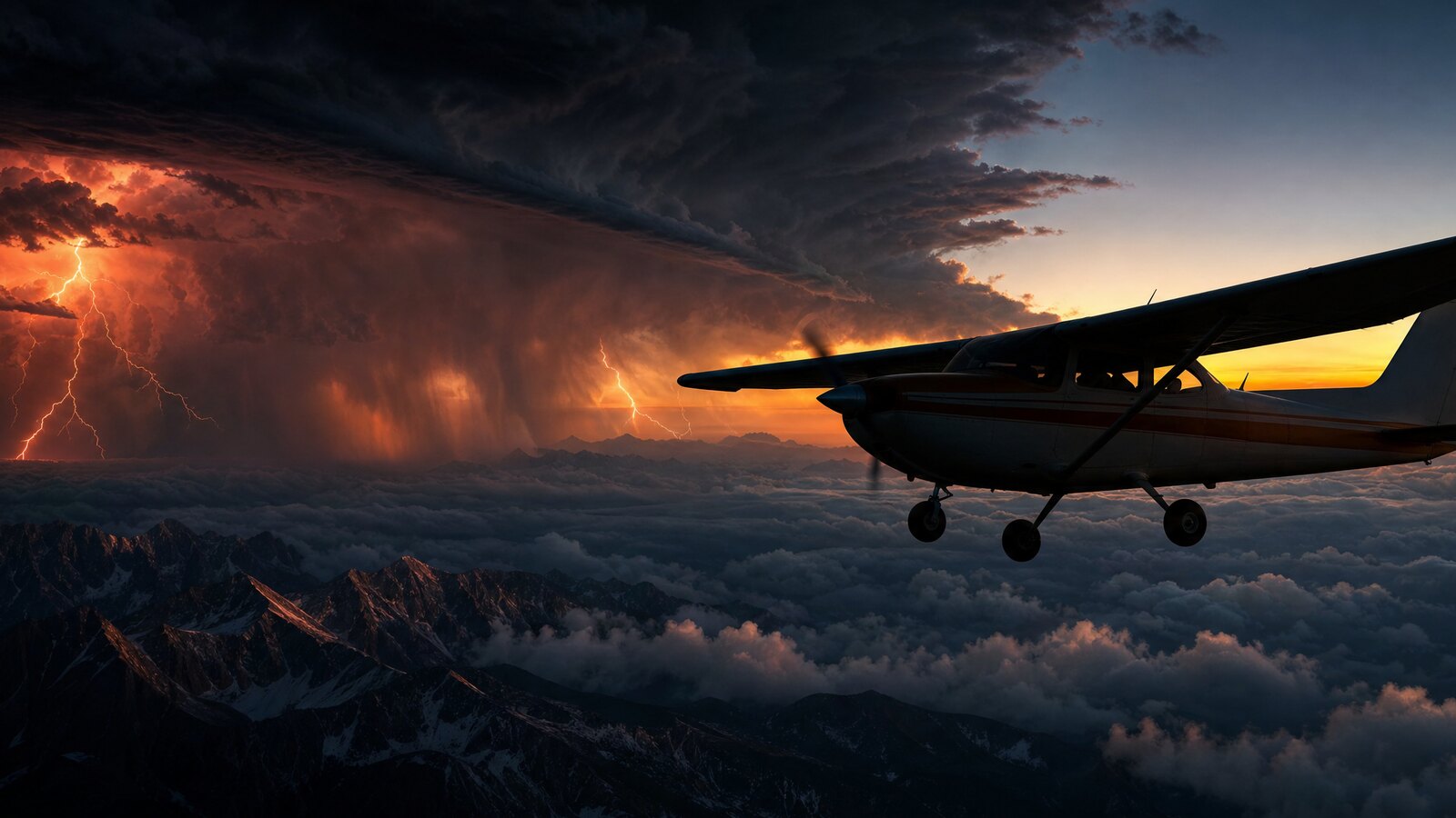
- High pressure = sinking air. Air descends, warms, and spreads outward (diverges), which suppresses cloud formation and gives you the fair, stable weather pilots love.
- Low pressure = rising air. Air converges at the surface and lifts, cools, and condenses, producing clouds, precipitation, and the turbulence that makes a flight day “interesting.”
- Wind circulation is opposite. In the Northern Hemisphere, wind flows clockwise and outward around a high and counterclockwise and inward around a low — a direct result of pressure gradient force, the Coriolis effect, and friction.
- Isobars are your wind speedometer. Tightly packed isobars mean a strong pressure gradient and strong winds; widely spaced isobars mean light winds.
- “High to low, look out below.” Flying into lower pressure or colder air without resetting your altimeter makes your true altitude lower than what the instrument reads — a terrain-clearance trap.
- Lows steer the worst hazards. Fronts, low ceilings, icing, and embedded thunderstorms cluster around low pressure systems, so a deepening low on the chart is your cue to plan an out.
WHAT’S IN THIS GUIDE
- 1What Is a High Pressure System?
- 2What Is a Low Pressure System?
- 3High vs Low Pressure: The Pilot’s Side-by-Side
- 4Why Do Winds Circle Highs and Lows in Opposite Directions?
- 5How Do High and Low Pressure Systems Affect Your Flight?
- 6How Do Pressure Systems Mess With Your Altimeter?
- 7How Do You Read Highs and Lows on a Weather Chart?
- 8A Story From Alaska: Reading the Low Before It Read Me
- 9PLT Study Guide
- 10Frequently Asked Questions
What Is a High Pressure System?
A high pressure system, also called an anticyclone, is an area where atmospheric pressure is higher than the surrounding air. Air at the top of the column sinks toward the surface, warms as it descends, and spreads outward. That sinking, drying motion is why a strong high usually means clear skies, light winds, and good visibility — classic fair-weather flying.
The catch is that the same descending air can trap moisture and pollutants near the surface. A stagnant high parked over a region for days often produces haze, reduced slant-range visibility, and shallow fog or low stratus in the early morning. So “high pressure” doesn’t automatically mean unlimited visibility — it means stable, and stable air can hold junk close to the ground.
Highs also tend to move slowly. When a strong high settles in, you can usually count on several days of similar weather, which makes them friendly for cross-country planning. The FAA’s Aviation Weather Handbook (FAA-H-8083-28) and Pilot’s Handbook of Aeronautical Knowledge (PHAK, FAA-H-8083-25C) both describe this sinking-air, fair-weather signature.
What Is a Low Pressure System?
A low pressure system, also called a cyclone or depression, is an area where atmospheric pressure is lower than the surrounding air. Surface air flows inward toward the center (converges) and is forced to rise. As that air rises it cools, water vapor condenses, and you get clouds, precipitation, and the unstable, bumpy conditions that define a low.
Lows are where the action is. The lifting motion is what builds towering cumulus and thunderstorms, and the circulation around a low is what drags fronts, moisture, and temperature contrasts across the country. When you hear a briefer talk about an “approaching system” or a “deepening low,” they’re describing pressure falling and weather worsening.
Because lows organize fronts and bad weather, a deepening or fast-moving low is a planning red flag. It doesn’t mean cancel — it means build an exit. Know where the clear air is, where the nearest VFR airport sits, and what the trend has been over the last few hours, because a low rarely sits still.
High vs Low Pressure: The Pilot’s Side-by-Side
Here’s the fastest way to keep them straight: high pressure sinks and settles, low pressure lifts and stirs. Everything else — the wind direction, the weather, the hazards — flows from that one difference in vertical air motion. The table below is the side-by-side I wish someone had handed me on day one.
| Feature | High Pressure (Anticyclone) | Low Pressure (Cyclone) |
|---|---|---|
| Vertical air motion | Sinking (subsiding) | Rising |
| Surface airflow | Diverges (spreads outward) | Converges (flows inward) |
| Rotation (N. Hemisphere) | Clockwise | Counterclockwise |
| Typical weather | Clear, stable, fair | Cloudy, unstable, precipitation |
| Visibility | Good — but haze/fog if stagnant | Often reduced in cloud and rain |
| Turbulence | Generally light | Often moderate or worse |
| Associated hazards | Morning fog, low stratus, haze | Fronts, icing, thunderstorms, low ceilings |
| On a surface chart | Marked H | Marked L |
Memorize the rotation with a simple mental picture: in the Northern Hemisphere a high “blows out and to the right” (clockwise, outward), and a low “sucks in and to the left” (counterclockwise, inward). In the Southern Hemisphere those rotations reverse, but for your Private Pilot training in the U.S., the Northern Hemisphere pattern is the one that matters.
Why Do Winds Circle Highs and Lows in Opposite Directions?
Winds circle highs and lows in opposite directions because of three forces acting together: the pressure gradient force, the Coriolis effect, and surface friction. Air always wants to move from high pressure to low pressure, but the Earth’s rotation deflects that moving air — to the right in the Northern Hemisphere — so instead of flowing straight in, it spirals.
Start with the pressure gradient force. Air pushes from high pressure toward low pressure, just like air rushing out of a balloon. The bigger the pressure difference over distance, the stronger the push — and the stronger the wind. That’s why isobars matter so much, and we’ll get to reading them shortly.
Now add the Coriolis effect (PLT197). Because the Earth spins, anything moving freely across its surface gets deflected — to the right in the Northern Hemisphere. That rightward bend is what turns straight-line flow into rotation: clockwise and outward around a high, counterclockwise and inward around a low. Aloft, where there’s no friction, the pressure gradient force and Coriolis effect balance into a steady “geostrophic” wind that flows nearly parallel to the isobars.
Finally, friction near the surface slows the wind and weakens the Coriolis deflection, which lets air angle slightly across the isobars — inward toward a low and outward from a high. That’s why surface winds don’t blow exactly parallel to the isobars the way winds aloft do. It’s also the physics behind a rule you’ll feel on every flight: winds aloft are generally stronger than the surface winds you taxi out in.
How Do High and Low Pressure Systems Affect Your Flight?
Pressure systems hit your flight in three places: the weather they produce, the winds they generate, and the trend they set. A high gives you stable air, light winds, and good (if sometimes hazy) visibility. A low gives you clouds, precipitation, gustier and shifting winds, and the fronts that carry the real hazards — icing, embedded thunderstorms, and low ceilings.
Wind is the part students underestimate. The tighter the pressure gradient — the closer the isobars — the stronger the wind, both at the surface and aloft. A deep low with packed isobars can mean a brutal crosswind on landing and a headwind that quietly eats your fuel reserve on the way home. Always check the winds-and-temperatures-aloft forecast (the FB, PLT284 territory) against your route, not just the surface wind at your departure field.
Then there’s the trend, which is where pressure systems earn their keep in flight planning. A building high over your destination is a green light that should hold. A falling barometer and an approaching low mean conditions are deteriorating — and the rate of change tells you how much margin you’ve got. Reading that trend, not just the snapshot, is what separates a confident go/no-go call from a guess.
If you want this to feel automatic instead of memorized, that’s exactly what we drill in the Total Student Pilot course and our Private Pilot Ground School — connecting the chart to the sky so weather theory turns into real go/no-go judgment you can use on day one.
How Do Pressure Systems Mess With Your Altimeter?
Pressure systems affect your altimeter because the instrument is really a barometer — it measures the pressure outside and converts it to an altitude. Your altimeter only reads true altitude correctly when the local barometric setting (set in the Kollsman window) matches the actual pressure where you are. Fly into a lower-pressure area without resetting it, and the altimeter will read higher than your true altitude.
That’s the meaning behind the old memory aid: “High to low, look out below.” When you fly from an area of high pressure into low pressure — or from warm air into cold air — without updating your altimeter setting, your true altitude is lower than what the instrument shows. On a long cross-country toward an approaching low, that error stacks up, and it’s a genuine terrain-clearance hazard in mountains or low IFR.
The fix is simple, and it’s why the regulation exists: update your altimeter setting regularly. Under 14 CFR § 91.121, when flying below 18,000 feet MSL you set your altimeter to the current setting of a station along your route within 100 nautical miles of the aircraft. Get a fresh setting from ATIS, AWOS, or ATC as you go, and the pressure-system error never has a chance to build. PHAK (FAA-H-8083-25C) covers the altimeter and these errors in its flight-instruments chapter.
How Do You Read Highs and Lows on a Weather Chart?
You read highs and lows on a surface analysis chart by finding the big blue H and red L symbols, then reading the isobars — the lines connecting points of equal pressure (PLT031). The isobars form roughly concentric rings around each center, and their spacing tells you the wind strength: tightly packed isobars mean a steep pressure gradient and strong winds, while widely spaced isobars mean a weak gradient and light winds.
Once you’ve found the centers and read the spacing, picture the circulation. Trace the isobars around a high and the wind flows clockwise; around a low it flows counterclockwise. That lets you predict the wind direction at any point on the map — including your route — before you ever check a winds-aloft forecast. Front symbols draped off a low (the triangles and half-circles) show you where the sharpest weather changes will be.
The surface analysis chart is one of several products you’ll learn in weather training, alongside the FB winds-and-temperatures-aloft forecast, the prog charts, and graphical AIRMETs and SIGMETs. The FAA’s Aviation Weather Handbook (FAA-H-8083-28) walks through each of them. The skill that ties it all together is the one we’ve been building this whole article: see the symbol, picture the moving air, predict the sky.
A Story From Alaska: Reading the Low Before It Read Me
Early one morning out of Homer, the ramp was glass-calm — the kind of dead-still air that feels like permission. But the surface chart told a different story. There was a low spinning up in the Gulf, isobars stacking tighter on each new chart, and the barometer at the field had been sliding for hours. Calm now didn’t mean calm later. It meant I was sitting in the slack air ahead of a system that was winding up.
I’ve watched students look at that exact picture and only see the glassy water out the window. The chart was the real briefing, and the chart was trending the wrong way. We went, but we went with the low respected: a hard turn-around time, a fuel reserve padded well past the legal minimum, and two alternates that sat upwind of the system, not downwind into it. Sure enough, by early afternoon the wind had clocked around and come up hard, and the ceilings down the coast had dropped right on schedule.
Here’s the lesson I’ve taught since I started flying these mountains: a low pressure system doesn’t ask permission, and it doesn’t care how calm the morning was. Read the trend, not the snapshot. The pressure was falling, the isobars were tightening, and the system was telling me exactly what it planned to do — I just had to listen before it got loud.
PLT Study Guide
The FAA tags every knowledge-test question with a PLT (Pilot Learning Statement) code. These are the codes that map directly to high and low pressure systems — learn the concept behind each one and you’ve covered the cluster the way the FAA frames it.
| PLT Code | Official FAA Learning Statement | What It Means for This Topic |
|---|---|---|
| PLT517 | Recall winds associated with high / low-pressure systems | The core code: clockwise/outward around a high, counterclockwise/inward around a low (Northern Hemisphere). |
| PLT031 | Define isobars / associated winds | Isobars connect equal-pressure points; tight spacing = strong wind, wide spacing = light wind. |
| PLT197 | Recall Coriolis effect | The Earth’s rotation deflects moving air to the right (N. Hemisphere), turning straight flow into rotation. |
| PLT516 | Recall winds — types / characteristics | Surface vs. winds aloft, why aloft is stronger, and how friction angles surface wind across the isobars. |
| PLT511 | Recall weather associated with frontal activity / air masses | Lows organize fronts; fronts carry the sharpest weather changes, icing, and storms. |
| PLT173 | Recall atmospheric conditions — measurements / pressure / stability | Stable (sinking) air vs. unstable (rising) air — the engine behind fair vs. foul weather. |
If you’re studying for the Private Pilot knowledge test, don’t just memorize the rotation direction. Practice the chain: pressure gradient pushes the air, Coriolis bends it, friction tilts it near the ground. When you can explain why the wind circles a low counterclockwise, the test questions answer themselves.
Frequently Asked Questions
Which is better for flying, high or low pressure?
High pressure is generally better for VFR flying because the sinking, stable air produces clear skies, light winds, and good conditions. Low pressure brings rising air, clouds, precipitation, and turbulence. The exception: a stagnant high can trap haze and morning fog near the surface, so “high” isn’t a guarantee of unlimited visibility.
Which way do winds rotate around a high and a low?
In the Northern Hemisphere, winds flow clockwise and outward around a high pressure system and counterclockwise and inward around a low. This is caused by the pressure gradient force pushing air outward or inward, then deflected by the Coriolis effect. In the Southern Hemisphere, both rotations reverse.
Why does low pressure cause bad weather?
Low pressure causes bad weather because surface air converges toward the center and is forced to rise. As that air rises it cools, water vapor condenses into clouds, and precipitation forms. The lifting also fuels thunderstorms and drags fronts across the region, which is why the worst hazards cluster around lows.
What are isobars and why do they matter to pilots?
Isobars are lines on a weather chart connecting points of equal atmospheric pressure. They matter because their spacing reveals wind strength: tightly packed isobars mean a steep pressure gradient and strong winds, while widely spaced isobars mean light winds. Tracing isobars also lets you predict wind direction around highs and lows.
What does “high to low, look out below” mean?
It’s a memory aid for altimeter error. When you fly from high pressure into low pressure (or warm air into cold) without resetting your altimeter, the instrument reads higher than your true altitude — so you’re actually lower than you think. Updating your altimeter setting along the route, per 14 CFR § 91.121, prevents this terrain-clearance trap.
How do I find high and low pressure systems on a weather chart?
Look at a surface analysis chart for the blue H (high) and red L (low) symbols. The isobars circling each center show wind strength by their spacing and wind direction by their curve. Front symbols draped off a low mark where the sharpest weather changes are. The FAA Aviation Weather Handbook (FAA-H-8083-28) details these products.
Do pressure systems move, or do they stay put?
Both happen, and the difference matters for planning. Strong highs often move slowly and can park over a region for days, giving stable weather you can count on. Lows tend to move faster and deepen, dragging fronts with them. That’s why you read the trend — a falling barometer signals an approaching low and deteriorating conditions.
Does this work the same in the Southern Hemisphere?
No — the rotations flip. Because the Coriolis effect deflects moving air to the left in the Southern Hemisphere, winds rotate counterclockwise and outward around a high and clockwise and inward around a low. For Private Pilot training in the United States, you’ll work entirely with the Northern Hemisphere pattern.
Master every system on your checkride — and on day one.
The Private Pilot Ground School breaks down every FAA subject area in the same plain-English, real-world way you just read — with quizzes, scenarios, and the explanations that finally make it click.
Pressure systems are the skeleton that every other weather product hangs on. Get fluent at picturing the moving air behind an H and an L, and the prog charts, winds aloft, and front symbols stop being separate things to memorize — they become one connected story you can read at a glance. That’s the kind of weather judgment that makes you day-one ready, not just checkride-ready.


ON THE SAME TOPIC

IFR vs VFR: The Two Sets of Rules Every Pilot Flies By
IFR vs VFR: The Two Sets of Rules Every Pilot Flies By 19 min read Last updated June 2026 · Chris Palmer The difference between IFR and VFR is which set of rules you fly under. VFR — visual flight rules — lets you navigate by looking outside and staying clear of clouds in good […]
 Read more
ASOS vs AWOS vs ATIS: How to Pull the Right Weather Before You Fly
ASOS vs AWOS vs ATIS: How to Pull the Right Weather Before You Fly 13 min read Last updated June 2026 · Chris Palmer The difference comes down to who is talking and what the broadcast covers. ASOS and AWOS are automated, computer-generated weather observations of the conditions right at the field. ATIS is a […]
Read more 
What Is RNAV Navigation? Area Navigation for VFR Pilots
What Is RNAV Navigation? Area Navigation for VFR Pilots 17 min read Last updated June 2026 · Chris Palmer RNAV — Area Navigation — is a method that lets an aircraft fly any desired path within the coverage of ground- or space-based navigation aids, rather than being forced to fly directly to and from stations. […]
Read more 
NDB and ADF Explained: The Oldest Radio Nav System You Still Need to Understand
NDB and ADF Explained: The Oldest Radio Nav System You Still Need to Understand 16 min read Last updated June 2026 · Chris Palmer An NDB (non-directional beacon) is a ground-based radio transmitter that sends a signal in all directions, and an ADF (automatic direction finder) is the cockpit receiver whose needle points straight at […]
Read more 
Stay Connected
Be the very first to get notified when we publish new flying videos, free lessons, and special offers on our courses.
