
What Is a Squall Line? The Wall of Thunderstorms Every Pilot Must Respect
A squall line is a long, narrow band of active thunderstorms that forms along or just ahead of a fast-moving cold front, often stretching for hundreds of miles with no usable gaps between cells, producing the most violent, fast-changing weather a small airplane can encounter — severe turbulence, hail, lightning, and wind shear. The PHAK calls it “the single most intense weather hazard to aircraft.” There is no safe way to fly through one. You go around it, or you stay on the ground.
For a student pilot, the squall line is the single clearest example of why “I’ll just pick my way through it” is a deadly idea. A scattered thunderstorm you can dodge. A squall line is a closed door. Understanding how one forms, how to spot it on a weather product, and why it has killed experienced pilots in capable airplanes is one of the most important weather lessons you’ll learn before your checkride — and one you’ll use on day one as a real pilot.
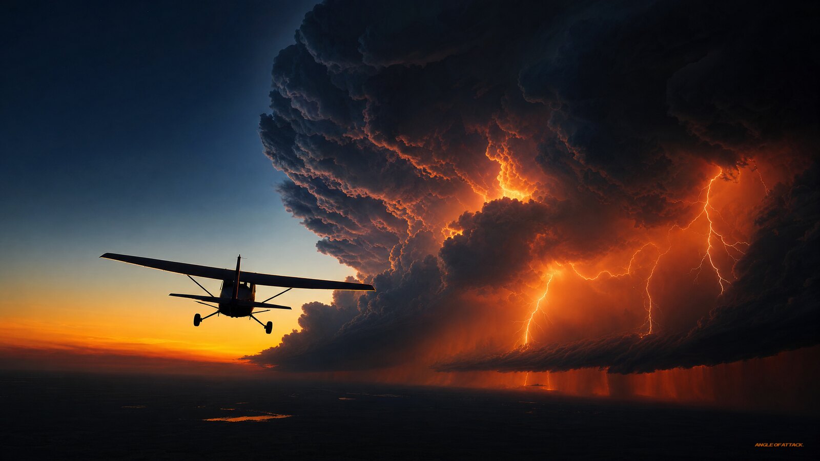
- A squall line is a continuous line of thunderstorms, typically forming 50 to 300 miles ahead of a fast-moving cold front — sometimes in clear air well in front of the actual frontal boundary.
- There are no safe gaps. Unlike scattered air-mass storms, the cells in a squall line merge into a near-solid wall, so “threading the needle” is not a real option. The “clear” spaces between cells contain microbursts and wind shear.
- The hazards stack up: severe-to-extreme turbulence, hail (which can be thrown 20 miles into clear air), lightning, and low-level wind shear from the gust front.
- The gust front arrives first. A sharp wind shift, a temperature drop, and a roll cloud can hit you 15 miles ahead of any visible rain.
- Squall lines move fast and peak in late afternoon and the first few hours of darkness — a morning briefing that looked fine can be catastrophically wrong by 1500 local.
- The FAA guidance is specific: AIM §7-1-27 (Thunderstorm Flying) says avoid by at least 20 miles any thunderstorm identified as severe or giving an intense radar echo, and don’t fly between echoes unless they are well separated — the rule of thumb is at least 40 miles apart. A squall line never meets that second test.
- Onboard weather (ADS-B FIS-B) is delayed. NEXRAD mosaics can be 5 to 15 minutes old. At 60 mph, those storms are a mile or more closer than your screen shows every minute you wait.
- Wait it out. A squall line typically clears a fixed location in 30 to 90 minutes. Land somewhere safe, drink coffee, and fly on.
WHAT’S IN THIS GUIDE
- 1What is a squall line in aviation?
- 2How does a squall line form?
- 3Where does a squall line form relative to the cold front?
- 4What are the dangers of flying near a squall line?
- 5What is a gust front and why does it matter?
- 6How fast do squall lines move and how big do they get?
- 7How do I identify a squall line in a weather briefing?
- 8Can you fly through or around a squall line?
- 9Squall line vs. other thunderstorm types: what’s the difference?
- 10What should a student pilot do when a squall line is forecast?
- 11PLT Study Guide
- 12Frequently Asked Questions
What is a squall line in aviation?
A squall line is a continuous or nearly continuous line of thunderstorms that forms along or ahead of a cold front. In aviation terms, it’s a band of severe weather — turbulence, hail, lightning, and wind shear — that can be hundreds of miles long but only 10 to 20 miles wide. The defining feature is that the storms are organized into a line with no reliable gaps, so it behaves like a solid wall.
The PHAK (FAA-H-8083-25C, Ch. 12) describes the squall line as “the single most intense weather hazard to aircraft” and notes that these systems are often “too long to detour easily, forcing a diversion to land until frontal passage.” That’s not hedging language — that’s the FAA telling you to get out of the way.
What makes the squall line special isn’t a single super-storm — it’s the organization. A row of strong-to-severe cells, each capable of severe or extreme turbulence, lined up shoulder to shoulder and self-sustaining for hours.
Think of the difference this way. A summer afternoon air-mass thunderstorm is one angry cell sitting over a valley — you can see around it, fly around it, and wait it out. A squall line is a marching army of those cells, stretching from one horizon to the other. You don’t dodge an army. You retreat and let it pass.
One more fact worth anchoring: the word “squall” itself has a meteorological definition. The PHAK defines a squall as a wind that suddenly increases to at least 16 knots, is sustained at 22 knots or more for at least one minute. A squall line is the organized frontal system that produces those conditions along a continuous boundary — along with everything else that comes with it.
How does a squall line form?
A squall line forms when a fast-moving cold front shoves under a warm, moist, unstable air mass, forcing that air to rise rapidly along a long boundary. As the warm air is lifted, it cools, the moisture condenses, and thunderstorms erupt all along the line at roughly the same time. The result is a wall of convection rather than a scattered handful of storms.
The PHAK identifies four ingredients for squall line formation — not three:
- Moisture — surface dewpoints at or above 55°F are favorable; this is the fuel
- Lifting mechanism — the cold front acts as a snowplow, forcing warm air upward along a continuous boundary; dry lines and other convergence zones can also trigger squall lines
- Atmospheric instability — a lapse rate steep enough that a rising parcel keeps accelerating upward
- Wind shear — the fourth ingredient most pilots miss; wind shear with height tilts the updraft away from the downdraft, preventing the downdraft from choking off its own inflow; this is what organizes a squall line into a sustained system instead of a brief burst
That fourth ingredient — wind shear — is what separates a squall line from a garden-variety afternoon storm. Without it, storms grow and collapse in 20–45 minutes. With it, the line sustains itself and propagates forward for hours.
Once the line gets going, it becomes self-sustaining. The downdrafts from mature cells spread out along the ground and push up the warm air ahead of them, triggering new cells on the leading edge. This is why a squall line can keep regenerating and “propagate” forward long after the original frontal lift has done its job — the system creates its own lifting mechanism.
This self-sustaining behavior is also why squall lines often form ahead of the actual cold front. The front is the trigger, but the line develops its own forward-moving engine and outruns the boundary that started it.
Where does a squall line form relative to the cold front?
A squall line typically forms in the warm air ahead of a fast-moving cold front — commonly 50 to 300 miles in advance of the actual frontal boundary, and sometimes in apparently clear, warm air with no visible front nearby. This is one of the most dangerous facts a pilot can know, because the worst weather may not be sitting on the front line you drew on your chart.
Cold fronts that produce squall lines move fast — typically 25 to 30 mph, and in strong synoptic setups, they can exceed 50 mph. The faster the cold front, the more likely the squall line — and the shorter your warning window. What looks like hours of buffer on your morning briefing can shrink to minutes by midday.
This “pre-frontal” position trips up a lot of new pilots. You look at a surface analysis, you see the cold front, and you plan to land or divert before you reach it. But the squall line can be a hundred miles closer than the front, hiding in air that looks unremarkable on a simple map. The FAA specifically warns that squall lines often develop too rapidly to detect on a routine briefing and may not show up in the forecast you read an hour before departure.
The takeaway: when a fast-moving cold front is anywhere in your forecast, treat the entire warm sector in front of it as suspect. Don’t anchor on the front’s plotted position. The storms can — and often do — get there first.
What are the dangers of flying near a squall line?
A squall line concentrates nearly every thunderstorm hazard into one band: severe-to-extreme turbulence that can exceed an airplane’s structural limits, hail, frequent lightning, low-level wind shear from the gust front, heavy rain and reduced visibility, and the embedded threat of microbursts and even tornadoes. It is, by FAA description, the most intense weather a pilot will ever encounter.
Turbulence is the killer for light aircraft. The updrafts and downdrafts inside a mature thunderstorm can exceed the design strength of the airframe, and in a squall line you face the strongest of those storms back to back.
Hail deserves special respect because it doesn’t stay inside the cloud. Strong updrafts can throw hailstones out the top and side of a cumulonimbus — the PHAK notes that hail can be ejected 20 miles from the storm into clear air. Pilots have encountered large hail in apparently clear sky well clear of the visible line. Hail can shatter a windscreen and dent leading edges in seconds. The “clear” air ahead of a squall line is not safe air.
Microbursts are another squall-line product. Downdrafts beneath strong cells can reach 2,000 to 4,000 feet per minute or more — more than enough to overwhelm a light aircraft’s climb capability at low altitude. Delta Flight 191, destroyed by a microburst on final approach at DFW on August 2, 1985 (137 fatalities), is the canonical example of what a convective microburst does even to a wide-body jet. It drove the FAA’s deployment of Terminal Doppler Weather Radar (TDWR) and mandatory wind shear recognition-and-escape training for airline crews.
Embedded thunderstorms are the hidden risk for IFR pilots. In a squall line, some cells are concealed inside the cloud mass — completely invisible without airborne radar. VFR pilots have one real advantage here: they can see the squall line and turn around. An IFR pilot flying toward a solid wall of cloud has no visual cue that the most violent cells in the line are directly ahead. The “just stay IFR” logic has a hard limit.
| Hazard | What it does | How far it extends |
|---|---|---|
| Severe/extreme turbulence | Can exceed airframe structural limits | Throughout and 20+ NM from cells |
| Hail | Shatters windscreens, dents structure | Up to 20 miles into clear air |
| Lightning | Damages avionics, temporary blindness | Throughout the line |
| Low-level wind shear | Sudden airspeed loss on approach/departure | At the leading-edge gust front, 15+ miles ahead |
| Microburst | Violent downdraft 2,000–4,000+ fpm | Beneath strong cells |
| Tornadoes | Most violent winds on Earth | Embedded in the most severe cells |
| Heavy rain / low visibility | IMC, hydroplaning on landing | At and behind the line |
What is a gust front and why does it matter?
A gust front is the leading edge of cool air that pours out of a thunderstorm’s downdraft and spreads along the ground ahead of the storm. It announces itself with a sudden wind shift, a sharp temperature drop, and often a low, rolling cloud — and it can arrive 15 miles or more in front of the visible rain. For a small airplane on takeoff or final approach, the wind shear at a gust front is one of the deadliest low-altitude hazards there is.
Here’s why it matters so much to a student pilot: you don’t have to be near the storm to be in danger. You can be turning final at your home field under a clear sky, with the squall line still well to the west, and the gust front can hit you with a sudden headwind-to-tailwind swing that robs your airplane of lift in seconds. Close to the ground, you have no altitude to trade for recovery.
The associated low-level wind shear is also why FAA guidance tells you to expect a wind shift and a rapid increase in surface wind ahead of an approaching line. If you feel the wind suddenly shift and gust at your departure airport, the squall line’s gust front may already be on top of you — that’s your cue to stay on the ground, not to hurry the takeoff.
Eastern Air Lines Flight 66 at JFK (1975, 113 fatalities) and Delta 191 at DFW (1985, 137 fatalities) are both microburst/gust-front accidents associated with squall-line or frontal convective activity on approach. Neither crew saw a wall of black cloud blocking their path. The gust front had raced ahead of the visible storm, and by the time wind shear hit at low altitude, there was no recovery available.
How fast do squall lines move and how big do they get?
Squall lines can be hundreds of miles long, are typically only 10 to 20 miles wide, and tend to move quickly — often 40 to 60 mph or more — which means a line that’s “comfortably out west” at your briefing can be over your destination within an hour or two. Their speed combined with their length is exactly what makes them impossible to outrun in a typical training airplane.
Do the math in a Cessna 172 cruising around 110 knots (about 125 mph). If a squall line is moving at 50 mph straight at you, your closure rate is 175 mph. A line that’s 80 miles away gives you barely 27 minutes before it arrives. And because the line can be 300, 400, even 500 miles long, you can’t simply turn and fly around the end of it the way you could a single storm. Going around the end might require a 100 to 200 NM detour — and that’s only viable if you have the fuel, if the end is actually within range, and if the end hasn’t moved by the time you get there. Most of the time in a trainer, it isn’t viable.
The vertical scale is just as intimidating. The thunderstorms in a squall line frequently build to 40,000, 50,000, even 60,000 feet — far above the service ceiling of any light single. You cannot climb over a squall line in a 172. There is no “over the top” option.
The squall line peaks late. The PHAK notes that squall lines “generally reach maximum intensity during the late afternoon and the first few hours of darkness.” This is when surface heating (which feeds instability) is greatest and frontal forcing is strongest simultaneously. For student pilots planning cross-countries, this has a direct scheduling implication: if a fast-moving cold front is in your forecast and your ETD is mid-afternoon into a warm, moist air mass — re-brief two hours before departure. Don’t rely on the 0700 briefing for a 1400 departure.
How do I identify a squall line in a weather briefing?
You identify a likely squall line by combining several products: a fast-moving cold front on the surface analysis, a Convective SIGMET or Severe Weather Watch (WW) covering your route, a line of returns on radar, and the broad-brush convective outlook. The single most direct signal is a Convective SIGMET (WST) that specifically describes a “line of thunderstorms” or an “area of severe thunderstorms” along your path.
Convective SIGMET (WST): A line of thunderstorms is a named trigger for convective SIGMET issuance (AIM §7-1-6). These are issued unscheduled as conditions develop, valid for two hours, and apply to all aircraft of all categories. When you see a Convective SIGMET describing a line on your route, the go/no-go decision is essentially made for you. It’s not “be careful” language — it’s a fence.
Severe Weather Watch (WW): Issued by the Storm Prediction Center, a WW tells you the atmosphere is primed for severe storms — the setup that builds squall lines. Watches cover large areas and look hours ahead; if one covers your destination, treat the whole region as actively dangerous.
Convective Outlook: The SPC’s Day 1, 2, and 3 outlooks flag expected convective areas. “Slight,” “Enhanced,” and “Moderate” risk categories all become relevant when a fast cold front is approaching.
Radar: NEXRAD will show the storms strung into a recognizable line — often with the characteristic “bow echo” shape that indicates the strongest forward-moving segment. On ForeFlight or other EFB software, a solid red-to-magenta line of returns is the visual signature. If you see it, you are looking at a wall, not dots.
One critical caution on in-cockpit weather: ADS-B FIS-B NEXRAD has a time lag of 5 to 15 minutes. At 60 mph, a squall line moves one mile every minute — meaning the “current” display could be showing you a picture that’s already 10 to 15 miles stale. Use datalink weather for the strategic big picture and trend only. Never use it to thread close to cells.
| Product | What it tells you | Where it comes from |
|---|---|---|
| Convective SIGMET (WST) | Active line/area of severe thunderstorms; 2-hr valid, all aircraft | Aviation Weather Center (AIM §7-1-6) |
| Severe Weather Watch (WW) | Atmosphere primed for severe storms | Storm Prediction Center |
| Convective Outlook | Expected convective areas, hours ahead | Storm Prediction Center |
| Surface analysis | Position/speed of the cold front | Weather Prediction Center |
| NEXRAD radar (incl. FIS-B) | Line vs. scattered cells (5–15 min lag) | NWS / ADS-B datalink |
Can you fly through or around a squall line?
You cannot safely fly through a squall line — full stop.
AIM §7-1-27 (Thunderstorm Flying) is specific: avoid by at least 20 miles any thunderstorm identified as severe or giving an intense radar echo, and don’t fly between echoes that aren’t well separated — the standard teaching is at least 40 miles apart. A squall line never meets that second test — the cells are merged, not spaced. The 20-mile buffer exists because hail and severe turbulence extend well beyond the visible edge of the storm; the “clear” corridor between cells is filled with microbursts and wind shear, not safe air.
“Around” is theoretically possible but usually impractical. The line can stretch for hundreds of miles. Going around the end in a trainer requires a 100 to 200 NM detour — and that math has to work with your actual fuel load, with actual weather at a divert airport, while the end of the line continues moving. Most of the time, the detour is longer than you have fuel for, or the end has moved by the time you arrive.
People die trying to find a gap. TACA Flight 110 (New Orleans, 1988) suffered dual engine flameout from hail and water ingestion while crew intentionally penetrated a squall line. The crew survived by successfully gliding to a levee — a miracle, not a plan. From a distance, or on a delayed radar image, the line can look like it has a hole. Those holes close fast as new cells build, and what looks like a soft spot from 30 miles out can be a wall of hail and severe turbulence by the time you arrive.
If you build only one rule into your weather decision-making, make it this: a squall line means I’m not going that way today. That’s not timidity. That’s exactly what professional crews in far more capable airplanes do — they route around the system or wait, and so should you.
Squall line vs. other thunderstorm types: what’s the difference?
The key difference is organization and escapability. An air-mass (single-cell) thunderstorm is isolated, short-lived, and easy to circumnavigate — if cells are 40+ NM apart, you can fly between them with the required 20 NM clearance each side. A squall line is a long, organized band of strong-to-severe cells with no usable gaps, often the most intense thunderstorms there are. Frontal thunderstorms sit on a front; a squall line frequently runs ahead of the front in clear-looking air, which is what makes it sneaky.
All thunderstorms march through the same three stages — the cumulus (building) stage dominated by updrafts, the mature stage where updrafts and downdrafts coexist and the storm is most dangerous, and the dissipating stage as downdrafts choke off the inflow. In a squall line, you face dozens of cells in their mature stage simultaneously, continuously regenerating along the leading edge. The system doesn’t dissipate — it replaces itself.
Squall lines also account for a significant share of U.S. tornadoes. The most severe cells in the line can spawn tornadoes, and because they’re embedded in the larger cloud mass, they can be difficult to detect visually.
| Type | Organization | Can you go around it? | Typical severity |
|---|---|---|---|
| Air-mass (single-cell) | Isolated, scattered | Yes — 20 NM clearance, cells ≥40 NM apart | Moderate |
| Multicell cluster | Group of cells | Sometimes | Moderate to strong |
| Frontal thunderstorms | Along the front | Sometimes, route-dependent | Strong |
| Squall line | Continuous line, no gaps | Rarely practical (100–200 NM detour) | Severe to extreme — “the single most intense weather hazard to aircraft” (PHAK) |
So when your instructor asks “what’s worse than a thunderstorm?” the answer is a hundred of them welded into a line, moving fast, in air that looked clear an hour ago.
What should a student pilot do when a squall line is forecast?
If a squall line is forecast anywhere along your route, the answer is simple: don’t go, or land well before it arrives and wait it out. The good news is this isn’t a complicated problem once you commit to the right mindset — squall lines move fast, and they also clear fast.
Your three options:
-
Don’t depart. If the squall line is forecast to affect your route before you could reach your destination and land with a solid weather buffer, stay on the ground. Decide on the ramp, with the whole picture in front of you and no fuel clock ticking.
-
Land and wait. A squall line typically clears a fixed point in 30 to 90 minutes. If you’re airborne and can get down ahead of the line at a safe airport, do that. Order coffee, watch the radar, and fly on when the line has passed. This is not a defeat — it’s exactly what experienced pilots do.
-
Divert around the end. Only viable if you’ve done the fuel math, the end is within range, and you’ve accounted for the fact that the line is moving while you’re flying. Check your fuel. If it doesn’t work cleanly, it’s not an option — you’re back to option 1 or 2.
Make the call early. The worst position is airborne, halfway through a cross-country, watching a line build on your delayed FIS-B display with your destination on the far side. Decisions made under that pressure are bad decisions.
Watch the timing. Squall lines peak in late afternoon. If your ETD is afternoon into a warm, moist air mass with a fast cold front approaching, re-brief two hours before departure. Conditions can go from “manageable” to “impassable” in the time it takes to eat lunch and load your bags.
Build in margin. If the line is forecast to reach your destination at 1500, don’t plan to land at 1455. Give yourself at least an hour of cushion, or simply fly tomorrow. There is no destination worth penetrating a squall line for, and that judgment call — made calmly, on the ground, before things get tight — is exactly the aeronautical decision-making your examiner wants to see.
The diversion that never gets second-guessed is the one where you landed somewhere safe, drank bad coffee for a couple of hours, and flew on once the line moved through. That’s the template.
Want to make these weather decisions with real confidence instead of guesswork? Our free Total Student Pilot course walks you through reading the sky and the products step by step, and when you’re ready to go all the way to your certificate, the Private Pilot Ground School covers thunderstorms, fronts, and aviation weather in the depth your checkride — and your first solo cross-countries — demand.
PLT Study Guide
The FAA tags knowledge-test questions with PLT (Pilot Learning Statement) codes. These are the codes that map directly to squall-line content, in their exact FAA wording:
-
PLT475 — Recall squall lines: formation / characteristics / resulting weather. This is the core code. Know that a squall line is a continuous line of thunderstorms forming along or ahead of a fast-moving cold front, often well in front of the boundary; that four ingredients are required (moisture, lifting, instability, wind shear); that it is the most intense weather hazard to aircraft per PHAK; and that there are no safe gaps to fly through.
-
PLT495 — Recall thunderstorms: types / characteristics / formation / hazards / precipitation static. Because a squall line is a line of thunderstorms, know the three required ingredients (moisture, unstable air, lifting force — with wind shear as the organizational fourth), the three stages (cumulus, mature, dissipating — mature being most dangerous), and that no light aircraft can safely penetrate a thunderstorm.
-
PLT511 — Recall weather associated with frontal activity / air masses. Know that fast-moving cold fronts are the classic trigger for squall lines, that the violent weather often forms ahead of the front (50–300 miles), and how cold-front weather (narrow band, steep slope, fast movement) differs from warm-front weather.
-
PLT501 — Recall turbulence: types / characteristics / reporting / corrective actions. Severe-to-extreme turbulence is the squall line’s deadliest hazard for light aircraft. Know that thunderstorm turbulence can exceed airframe structural limits, that you should avoid storms entirely, and how turbulence is reported in PIREPs.
The PLT code originally suggested for this article that did not match — PLT281 (Recall information in a Chart Supplements U.S.) — has nothing to do with squall lines and was corrected out.
Frequently Asked Questions
What is a squall line in simple terms?
A squall line is a long, continuous row of thunderstorms — picture a wall of storms stretching across the horizon. The PHAK calls it “the single most intense weather hazard to aircraft.” It forms along or ahead of a fast-moving cold front and brings severe turbulence, hail, lightning, and dangerous wind shear, with no safe gaps for an airplane to fly through.
How far ahead of a cold front does a squall line form?
Typically 50 to 300 miles ahead of a fast-moving cold front, and sometimes in seemingly clear air with no front nearby. That’s why pilots can’t plan around the front’s plotted position — the storms frequently arrive well before the front itself.
Can a small plane fly through a squall line?
No. AIM §7-1-27 (Thunderstorm Flying) tells you to avoid by at least 20 miles any thunderstorm giving an intense radar echo, and not to fly between echoes that aren’t well separated — at least 40 miles apart is the standard teaching. A squall line never meets that test. The cells contain severe-to-extreme turbulence that can exceed the airplane’s structural limits, plus hail ejected 20 miles into clear air. There is no safe penetration.
Can I fly through the gap between cells in a squall line?
No. The “clear” areas between squall-line cells are not clear — they contain microbursts and wind shear from the surrounding storms. The FAA guidance (AIM §7-1-27) is to avoid intense echoes by at least 20 miles and not to fly between echoes unless they’re well separated — at least 40 miles apart. Squall-line cells don’t meet that standard.
What is the difference between a squall line and a cold front?
A cold front is the boundary where cold air replaces warm air. A squall line is a band of thunderstorms that forms along or ahead of that boundary. The cold front is the trigger; the squall line is the violent weather it produces, and that weather frequently runs out ahead of the front by 50 to 300 miles.
What is a gust front in a squall line?
A gust front is the leading edge of cold air rushing out of the thunderstorms’ downdrafts. It can arrive 15 or more miles ahead of the rain, bringing a sudden wind shift, a temperature drop, a rolling shelf cloud, and dangerous low-level wind shear that’s especially deadly during takeoff and landing. The Delta 191 accident in 1985 is the most-cited example of what a squall-line gust front does on approach.
How fast do squall lines move?
Squall lines often move at 40 to 60 mph or more. Combined with your own airspeed in a trainer, a line that looks far away at briefing can reach your destination within an hour. Their speed plus their length — often hundreds of miles — is exactly why you can’t outrun or outflank them in a Cessna 172.
How long does it take a squall line to pass?
Typically 30 to 90 minutes at a fixed location. Land somewhere safe, watch the radar, and fly on when the line clears. The lines move fast in both directions — they arrive fast and they leave fast. Waiting is almost always the practical answer.
Does a squall line always form along a cold front?
No. The PHAK notes “nonfrontal bands of thunderstorms or squall lines” — they can form along dry lines and other atmospheric boundaries. In the central U.S., dry line squall lines are common in the spring severe weather season. Cold fronts are the most common trigger, but they’re not the only one.
Are squall lines worse than regular thunderstorms?
Generally yes. A squall line often contains the most intense thunderstorms in existence, lined up with no usable gaps. A single air-mass storm can be circumnavigated; a squall line behaves like a solid wall, concentrating turbulence, hail, lightning, and wind shear into one impassable band. The PHAK calls the squall line the single most intense weather hazard to aircraft — not the most intense thunderstorm, the most intense weather hazard, full stop.
What triggers a Convective SIGMET for a squall line?
A line of thunderstorms is a named trigger for convective SIGMET issuance (AIM §7-1-6). Convective SIGMETs are issued unscheduled as conditions develop, valid for two hours, and apply to all aircraft of all categories. When you see one on your route, treat it as a hard no-go for that area.
What weather product tells me a squall line is coming?
The most direct one is a Convective SIGMET (WST) describing a line of thunderstorms along your route. Back it up with a Severe Weather Watch (WW) from the Storm Prediction Center, the Convective Outlook, a fast-moving cold front on the surface analysis, and a line of returns on radar. If all four are pointing the same direction, the answer is clear before you even finish the briefing.
Master every system on your checkride — and on day one.
The Private Pilot Ground School breaks down every FAA subject area in the same plain-English, real-world way you just read — with quizzes, scenarios, and the explanations that finally make it click.
A squall line isn’t a weather problem you solve in the air — it’s one you solve on the ground, by deciding not to go. Every capable pilot, from a student in a 172 to an airline captain in a jet, treats it the same way: you give it room, you let it pass, and you fly another day. Learn to spot the setup in your briefing, respect the gust front that arrives before the rain, and you’ll have one of the most important weather skills a pilot can own.


ON THE SAME TOPIC

IFR vs VFR: The Two Sets of Rules Every Pilot Flies By
IFR vs VFR: The Two Sets of Rules Every Pilot Flies By 19 min read Last updated June 2026 · Chris Palmer The difference between IFR and VFR is which set of rules you fly under. VFR — visual flight rules — lets you navigate by looking outside and staying clear of clouds in good […]
 Read more
ASOS vs AWOS vs ATIS: How to Pull the Right Weather Before You Fly
ASOS vs AWOS vs ATIS: How to Pull the Right Weather Before You Fly 13 min read Last updated June 2026 · Chris Palmer The difference comes down to who is talking and what the broadcast covers. ASOS and AWOS are automated, computer-generated weather observations of the conditions right at the field. ATIS is a […]
Read more 
What Is RNAV Navigation? Area Navigation for VFR Pilots
What Is RNAV Navigation? Area Navigation for VFR Pilots 17 min read Last updated June 2026 · Chris Palmer RNAV — Area Navigation — is a method that lets an aircraft fly any desired path within the coverage of ground- or space-based navigation aids, rather than being forced to fly directly to and from stations. […]
Read more 
NDB and ADF Explained: The Oldest Radio Nav System You Still Need to Understand
NDB and ADF Explained: The Oldest Radio Nav System You Still Need to Understand 16 min read Last updated June 2026 · Chris Palmer An NDB (non-directional beacon) is a ground-based radio transmitter that sends a signal in all directions, and an ADF (automatic direction finder) is the cockpit receiver whose needle points straight at […]
Read more 
Stay Connected
Be the very first to get notified when we publish new flying videos, free lessons, and special offers on our courses.
