
Advection Fog Explained: The Moving Fog That Blankets Coastlines and Catches Pilots Off Guard
Advection Fog Explained: The Moving Fog That Blankets Coastlines and Catches Pilots Off Guard
Advection fog forms when warm, moist air moves horizontally on the wind over a colder surface, such as cool ocean water or chilled ground, cooling from below until the air reaches its dew point and the water vapor condenses into a low cloud sitting right at ground level — essentially a stratus cloud touching the surface. Unlike radiation fog, advection fog needs wind, travels with the air mass, and can roll in fast over coastlines, large lakes, and cool ground after a thaw. For a student pilot, it’s one of the sneakiest weather hazards out there — it doesn’t wait for a calm, clear night, and it can drop your home field below minimums while the sun is still up.
Let’s break down exactly what advection fog is, why it behaves the way it does, and how you actually use this in the cockpit — not just on the written test.
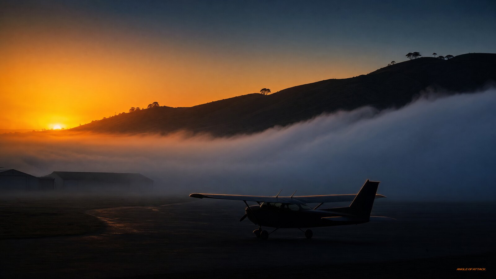
airport with a parked Cessna, as clear hilltops rise above the gray fog layer." src="https://www.angleofattack.com/wp-content/uploads/2026/07/what-is-advection-fog-featured.jpg" style="margin-bottom: 0;">
- Advection fog is fog in motion. It forms when warm, moist air is blown horizontally across a colder surface, cooling from below to its dew point.
- It needs wind — but not too much. Per the PHAK (FAA-H-8083-25C, Ch.12), “wind below 15 knots is required to form advection fog.” Above that, mixing lifts it into low stratus — still IFR, just a different problem.
- It’s a coastal and “cold surface” specialist. Sea breezes carrying ocean moisture over cool land, or warm air flowing over snow-covered or recently thawed ground, are classic setups.
- It can form day or night. Radiation fog is a nighttime, clear-sky event; advection fog doesn’t care about the time of day.
- It can be thick and persistent — for days. Because it’s continuously fed by moving air, advection fog can last far longer than radiation fog and reduce visibility well below VFR minimums.
- Dew point spread is your early warning. A small, shrinking temperature/dew point spread plus an onshore or warm-over-cold flow is the recipe to watch.
- Fog type = decision tool. Knowing it’s advection fog — not radiation fog — tells you whether to wait at the FBO or scrub the day entirely.
WHAT’S IN THIS GUIDE
- 1What is advection fog?
- 2How does advection fog form?
- 3What’s the difference between advection fog and radiation fog?
- 4Where and when does advection fog happen?
- 5Why does advection fog need wind?
- 6How is advection fog different from the other types of fog?
- 7Why does advection fog matter to a pilot?
- 8How do you forecast and spot advection fog before you fly?
- 9Does fog type change your go/no-go decision?
- 10What should you do if advection fog rolls in while you’re flying?
- 11PLT Study Guide
- 12Frequently Asked Questions
What is advection fog?
Advection fog is a type of fog that forms when warm, moist air flows horizontally over a colder surface — like cool ocean water or chilled land — and the air is cooled from below until it reaches its dew point and condenses. The word “advection” simply means horizontal movement of air, which is the key feature: this fog comes to you, carried by the wind.
That horizontal-transport piece is what sets advection fog apart from every other type. Most people picture fog as something that quietly settles in place overnight. Advection fog is different. It’s an air mass on the move, and it can sweep across a coastline or a cold field and drop visibility in a matter of minutes.
The FAA’s Pilot’s Handbook of Aeronautical Knowledge (PHAK, FAA-H-8083-25C, Chapter 12, Weather Theory) defines it directly: “Advection fog is likely to occur when a layer of warm, moist air moves over a cold surface. Wind below 15 knots is required to form advection fog.” The Aviation Weather Handbook (AWH, FAA-H-8083-28) and AC 00-6B both classify advection fog among the major fog types a pilot must recognize. It shows up on the Private Pilot knowledge test under learning statement code PLT226 — recall fog types, formation, and resulting weather.
How does advection fog form?
Advection fog forms when a layer of warm, moist air is transported by wind across a surface that’s colder than the air. The cold surface chills the bottom of the air layer; as that air cools to its dew point, the water vapor it carries condenses into tiny suspended droplets — fog — right at the surface. The wind keeps feeding fresh moist air over the cold surface, so the fog can build and spread.
Think of it as the same physics as your iced drink “sweating” on a humid day. The cold glass cools the air touching it below its dew point, and moisture condenses on the outside. Advection fog is that process scaled up to a whole air mass sliding over cold ground or water.
Three ingredients have to line up:
- Moist air — usually air that has picked up moisture over a warm body of water or warm ground.
- A colder surface — cool ocean water, a chilled bay, snow cover, or land that’s cooled after a front passes.
- Wind below about 15 knots — enough breeze to carry that moist air across the cold surface, but not so much that it mixes the layer upward into stratus clouds aloft (PHAK Ch.12).
One detail the textbooks often gloss over: coastlines are loaded with condensation nuclei — salt particles, sea spray, and pollution — that give water vapor something to cling to when it condenses. That’s part of why coastal advection fog can be so thick and sudden. The air isn’t just near its dew point; it has all the raw material it needs to turn to fog the instant it cools.
Cooling from below is the engine here. In radiation fog, the ground radiates heat away on a clear night and cools the air above it in place. In advection fog, the surface is already cold and the air is delivered to it — so advection fog doesn’t need a clear, calm night. It just needs the right air showing up over the right surface.
What’s the difference between advection fog and radiation fog?
The core difference is movement and wind. Radiation fog forms in place on calm, clear nights as the ground radiates heat and cools the air directly above it. Advection fog forms when wind moves warm, moist air horizontally over a colder surface. Radiation fog needs calm, clear conditions and burns off after sunrise; advection fog needs wind, can form any time of day, and is far more persistent.
This is one of the most-tested fog concepts on the Private Pilot written, and it’s an easy one to mix up. Here’s the side-by-side:
| Feature | Radiation fog | Advection fog |
|---|---|---|
| Primary cause | Ground radiates heat, cools air in place | Warm moist air blown over a colder surface |
| FAA source | PHAK Ch.12 | PHAK Ch.12 (“wind below 15 knots”) |
| Wind required | No — needs calm or very light wind | Yes — wind below ~15 kt (PHAK) |
| Time of day | Forms at night / early morning | Forms day or night |
| Sky condition needed | Clear skies (to radiate heat) | Not critical |
| Typical location | Low ground, valleys, over land | Coasts, lakeshores, over cold land/water |
| Movement | Stays put | Travels with the wind |
| Burns off with sun? | Usually — hours after sunrise | Rarely — persists as long as flow holds |
Notice both fogs cool from below — the difference isn’t the direction of cooling, it’s what does the cooling and whether wind is involved. Radiation fog: still air, the surface chills overnight, fog settles. Advection fog: moving air, a surface that’s already cold, fog delivered on the wind. Lock that distinction in and the test questions get easy.
Where and when does advection fog happen?
Advection fog is most common along coastlines, over and near large lakes, and over land that has recently been cooled — for example, after a cold front passes or where snow still covers the ground. It can form at any time of day or night, in any season, as long as warm moist air is flowing over a colder surface.
The classic coastal setup: air sits over relatively warm ocean water and picks up moisture, then an onshore breeze pushes that moist air over cooler coastal land — or over a cold ocean current — and it fogs in. San Francisco’s famous summer fog is textbook advection fog: warm, moist Pacific air drifts over the cold California Current and rolls through the Golden Gate. It can persist for days because the cold water doesn’t warm up, and the sea breeze just keeps running.
Winter brings a second flavor that catches inland pilots off guard. When warm, moist air moves over snow-covered or recently frozen ground, the cold surface chills the air to its dew point and you get advection fog far from any coastline. Gulf Coast air flowing north over winter-cooled land can fog in entire states well away from the water.
There’s also a trap that almost no one talks about: the day after a cold front. The front sweeps through and leaves cool, dry air behind — classic CAVU. Then the warm sector pushes in behind it, and that moist air advects over the front-cooled ground. Suddenly pilots who expected another beautiful day are dealing with fog that formed over ground that was chilled just 12 hours ago by the frontal passage. The day after the storm can be the foggiest day.
Large lakes are another underappreciated source. The Great Lakes — especially during the spring-to-summer transition when the water is still cold — generate widespread advection fog as warm, moist air flows over the ice-cold lake surface. Pilots who expect spring-clear conditions get surprised by a fog bank that wasn’t there yesterday.
Why does advection fog need wind?
Advection fog needs wind because the wind is the delivery mechanism — it continuously transports warm, moist air over the colder surface. The PHAK (Ch.12) states this as a requirement: wind below 15 knots is needed to form advection fog. With no wind, the warm moist air never reaches the cold surface and the process stalls. But the “below 15 knots” figure matters as much as the minimum.
Here’s what happens at different wind speeds:
| Wind speed | Result |
|---|---|
| Calm | Advection fog doesn’t form — no transport |
| Light to moderate (~3–15 kt) | Fog forms and thickens — classic advection fog |
| Above ~15 kt | Mixing lifts the layer — fog becomes low stratus |
| Strong | Dispersion — fog or stratus may break |
The key point that most sources skip: above 15 knots, the fog doesn’t just disappear. Increased turbulence mixes the cooling air upward instead of holding it against the surface, and the moisture condenses higher up as a low stratus deck — BKN or OVC at a few hundred feet AGL. That’s still an IFR ceiling. Still a visibility problem. Just a different presentation. Thinking “wind picked up, fog’s gone” is the wrong read; thinking “wind picked up, now I’ve got a 300-foot ceiling instead of surface fog” is the right one.
This is the opposite of radiation fog, which wants calm air. Wind stirs the cold surface air up and disrupts radiation fog. Advection fog requires that horizontal motion. Wind is the single cleanest way to tell the two apart on a test question: calm equals radiation, breezy-but-not-blustery equals advection.
How is advection fog different from the other types of fog?
Advection fog is one of several fog types the FAA expects you to recognize, and each forms by a different mechanism. Advection fog is set apart by horizontal air movement over a colder surface and its need for wind. The other major types — radiation, upslope, steam (evaporation), precipitation-induced, and ice fog — each have their own trigger.
| Fog type | How it forms | Key condition | Where you see it |
|---|---|---|---|
| Advection | Warm moist air moves over a colder surface | Wind below ~15 kt | Coasts, lakeshores, over cold/snowy land |
| Radiation | Ground cools air in place on a clear night | Calm, clear, humid | Valleys, low ground, over land |
| Upslope | Moist air forced up rising terrain, cooling adiabatically | Wind blowing toward higher terrain | Hills, mountain slopes, plains rising to ranges |
| Steam (evaporation) | Cold air moves over warm water; moisture evaporates and condenses | Cold air over much warmer water | Lakes, rivers in fall/winter |
| Precipitation-induced | Warm rain falls through cooler air, saturating it | Rain through a cold layer | Ahead of and along warm fronts |
| Ice fog | Water vapor sublimates directly to ice crystals | Very cold temperatures (~−25°F or colder) | Arctic and far-north regions |
Steam fog (evaporation fog) is almost the mirror image of advection fog: in steam fog, cold air moves over warm water, and moisture evaporates upward and recondenses. In advection fog, warm air moves over a cold surface. Same idea of contrasting temperatures, opposite direction. Don’t conflate them.
And advection fog is essentially a stratus cloud sitting on the ground. If the wind picks up and lifts the condensation off the surface, that advection fog literally becomes a low stratus deck — same physics, different altitude. That’s why fog and low stratus often trade places at coastal fields through the day, and why both carry the same family of test codes (PLT226 for fog, PLT192 for clouds).
Why does advection fog matter to a pilot?
Advection fog matters because it is one of the most common causes of widespread, persistent, below-minimums visibility — and it can do it fast, in daylight, with little warning. For a VFR student pilot, that’s a direct go/no-go threat: your departure or destination can go from clear to IFR while you’re in the run-up. For an instrument-rated pilot, it can wipe out your alternate too, because it tends to blanket entire regions at once.
The PHAK and AC 00-6B list fog and low visibility among the leading weather-related causes of general aviation accidents. Continued VFR flight into instrument conditions remains one of the deadliest patterns in the NTSB data — with probable cause language that reads something like: “the pilot’s decision to continue VFR flight in IMC resulted in spatial disorientation and impact with terrain.” Advection fog is a frequent setup for exactly that chain because it can arrive mid-flight, not just at departure. Radiation fog at least has the decency to form overnight before you even launch.
Here’s the cockpit reality. You plan a VFR cross-country to a coastal airport on a beautiful afternoon. The forecast mentions an onshore flow and a tight temperature/dew point spread, but you launch because it’s clear right now. By the time you arrive, a marine layer has pushed in and your destination is reporting a quarter-mile in fog. Your fuel is burning, and your “clear day” just turned into a diversion. That’s advection fog doing what it does.
From the field: Chris Palmer, AOA’s founder and chief CFI, got stuck in Oregon because of exactly this. It was a wall of fog you could see — a gray sheet marching in off the water — and it had socked in the coast just one mile inland. That was the whole margin: one mile. The flight in to the nearest workable airport was right at the edge of VFR. No front, no rain, no overnight cooling — just warm, wet Pacific air sliding over cold coastal ground on a sustained sea breeze. The lesson it teaches is the one every coastal pilot eventually learns the hard way: “clear right now” is not a forecast.
If you fly anywhere near the coast or big water — which describes a huge share of the country’s training airports — advection fog deserves a permanent spot on your personal weather checklist.
How do you forecast and spot advection fog before you fly?
You spot advection fog risk by watching three things in your weather briefing: a small and shrinking temperature/dew point spread, an onshore or warm-air-over-cold-surface flow, and a breeze in the rough 5-to-15-knot range. When those line up — especially near a coast, a lake, or over snow-covered ground — advection fog is likely, regardless of time of day. The TAF and area forecast discussion will often call it out directly.
Temperature/dew point spread: your single best number
When the temperature and dew point are within a couple of degrees and closing, the air is nearly saturated and only a little cooling will produce fog. A METAR showing 10°C/09°C with an onshore wind near a cold coastline is waving a flag. Read that spread on every METAR you pull.
| Spread | Risk level |
|---|---|
| > 10°C (>18°F) | Low — dry air, fog unlikely |
| 5–10°C (9–18°F) | Watch the trend |
| 2–5°C (4–9°F) | Fog/clouds possible |
| 0–2°C (0–4°F) | Fog likely with wind + cold surface present |
| 0°C | Saturated — fog present or imminent |
The cloud-base formula makes this concrete: (Temp °F − Dewpoint °F) × 220 = estimated cloud base AGL. Advection fog is this formula reaching zero. A 2°F spread gives you roughly a 440-foot base — already MVFR. A 1°F spread puts you at 220 feet. Watch that number close toward zero on an onshore flow day.
METAR codes for advection fog conditions
Knowing what the METAR is actually reporting helps you read the severity:
| Code | Meaning |
|---|---|
| BR | Mist — visibility 5/8 SM to 6 SM (AWH FAA-H-8083-28) |
| FG | Fog — visibility below 5/8 SM (AWH FAA-H-8083-28) |
| MIFG | Shallow fog — fog layer less than 6 feet deep |
| FZFG | Freezing fog — supercooled droplets at or below 0°C; icing hazard |
| VV | Vertical visibility into an obscuration — sky is obscured, not just cloudy |
The threshold matters: FG means below 5/8 statute mile. Once your destination is reporting FG, you’re already in IFR territory. BR is the warning flag before FG arrives.
Briefing clues at a glance
| Briefing clue | What to look for | Why it signals advection fog |
|---|---|---|
| Temp/dew point spread | Within ~2°C and narrowing | Air is near saturation; little cooling needed |
| Wind | Steady breeze, roughly 5–15 kt | Enough to transport moist air, not enough to mix it out |
| Wind direction | Onshore, or warm air over cold/snow | Delivers warm moist air to a colder surface |
| Location | Coast, large lake, recently thawed/snowy ground | Provides the cold surface |
| TAF / forecast discussion | Mentions marine layer, BR/FG, MVFR→IFR | Forecasters already see the setup |
Use the official tools. Get a standard weather briefing through 1800wxbrief.com or your EFB; read the METAR and TAF for departure, destination, and alternate; and don’t skip the Aviation Weather Center’s area forecast discussions, which often explain why fog is expected (AIM Chapter 7 covers the weather services available to you).
One practical habit: when you see a coastal destination with a tight spread and an onshore flow, build your plan around the assumption it will fog in, then let good conditions be a pleasant surprise. That’s far safer than planning for clear and getting ambushed.
Does fog type change your go/no-go decision?
Yes — and this is the most practical thing you can take away from understanding advection fog. The type of fog tells you whether to wait at the FBO or cancel the day. That’s not something any textbook comes out and says, but it’s the real-world implication of how each type forms.
Radiation fog at your departure airport? You might wait it out. Radiation fog is a ground-cooling event — it needs clear skies and calm air to persist. Once the sun gets up and starts heating the surface, radiation fog typically burns off. A 7 AM fog bank might be gone by 10 AM. Watch the spread, watch the METAR trend, and you’ll often see it clear.
Advection fog at your destination? Think harder before you wait. Advection fog is sustained by a continuous feed of moist air over a cold surface. As long as that sea breeze or onshore flow keeps running, the fog keeps coming. The sun rarely helps — solar heating isn’t strong enough to warm a cold ocean current or a frozen ground surface through a thick fog bank. There’s no burn-off clock. The fog lifts when the wind shifts, the air mass changes, or the temperature differential disappears — none of which you can predict sitting at the FBO watching the clock.
The decision frame: if your destination has an onshore flow, a tight dew point spread, and a persistent breeze, assume the fog is there for the day. Not “maybe it’ll clear by noon.” For the day. Make alternate plans, get a hotel number, set passenger expectations, and be genuinely willing to get stuck. Coastal flying in fog country means building your schedule around the weather, not the other way around.
That mentality — “willing to get stuck” — is the mark of a coastal pilot who’s been humbled by advection fog once and learned from it.
What should you do if advection fog rolls in while you’re flying?
If advection fog moves in around you, the move is simple and non-negotiable for a VFR pilot: do not press into it. Divert early to an airport that’s still clearly VFR, while you have the fuel, daylight, and clear air to do it safely. Advection fog tends to blanket a whole area, so divert toward higher terrain or inland away from the coast or lake — the fog usually thins as you move away from the cold surface feeding it.
The trap to avoid is “scud running” — trying to sneak in underneath a lowering deck. Visibility in fog can collapse to near zero in seconds, and the ground is right there. The NTSB record on continued VFR into IMC is brutal and consistent. If your destination is reporting visibility below VFR minimums in fog, it is not a place you are landing VFR. Period.
Make the decision early, while you still have options. Fuel turns into time, and time turns into reach toward a safe alternate. Once you’ve burned the margin chasing a destination that won’t open up, your choices shrink fast. Set a personal hard deck — a fuel and visibility number — before you leave the ground, and honor it.
If you’re a VFR-only pilot, the honest answer is that fog at your destination ends your day there. Land somewhere clear, tie down, and wait it out or get a ride. Don’t plan to “wait twenty minutes” the way you might with radiation fog. Advection fog runs on the wind, and until the wind changes, the fog stays.
Want the full weather picture — fog, fronts, stability, and how it all ties into your go/no-go decision — taught in plain language and built for day-one flying? That’s the heart of our Private Pilot Ground School, where weather theory becomes a skill you actually use, not trivia you memorize.
PLT Study Guide
Advection fog shows up on the FAA Private Pilot and Instrument knowledge tests under several learning statement codes. Here are the codes that match this topic, with the real FAA wording translated into plain-English study points.
| PLT code | FAA learning statement | What to study for advection fog |
|---|---|---|
| PLT226 | Recall fog – types / formation / resulting weather | The core code. Know how advection fog forms (warm moist air over a colder surface, PHAK Ch.12), that wind below 15 kt is required (PHAK exact wording), and how it differs from radiation, upslope, and steam fog. |
| PLT263 | Recall hazardous weather – fog / icing / turbulence / visibility restriction | Understand fog as a visibility hazard: why low visibility is dangerous, how persistent advection fog drops conditions below VFR minimums regionally, and why FZFG adds an icing dimension. |
| PLT512 | Recall weather conditions – temperature / moisture / dewpoint | The temperature/dew point relationship. A small, shrinking spread means near-saturation and fog potential — your earliest warning. The cloud-base formula ties this together. |
| PLT492 | Recall temperature – effects on weather formations | How temperature differences between air and surface drive condensation. Warm air over a cold surface is the advection fog engine. |
| PLT192 | Recall clouds – types / formation / resulting weather | Advection fog is surface-level stratus. If wind above ~15 kt lifts it, it becomes a low stratus deck — same physics, different altitude. |
How to use these: Most advection fog questions on the written test live under PLT226 and turn on two facts — it forms when warm moist air moves over a colder surface, and it requires wind below 15 knots (PHAK Ch.12 verbatim). If you can recite those two and contrast them with radiation fog’s “calm and clear,” you’ll get the vast majority of fog questions right. The temperature/dew point spread idea (PLT512) ties the whole thing together.
Frequently Asked Questions
What causes advection fog?
Advection fog is caused by warm, moist air moving horizontally on the wind over a colder surface — such as cool ocean water, a cold bay, or snow-covered ground. The cold surface chills the air from below to its dew point, condensing water vapor into fog. The wind keeps feeding fresh moist air, so the fog builds and spreads.
Does advection fog need wind?
Yes. The PHAK (FAA-H-8083-25C, Ch.12) states directly: “wind below 15 knots is required to form advection fog.” Wind is the delivery mechanism that transports warm, moist air across the colder surface. No wind — no transport, no fog. But above ~15 knots, turbulence mixes the air upward and turns fog into a low stratus deck instead.
What happens above 15 knots — does the fog disappear?
No. Above about 15 knots, increased mixing lifts the fog off the surface and it becomes a low stratus ceiling — BKN or OVC a few hundred feet AGL. That’s still IFR. Still a ceiling and visibility problem. The fog just changed shape. Don’t fly toward a “windy” coastal destination assuming it’s clear; you may find a 300-foot overcast instead.
What is the difference between advection fog and radiation fog?
Radiation fog forms in place on calm, clear nights as the ground radiates heat and cools the air directly above it. Advection fog forms when wind moves warm, moist air horizontally over a colder surface. The PHAK-tested distinction: radiation fog needs no wind; advection fog requires wind below ~15 kt. Radiation fog typically burns off after sunrise; advection fog can persist for hours or days.
Can advection fog form during the day?
Yes. Unlike radiation fog, which is a nighttime and early-morning event tied to a clear sky, advection fog can form at any time of day or night. It only requires warm moist air flowing over a colder surface — including a sunny afternoon along a cool coastline.
Why won’t advection fog just burn off in the sun?
Because solar heating rarely penetrates a thick coastal fog bank enough to warm the cold surface below it — especially ocean water, which has an enormous heat capacity and doesn’t warm easily. And the wind keeps bringing in fresh moist air. Radiation fog burns off because the ground warms; advection fog persists because the cold surface (ocean, cold land) stays cold and the airflow keeps running.
Where is advection fog most common?
Along coastlines, near large lakes, and over land that has recently been cooled — such as snow-covered ground or land chilled after a cold front. The Pacific Northwest, California, the Gulf Coast, the Northeast, and the Great Lakes region all see it regularly, especially with an onshore breeze.
How long does advection fog last?
Much longer than radiation fog — often many hours, sometimes days. San Francisco Bay’s summer marine layer can persist for weeks. Because moving air continuously supplies fresh moisture to the cold surface, it doesn’t simply burn off. It clears only when the wind shifts, the air mass changes, or the temperature difference disappears.
What does FZFG mean on a METAR?
Freezing fog — supercooled liquid water droplets at or below 0°C that deposit rime ice on aircraft surfaces, runways, and control surfaces on contact. Advection fog over snow-covered ground or in cold-air conditions can become FZFG. It’s a hard no-go for any aircraft without certified ice protection: every surface the droplets touch accumulates rime immediately. If your destination METAR shows FZFG, the decision is already made.
Is sea fog the same as advection fog?
Essentially yes. “Sea fog” is advection fog that forms over or near a body of water. The mechanism is identical: warm moist air over a cold surface. The label changes based on location; the physics don’t.
Is advection fog dangerous for pilots?
Yes. Advection fog is a leading cause of widespread, persistent below-minimums visibility, and it can form quickly in daylight with little warning. It can drop a destination below VFR minimums while you’re en route and blanket entire regions, including potential alternates. For VFR pilots it’s a clear divert-or-don’t-go situation. It’s also one of the most common setups for the continued-VFR-into-IMC accident chain.
How can I tell if advection fog will form before I fly?
Watch the temperature/dew point spread, the wind, and the location. A small, shrinking spread (within about 2°C), a steady onshore or warm-over-cold breeze of roughly 5–15 knots, and a coastal, lakeside, or snow-covered area together signal advection fog. Pull the METAR, TAF, and area forecast discussion in your standard weather briefing to confirm. A TAF showing FG, FZFG, TEMPO, or BECMG windows is the forecasters’ way of telling you it’s already in the model.
Advection fog is one of those weather concepts that looks like dry test trivia until the day it parks itself over your destination and turns a clear-sky flight into a diversion. Learn the mechanism — warm moist air, cold surface, a steady breeze — and you’ll never be surprised by it again. More than that, you’ll read a briefing like a pilot instead of a tourist, and you’ll make the go/no-go call early, when it’s easy.
Master every system on your checkride — and on day one.
The Private Pilot Ground School breaks down every FAA subject area in the same plain-English, real-world way you just read — with quizzes, scenarios, and the explanations that finally make it click.
Know the type. Know what it means for your day. That’s the whole game with weather: understand the why, and the decisions make themselves.


ON THE SAME TOPIC

IFR vs VFR: The Two Sets of Rules Every Pilot Flies By
IFR vs VFR: The Two Sets of Rules Every Pilot Flies By 19 min read Last updated June 2026 · Chris Palmer The difference between IFR and VFR is which set of rules you fly under. VFR — visual flight rules — lets you navigate by looking outside and staying clear of clouds in good […]
 Read more
ASOS vs AWOS vs ATIS: How to Pull the Right Weather Before You Fly
ASOS vs AWOS vs ATIS: How to Pull the Right Weather Before You Fly 13 min read Last updated June 2026 · Chris Palmer The difference comes down to who is talking and what the broadcast covers. ASOS and AWOS are automated, computer-generated weather observations of the conditions right at the field. ATIS is a […]
Read more 
What Is RNAV Navigation? Area Navigation for VFR Pilots
What Is RNAV Navigation? Area Navigation for VFR Pilots 17 min read Last updated June 2026 · Chris Palmer RNAV — Area Navigation — is a method that lets an aircraft fly any desired path within the coverage of ground- or space-based navigation aids, rather than being forced to fly directly to and from stations. […]
Read more 
NDB and ADF Explained: The Oldest Radio Nav System You Still Need to Understand
NDB and ADF Explained: The Oldest Radio Nav System You Still Need to Understand 16 min read Last updated June 2026 · Chris Palmer An NDB (non-directional beacon) is a ground-based radio transmitter that sends a signal in all directions, and an ADF (automatic direction finder) is the cockpit receiver whose needle points straight at […]
Read more 
Stay Connected
Be the very first to get notified when we publish new flying videos, free lessons, and special offers on our courses.
