
Freezing Rain in Aviation: The Ice That Forms Before You Can React
Freezing rain in aviation is rain that exists as a supercooled liquid — chilled below freezing but still liquid — that turns to ice the instant it strikes a colder surface like your airframe. It coats the airplane in smooth, dense clear ice extremely fast, destroys lift, adds weight, and is considered one of the most dangerous icing conditions a pilot can encounter. For a student pilot, freezing rain is the textbook example of why “stay out of it” is the only safe answer. There is no anti-ice system on a Cessna 172 that beats it, and there is no good way to fly out of it once you’re in it. The win is recognizing the setup before you ever leave the ground.
This article walks through exactly what freezing rain is, the weather pattern that creates it, why it forms ice so much faster than clouds do, how it shows up in your weather briefing, and what to actually do about it. We’ll keep it grounded in FAA sources so you can trust every number.
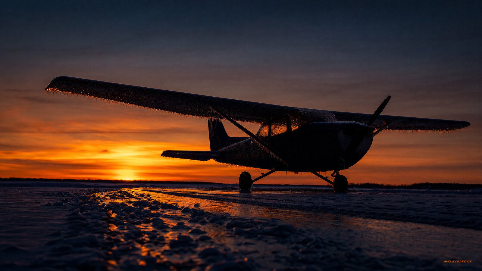
- Freezing rain is supercooled liquid water. It’s rain that falls through a cold layer near the ground and stays liquid below 0°C until it hits something — then it freezes on contact.
- It produces clear ice, the worst kind. The drops are large (Supercooled Large Droplets, or SLD — over 40 micrometers), so they run back across the wing before freezing into a smooth, heavy, hard-to-shed glaze that extends far behind any protection system.
- A temperature inversion usually causes it. Warm air aloft over a cold surface layer is the classic freezing-rain recipe, most common ahead of a warm front or stationary front.
- Light airplanes have no defense. The PHAK (FAA-H-8083-25C) is blunt: freezing rain can be the most hazardous icing because of how fast and how much ice accumulates.
- METAR code is FZRA; freezing drizzle is FZDZ. Learn to spot both in a briefing and treat a forecast of either as a no-go for a non-deiced trainer.
- Ice pellets (PL) in a METAR is a warning shot. If solid pellets are falling, a warm layer exists just above — change the temperature slightly and you’d have FZRA instead.
- Climbing can be your escape — but it’s a gamble. Because the freezing air is often a shallow layer near the surface, warmer air may sit just above you. But the climb requires burning performance you may not have, and a VFR pilot may need to enter IMC to reach it.
- The fix is on the ground. Recognizing the freezing-rain setup in your weather briefing and choosing not to launch is the only reliable defense.
WHAT’S IN THIS GUIDE
- 1What is freezing rain in aviation?
- 2How does freezing rain actually form?
- 3Why is freezing rain so dangerous for airplanes?
- 4What is supercooled water and why does it freeze on contact?
- 5Freezing rain vs. freezing drizzle vs. sleet vs. clouds
- 6How do I spot freezing rain in a weather briefing?
- 7What should I do if I encounter freezing rain in flight?
- 8Can a Cessna 172 or other trainer handle freezing rain?
- 9What does freezing rain do to lift, weight, and control?
- 10How do I avoid freezing rain before I ever take off?
- 11Which fronts produce the worst freezing rain?
- 12PLT Study Guide
- 13Frequently Asked Questions
What is freezing rain in aviation?
Freezing rain is precipitation that falls as liquid raindrops at a temperature below freezing and turns to ice the moment it touches a surface that’s at or below 0°C (32°F). The water is “supercooled” — still liquid, but colder than its normal freezing point — so it waits to freeze until it has something to freeze onto. For a pilot, that something is your airplane.
This is different from snow, which is already frozen, and different from cloud icing, which involves tiny supercooled droplets inside a cloud. Freezing rain falls from the sky as rain you can see and hear hitting the windshield, and it leaves behind a smooth, glassy coat of clear ice. The FAA’s Aviation Weather Handbook (FAA-H-8083-28) and the Pilot’s Handbook of Aeronautical Knowledge (PHAK, FAA-H-8083-25C) both treat freezing rain as a top-tier hazard precisely because of how fast that ice builds.
In a METAR or TAF, freezing rain is coded FZRA. When you see those four letters in a forecast for your route or destination, the planning conversation for a non-deiced trainer is over — you’re not going.
How does freezing rain actually form?
Freezing rain forms when a layer of warm air sits on top of a layer of below-freezing air near the ground — a setup called a temperature inversion. Snow falls from the cold clouds aloft, melts into rain as it passes through the warm middle layer, then falls into the shallow cold layer at the surface. It doesn’t have time or a particle to freeze around, so it stays liquid and supercooled until it hits the ground, the trees, the road, or your wing.
That warm-over-cold profile is the whole story. The classic place to find it is ahead of a warm front, where warm air is gliding up and over a wedge of colder air still hugging the surface. As that warm air overruns the cold air, you get a band of rain falling into freezing temperatures. The PHAK and FAA-H-8083-28 both point to warm fronts as the prime breeding ground for freezing rain.
Here’s the part student pilots miss: the cold surface layer is often shallow — sometimes only a few hundred to a couple thousand feet thick, though it can reach up to 7,000 feet in extreme setups. That matters enormously, because it means the freezing zone may be a thin slice near the ground with warmer air right above it. We’ll come back to why that’s both your danger and your potential escape route.
The other ingredient is simply that everything is cold enough to start frozen up high. If the entire column were warm, you’d just have rain. If the cold layer were deeper, the drops would refreeze into ice pellets (sleet) before reaching the ground. Freezing rain lives in that narrow in-between.
One more warning flag the briefing teaches: watch the cloud sequence ahead of a warm front. Cirrus at altitude gives way to altostratus, then nimbostratus. By the time you see nimbostratus and rain, the warm-over-cold inversion is already set up. Don’t wait for FZRA to appear in a METAR before you take the threat seriously — the cloud sequence is reading you the setup hours ahead of time.
Why is freezing rain so dangerous for airplanes?
Freezing rain is dangerous because it deposits more ice, faster, over more of the airframe than almost any other icing condition. The PHAK (FAA-H-8083-25C) specifically identifies freezing rain as potentially the most hazardous icing condition a pilot can meet. The reason is the size of the water drops: rain drops are far larger than cloud droplets, so a single pass through freezing rain delivers a huge volume of water that freezes into thick, heavy ice in minutes.
The technical term from AC 91-74B is Supercooled Large Droplets, or SLD — drops with diameters greater than 40 micrometers. Regular icing clouds produce droplets well under 40 micrometers; those freeze quickly and mainly build up at the leading edge. SLD drops are big enough that they flow back across the chord before freezing. That matters for one critical reason: the ice forms aft of the leading edge, behind where any de-icing boot or heated leading edge provides protection. Even an airplane certified for flight into known icing can be overwhelmed by SLD conditions. Freezing rain is SLD by definition.
Because the drops are large, they don’t freeze instantly on the leading edge. They splash and run back across the upper wing surface before freezing, building a smooth sheet of clear ice that extends behind anything the de-icing system could reach. That ice is dense, hard, well-bonded, and it reshapes the airfoil exactly where it does the most damage to lift.
Now stack the effects. The ice adds weight. It disrupts the smooth airflow your wing needs to make lift, which raises your stall speed. It adds drag, so you need more power just to hold altitude. It can jam control surfaces and freeze over the pitot tube and static ports, corrupting your airspeed and altitude indications. In a trainer with no ice protection, all of that can happen before you’ve finished deciding what to do about it.
And it isn’t only an in-flight problem. Freezing rain on the ground glazes a parked airplane with clear ice that’s notoriously hard to see — the smoothest, most invisible contamination there is. Taking off with that on the wings is its own well-documented killer.
What is supercooled water and why does it freeze on contact?
Supercooled water is liquid water chilled below its normal freezing point of 0°C (32°F) but not yet frozen. Pure water needs something to freeze around — a particle, an impurity, or a surface. In clean air, a raindrop can fall as a liquid well below freezing. The instant it touches your wing, it freezes almost immediately.
This single concept explains all aircraft icing. Whether it’s the tiny droplets inside a winter cloud or the big drops in freezing rain, supercooled liquid water is the raw material. Your airframe is the trigger. That’s why icing is a temperature-plus-visible-moisture problem: liquid water plus a surface cold enough to freeze it.
Drop size is what separates freezing rain from cloud icing. Freezing rain drops are full-sized rain — vastly more water per second, running farther back before they freeze. That’s the recipe for the smooth, extensive, fast-building clear ice that puts freezing rain in its own category.
Freezing rain vs. freezing drizzle vs. sleet vs. clouds
These four conditions get confused constantly, and the differences are exactly what the FAA wants you to know. The key variables are the size of the water and whether it arrives liquid or already frozen.
| Condition | METAR code | State when it hits you | What it leaves | Where ice forms | Threat level for a trainer |
|---|---|---|---|---|---|
| Freezing rain | FZRA | Supercooled liquid, large drops (SLD >40 µm) | Smooth, heavy clear ice | Runs back far behind LE — aft of any protection | Severe — among the worst |
| Freezing drizzle | FZDZ | Supercooled liquid, small drops (SLD — still >40 µm) | Clear/mixed ice; slower build than FZRA | Behind LE, less runback than FZRA | High — still a no-go |
| Sleet (ice pellets) | PL | Already frozen solid aloft | Bounces off; little airframe ice | Minimal | Lower for airframe ice, but signals a freezing layer nearby |
| Cloud (in-cloud) icing | (not precip) | Tiny supercooled droplets (<40 µm) | Rime, clear, or mixed depending on temp | Leading edge, mostly | Varies; rime is common, clear is worse |
Three takeaways from that table. First, sleet (ice pellets, coded PL) is actually a warning flag even though it doesn’t stick to your airframe much. It tells you a warm layer exists aloft — the precipitation melted and then refroze in a deeper cold layer below. Change the depth of that cold layer slightly and you’d have FZRA instead. If you’re hearing pellets on the windshield before takeoff, the atmosphere is primed. Second, freezing drizzle (FZDZ) is still classified as SLD by AC 91-74B and deserves the same no-go respect as FZRA; the drops are smaller, so it builds a little slower, but it still coats your airplane in clear ice. Third, notice the “where ice forms” column — the aft-of-leading-edge location is the critical difference between cloud icing and SLD. It’s why even FIKI-certified aircraft have SLD limitations.
How do I spot freezing rain in a weather briefing?
You spot freezing rain in a briefing by reading the codes and the setup. In a METAR or TAF, look for FZRA (freezing rain) and FZDZ (freezing drizzle). Either one in a current observation or a forecast for your route, departure, or destination is a hard stop for a non-deiced airplane. Also watch for PL (ice pellets/sleet) as a sign the temperature profile is primed for freezing precipitation.
Beyond the precipitation codes, read the pattern. An approaching warm front, surface temperatures near or below freezing with warmer air aloft, and a forecast of rain are the fingerprints of a freezing-rain situation. Two text products are built for exactly this: AIRMET Zulu, which covers moderate icing and freezing levels, and SIGMETs, which are issued for severe icing. The freezing level information in your briefing tells you how thick that cold layer near the surface is.
Pilot reports (PIREPs) are gold here — and are chronically underused. A PIREP of icing — especially clear ice or freezing precipitation, coded /IC in the report — from an airplane on your route is the most current, real-world signal you can get. No model or forecast product can tell you what’s actually happening at altitude right now. If someone ahead of you is reporting freezing rain, believe them.
Get a standard weather briefing through an official source such as 1800wxbrief.com (Leidos Flight Service) or your usual EFB, and treat any freezing-precipitation flag as decisive, not as one data point among many. And here’s the flip side of the PIREP equation: if you encounter freezing rain and escape, file a PIREP. That report protects the next pilot. It may be the only real-time data in the system for your area.
What should I do if I encounter freezing rain in flight?
If you blunder into freezing rain in a light airplane, treat it as an immediate emergency: get out of the freezing layer as fast as you safely can, and tell ATC. You have three basic exits — climb, descend, or reverse course — and which one is right depends on where the warm air is.
Because the cold layer in a freezing-rain setup is usually shallow and sits underneath warmer air, a climb can put you into above-freezing air where the ice stops forming and may even start to melt. That’s often the most effective move — but there’s a trap a lot of discussions skip: the warm layer above you may require flying into IMC to reach it. If you’re VFR and the warm air is above the cloud base, climbing is also a VFR-into-IMC problem on top of an icing problem. That’s two emergencies at once, and it’s why avoidance before takeoff is the only answer that doesn’t involve gambling. The PHAK notes that climbing into warmer air aloft is a recognized escape from freezing rain, but it assumes you have the instrument rating and clearance to make that climb safely.
Descending to land or to reach warmer air below is the other option if you know what’s beneath you and you’re sure the surface air isn’t even colder. And a 180-degree turn back into the air you just flew through — which you know was clear — is frequently the smartest first instinct.
Whatever you pick, fly the airplane first. Carry extra airspeed because your stall speed is now higher than the book says, avoid abrupt control inputs, and don’t trust an airspeed indicator that may be fed by an iced-over pitot tube. Declare the situation to ATC so you get priority handling and the altitudes you need. Pull on the pitot heat and carb heat if you have them. None of this is a fix — it’s damage control. The real lesson is that you should never have been there, which is why avoidance is the whole game.
Can a Cessna 172 or other trainer handle freezing rain?
No. A Cessna 172, a Piper trainer, or any typical training airplane is not certified or equipped for flight into known icing, and freezing rain in particular will overwhelm it. These airplanes have, at most, a heated pitot tube and carburetor heat — neither of which protects the wings, tail, or windshield where structural ice does its damage. There is no deicing boot, no heated leading edge, no weeping-wing system.
It’s worth being precise about the regulations, because this is exactly where a lot of online write-ups get sloppy. The rule that actually governs your trainer is 14 CFR § 91.9, which requires every pilot to comply with the aircraft’s AFM and POH operating limitations. Most light GA aircraft POHs contain a placard or limitation that says “Flight Into Known Icing: Prohibited.” That prohibition is not advisory — it’s an operating limitation you are legally required to follow under 91.9. That’s the hook for a Part 91 pilot, VFR or IFR; it doesn’t matter that you’re not on an IFR flight plan.
A word of caution about a regulation you’ll see cited elsewhere: 14 CFR § 91.527 (“Operating in icing conditions”) prohibits flight into known or forecast severe icing without certified ice protection — but it lives in Subpart F, which applies only to large and turbine-powered multiengine airplanes (and fractional-ownership aircraft). It does not apply to a Cessna 172 or a typical piston trainer. So don’t lean on 91.527 for your no-go; the correct basis is the 91.9 operating limitation, backed by the catch-all that flying a single-engine trainer into freezing rain is careless and reckless operation under 14 CFR § 91.13.
Either way, the conclusion is the same: you cannot legally or safely fly a standard trainer into freezing rain. More fundamentally, this isn’t a paperwork problem — it’s a physics problem. Even airplanes that are certified for flight into known icing (FIKI) are generally warned against prolonged flight in SLD conditions, because the ice forms behind the protected surfaces.
So when you read FZRA in a forecast, the answer for your trainer isn’t “be careful.” It’s “not today.” Day one as a pilot, this is one of the cleanest go/no-go calls you’ll ever make, and getting it right is what keeps you flying long enough to build the experience that earns the harder calls.
What does freezing rain do to lift, weight, and control?
Freezing rain degrades every part of how your airplane flies. Ice on the wing changes the shape of the airfoil, which spoils the smooth airflow that creates lift. The result is less lift at any given angle of attack and a higher stall speed — your wing now stalls at a faster airspeed than the number printed in your POH, and it can stall with little or no warning because the ice disrupts the normal aerodynamic cues.
There’s a subtlety here that matters: because freezing rain is SLD, the ice forms not just on the leading edge but back across the chord. If your airplane has a laminar flow wing (think Cirrus, Diamond, certain Mooneys), even a small amount of contamination destroys the design premise of that wing — laminar flow depends on an almost surgically smooth surface. But even a conventional wing is significantly degraded by clear ice extending behind the leading edge, because that’s the region of peak suction that drives lift.
At the same time, the ice adds weight and adds drag. More weight plus less lift plus more drag means you need more power and a higher angle of attack just to hold altitude — which pushes you closer to that already-elevated stall. On the controls, ice can build on the elevator and ailerons and make them stiff, heavy, or partially jammed, and tailplane icing can produce its own dangerous handling problems on approach when you add flaps.
| Effect of airframe ice | What happens | Why it matters in the cockpit |
|---|---|---|
| Disrupted airflow over wing (aft of LE with SLD) | Less lift, higher stall speed | You can stall at “normal” airspeeds, often without warning; stall may be abrupt with no buffet warning |
| Added weight | Aircraft is heavier | Reduced climb rate, harder to maintain altitude — especially with degraded lift |
| Added drag | More power required | Power margin may not be enough to hold altitude |
| Iced control surfaces | Stiff or jammed controls | Reduced or unpredictable control authority; ailerons, elevator both affected |
| Tailplane icing | Loss of pitch control, especially with flap extension | Can cause pitch-down on approach; add flaps cautiously or not at all |
| Blocked pitot/static | Bad airspeed/altitude | Your instruments lie when you need them most; pitot heat helps the pitot tube but not static ports |
The instrument failures deserve their own emphasis. If freezing rain blocks the pitot tube or static ports, your airspeed indicator, altimeter, and vertical speed indicator can all give false readings. Pitot heat helps protect the pitot tube, which is exactly why the runup and preflight habit of checking pitot heat matters — but it’s a last line of defense, not a license to fly into ice.
How do I avoid freezing rain before I ever take off?
You avoid freezing rain by catching it in the briefing and making the no-go decision on the ground, where it costs you nothing but a delay. Get a full standard weather briefing, scan for FZRA, FZDZ, and PL in METARs and TAFs along your whole route, and look for the warm-front-with-cold-surface-air pattern that produces it. Check AIRMET Zulu (moderate icing forecast for light aircraft) and any SIGMETs (severe icing — hard no-go for all GA) for icing, note the freezing levels, and read recent PIREPs for anyone already reporting ice.
The preflight briefing habit to build: scan the forecast, find the freezing level, look at the temperature profile — is there a warm layer aloft sitting over a below-freezing surface? That alone is the setup. You don’t need to see FZRA in the METAR yet; the configuration tells you the risk.
Build a personal rule and follow it without negotiating: any forecast or report of freezing precipitation on your route or at your destination is a no-go in a non-deiced airplane. This is the kind of bright-line decision the most experienced pilots make in advance, at the kitchen table, not at 2,000 feet with ice on the windshield. The best go/no-go call is the one that never feels like a close call because you set the line before you were emotionally invested in launching.
One more ground habit: if your airplane sat outside overnight and you suspect freezing rain fell, don’t just swipe the wing and call it clear. Clear ice from freezing rain can be all but invisible on a white or gray surface in flat morning light. Run a bare hand across every surface — leading edges, horizontal stabilizer, elevator. If there’s any doubt, full removal before flight. The rule is remove completely; polishing frozen contamination flat is not a solution.
The cleanest defense against freezing rain isn’t a system or a maneuver. It’s the habit of looking, recognizing the pattern, and being willing to stay on the ground. Our free Total Student Pilot course builds that go/no-go confidence from day one, and the Private Pilot Ground School goes deep on aviation weather so both the knowledge-test questions and the real cockpit decisions feel obvious before you ever see FZRA in a briefing.
Which fronts produce the worst freezing rain?
Not all fronts carry the same freezing-rain risk, and the differences are tactical — they affect how much warning time you have and how long the hazard persists.
| Front Type | Freezing Rain Risk | Why | Warning Time |
|---|---|---|---|
| Warm front | HIGH | Classic warm-over-cold inversion; broad area, gradual approach | Hours — cloud sequence (cirrus → altostratus → nimbostratus) is readable well in advance |
| Stationary front | VERY HIGH | Same inversion setup but it doesn’t move. Can park freezing rain over an area for days. | Long lead time, but the persistence creates a complacency trap — it’s easy to keep hoping it clears |
| Cold front | LOW–MODERATE | Steep slope, narrow band; less inversion setup | Short — but it also passes faster |
| Occluded front | HIGH | Combines warm and cold characteristics; complex, layered icing | Unpredictable — can produce icing at multiple altitudes |
The stationary front scenario is worth dwelling on because competitors don’t cover it. A stationary front doesn’t have the urgency of a moving system, so pilots can end up waiting it out for days while freezing rain persists overhead. There’s no “it’ll clear by this afternoon” escape; the divert may need to be a multi-day decision, not a weather hold.
The warm front is the classic setup to memorize for the knowledge test and for real flying. When you see a warm front approaching on the surface analysis chart, start tracking the temperature profile at your destination and looking for the inversion signature. The cloud sequence will tell you well before any precipitation code appears in a METAR.
PLT Study Guide
These are the FAA Learning Statement (PLT) codes that map to freezing rain and the broader icing knowledge the FAA tests on the Private Pilot exam. The two codes the FAA most directly attaches to airframe icing and aircraft contamination are PLT493 and PLT494 — anchor your study there. The supporting codes below cover the weather-theory backbone (icing formation, hazardous weather recognition, and the temperature mechanics behind it).
| PLT Code | Knowledge area it covers | What to study for freezing rain |
|---|---|---|
| PLT493 | Dynamics of frost / ice / snow formation on an aircraft | How contamination forms on the airframe, why clear ice is the worst, and why even overnight ground ice matters |
| PLT494 | Weather information / icing and its effect on aircraft | How icing degrades performance — higher stall speed, added weight and drag, reduced climb and control |
| PLT274 | Icing — formation, hazards, characteristics | How freezing rain forms (supercooled liquid, warm-over-cold inversion) and why it produces smooth clear ice |
| PLT263 | In-flight hazards / hazardous weather recognition | Recognizing icing as a hazardous-weather condition and the products (AIRMET Zulu, SIGMET, PIREP) that warn of it |
| PLT206 | Effects of temperature / atmospheric conditions | The role of temperature in whether falling moisture stays liquid and freezes on your airframe |
Study tip: the FAA loves to test the formation logic. If you can explain, out loud, why warm air over cold air gives you freezing rain — and why the same column with a deeper cold layer gives you sleet instead — you’ve nailed the heart of what these codes are really asking.
Frequently Asked Questions
What is freezing rain in aviation in simple terms?
Freezing rain is rain that is colder than freezing but still liquid (supercooled) until it touches your airplane, where it instantly turns to smooth, heavy clear ice. It’s coded FZRA in weather reports and is one of the most dangerous icing conditions a pilot can fly into.
What is the difference between freezing rain and sleet?
Freezing rain hits your airplane as supercooled liquid and freezes on contact, leaving dangerous clear ice. Sleet (ice pellets, coded PL) has already refrozen into solid pellets while still in the air — so it bounces off and adds little airframe ice. The key difference: freezing rain passes through a warm layer aloft (melting), then falls into a below-freezing surface layer without time to refreeze. Sleet has no warm layer — it freezes solid before it reaches you. If you’re hearing pellets on the windshield, the atmosphere is in the setup for freezing rain nearby; the temperature profile just ran slightly colder.
Why is freezing rain so dangerous compared to other icing?
Two reasons that compound each other. First, the drops are large Supercooled Large Droplets (SLD — over 40 micrometers per AC 91-74B), so a huge volume of water arrives fast. Second, SLD flows aft of the leading edge before freezing, building ice behind any de-ice or anti-ice system. Even aircraft certified for known icing can be overwhelmed. The PHAK (FAA-H-8083-25C) calls it potentially the most hazardous icing because of how fast and how far back the ice builds.
Can a Cessna 172 fly in freezing rain?
No. A Cessna 172 and similar trainers are not certified for flight into known icing and have no wing or tail ice protection. The POH operating limitation “Flight Into Known Icing: Prohibited” is a legally binding limitation under 14 CFR § 91.9 — that’s the regulation that actually governs your trainer. (You’ll see 91.527 cited elsewhere, but it applies only to large and turbine-powered multiengine airplanes, not a piston single.) A forecast of FZRA is a no-go, full stop.
Can a private pilot legally fly in freezing rain?
No. Your POH most likely says “Flight Into Known Icing: Prohibited,” and 14 CFR § 91.9 requires you to comply with that limitation — that single rule is the no-go for a piston trainer. (Skip the commonly miscited 91.527: it governs large and turbine multiengine airplanes, not your 172.) Add 14 CFR § 91.13, which makes flying a single-engine trainer into freezing rain careless and reckless operation, and it’s clear this isn’t a gray area.
How do you get out of freezing rain if you’re already in it?
Exit immediately and tell ATC. The three options — climb, descend, 180-degree turn — depend on what you know about the atmosphere around you. The 180 to known-clear air is often the safest first move because you’re reversing to known conditions. Climbing into the warmer layer above is effective, but remember: for a VFR pilot that layer may be above the cloud base, turning an icing emergency into a VFR-into-IMC emergency simultaneously. Descend if you know there’s warmer air below and a safe place to land. Whatever you choose, carry extra airspeed (stall speed is elevated), keep ATC informed, and file a PIREP when you’re clear. That report may save the next pilot.
What is supercooled water?
Supercooled water is liquid water chilled below its normal freezing point of 0°C (32°F) that hasn’t frozen yet because it lacks something to freeze around. Pure, clean water can stay liquid well below 0°C. When it strikes a surface like your wing, it freezes almost instantly. It’s the raw material behind all aircraft icing — cloud droplets, freezing drizzle, and freezing rain are all forms of supercooled water. The drop size is what separates them.
What does freezing rain look like on a METAR?
Freezing rain shows up as the code FZRA. Freezing drizzle is FZDZ, and ice pellets (sleet) are PL. Also watch for AIRMET Zulu (moderate icing forecast for a broad area) and SIGMETs for severe icing. Any of FZRA, FZDZ, or PL in a current observation or forecast along your route is a serious flag for a non-deiced airplane. PL is a warning that the atmosphere is primed for FZRA — don’t treat it as “safe.”
What weather causes freezing rain?
A three-layer atmosphere: (1) a below-freezing layer aloft where precipitation starts as snow, (2) a warm middle layer that melts the snow into rain, (3) a shallow below-freezing surface layer where the rain stays liquid and supercooled until it hits something. The warm middle layer is a temperature inversion, most common ahead of a warm front or stationary front. (PHAK Ch. 12)
Is freezing drizzle as dangerous as freezing rain?
Freezing drizzle (FZDZ) is classified as SLD by AC 91-74B, so it still flows aft of the leading edge and forms the same clear ice pattern as freezing rain — just slightly slower because the drops are smaller. Treat it with identical no-go respect. The only practical difference is accumulation rate.
At what temperature does freezing rain occur?
The aircraft surface needs to be at or below 0°C (32°F). The air near the surface also needs to be below freezing. But a warmer layer aloft (above 0°C) must exist to melt the falling snow into rain. Freezing rain is most common when surface temperatures hover right around freezing in the cold season — it’s the narrow temperature window between “all rain” and “all sleet.”
What should I do with ice on my airplane from overnight freezing rain?
Full removal before flight. Clear ice from freezing rain is nearly invisible on a light-colored surface in flat morning light — the only reliable check is running a bare hand across the leading edges and upper surfaces. If there’s any doubt, treat it as contaminated. “Polish it smooth” is not a solution; even a thin, smooth ice layer disrupts laminar flow and raises your stall speed. Remove it completely.
Master every system on your checkride — and on day one.
The Private Pilot Ground School breaks down every FAA subject area in the same plain-English, real-world way you just read — with quizzes, scenarios, and the explanations that finally make it click.
Here’s the thing nobody tells you about freezing rain: it doesn’t look like a monster. It looks like a wet airplane. The glazed wings catch the light at just the right angle, or you run a glove across the surface and feel something that isn’t quite right. By the time you realize what’s happening — on the ramp or in the air — the decision window has already narrowed. So master the warm-over-cold pattern, learn the FZRA and FZDZ codes cold, and set the personal minimum that keeps you on the ground when the briefing lights up. The whole game is making the call early, before the weather makes it for you. That single habit will outlast every airplane you ever fly.


ON THE SAME TOPIC

IFR vs VFR: The Two Sets of Rules Every Pilot Flies By
IFR vs VFR: The Two Sets of Rules Every Pilot Flies By 19 min read Last updated June 2026 · Chris Palmer The difference between IFR and VFR is which set of rules you fly under. VFR — visual flight rules — lets you navigate by looking outside and staying clear of clouds in good […]
 Read more
ASOS vs AWOS vs ATIS: How to Pull the Right Weather Before You Fly
ASOS vs AWOS vs ATIS: How to Pull the Right Weather Before You Fly 13 min read Last updated June 2026 · Chris Palmer The difference comes down to who is talking and what the broadcast covers. ASOS and AWOS are automated, computer-generated weather observations of the conditions right at the field. ATIS is a […]
Read more 
What Is RNAV Navigation? Area Navigation for VFR Pilots
What Is RNAV Navigation? Area Navigation for VFR Pilots 17 min read Last updated June 2026 · Chris Palmer RNAV — Area Navigation — is a method that lets an aircraft fly any desired path within the coverage of ground- or space-based navigation aids, rather than being forced to fly directly to and from stations. […]
Read more 
NDB and ADF Explained: The Oldest Radio Nav System You Still Need to Understand
NDB and ADF Explained: The Oldest Radio Nav System You Still Need to Understand 16 min read Last updated June 2026 · Chris Palmer An NDB (non-directional beacon) is a ground-based radio transmitter that sends a signal in all directions, and an ADF (automatic direction finder) is the cockpit receiver whose needle points straight at […]
Read more 
Stay Connected
Be the very first to get notified when we publish new flying videos, free lessons, and special offers on our courses.
