
What Are the Types of Fog? A Pilot’s Guide to the 6 Kinds and How They Form
The main types of fog a pilot needs to know are radiation fog, advection fog, upslope fog, precipitation-induced (frontal) fog, and steam (evaporation) fog, plus freezing fog and ice fog as cold-weather variants — each forming the same way, when air cools to its dewpoint or absorbs enough moisture to saturate and water vapor condenses into a cloud sitting on the ground. That last part is the whole secret. Fog is nothing more exotic than a cloud that happens to touch the surface. Learn the handful of ways air reaches saturation down low, and you’ve learned every kind of fog there is — and, more importantly, you’ve learned to see it coming before it traps you on the ground or, worse, in the air.
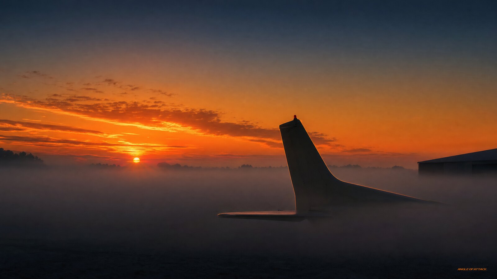
aircraft parked on a foggy airport ramp at dawn, its tail rising above a thick layer of low ground fog while the sky above stays clear." src="https://www.angleofattack.com/wp-content/uploads/2026/07/what-are-the-types-of-fog-featured.jpg" style="margin-bottom: 0;">
- Fog is a cloud at the surface. It forms when the air temperature and dewpoint converge — the temperature-dewpoint spread shrinks toward zero, the air saturates, and water vapor condenses into visible droplets right at ground level.
- There are five main types plus two cold variants. Radiation, advection, upslope, precipitation-induced (frontal), and steam (evaporation) fog are the big five; freezing fog and ice fog are the sub-freezing cousins.
- Radiation fog forms on clear, calm, cool nights as the ground radiates heat away, chilling the air above it to its dewpoint. It’s the classic morning valley fog that burns off after sunrise.
- Advection fog needs wind, not calm. It forms when warm, moist air moves horizontally over a colder surface — common along coastlines and over cold water — and it can persist for days.
- The temperature-dewpoint spread is your warning gauge. When the spread on a METAR closes to within about 4°F (2°C) and is still shrinking, fog is likely. Watch that number, not just the current visibility.
- The fog type tells you whether to wait or scrub. Radiation fog burns off after sunrise, so you wait it out; advection and upslope fog feed on wind and can last for days, so you scrub. Naming the fog turns guesswork into a go/no-go decision.
- Fog is the leading visibility killer in aviation. The NWS ties roughly 440 weather-aviation deaths a year to low visibility, and a VFR pilot who blunders into it averages about 178 seconds before losing control. “Scud running” beneath or through fog is a classic, deadly trap.
- Most fog “burns off,” but not all of it. Radiation fog usually lifts after the sun warms the ground; advection and upslope fog can hang on as long as the wind keeps feeding moist air in.
WHAT’S IN THIS GUIDE
- 1What is fog and how does it form?
- 2What are the main types of fog?
- 3What is radiation fog?
- 4What is advection fog?
- 5What is upslope fog?
- 6What is precipitation-induced (frontal) fog?
- 7What is steam (evaporation) fog?
- 8What are freezing fog and ice fog?
- 9Why does fog matter so much to pilots?
- 10Should you wait it out or scrub the day?
- 11How do you predict and avoid fog?
- 12A wall of fog in Oregon
- 13PLT Study Guide
- 14Frequently Asked Questions
What is fog and how does it form?
The FAA puts it about as plainly as it can be put. The Pilot’s Handbook of Aeronautical Knowledge (FAA-H-8083-25C, Chapter 12) defines it this way: “Fog is a cloud that is on the surface, occurring when the temperature of air near the ground is cooled to the dew point, causing water vapor to condense.” That’s the whole secret. Fog is a cloud — specifically a stratus-type cloud — that happens to touch the ground. It reduces horizontal visibility to less than 5/8 statute mile, and by definition that condensation has to happen right down at the surface rather than thousands of feet up.
Two ingredients make every fog: moisture in the air, and a way to reach saturation. There are really only two roads to saturation. You either cool the air down to its dewpoint (radiation, advection, and upslope fog all do this), or you add moisture until the dewpoint rises up to meet the temperature (steam and precipitation-induced fog do this). Memorize those two mechanisms and the rest is just details about where and why each one happens.
There’s a quiet third ingredient most articles skip entirely: condensation nuclei — microscopic specks of dust, salt, smoke, or pollution that water vapor needs something to condense onto. Pure, perfectly clean air will actually hold moisture past 100% relative humidity without forming droplets. In the real world, though, nuclei are essentially always present (the ocean throws off salt, the land throws off dust, towns throw off exhaust), so they’re never the limiting factor. That’s why pilots watch the dewpoint and not the dust: the moisture-and-temperature side is the constraint you can actually predict, and the nuclei are just there waiting.
The number that tells you how close the air is to fogging is the temperature-dewpoint spread. When the temperature and dewpoint are far apart, the air is dry and clear. When they squeeze together — within a few degrees — the air is near saturation and fog is on the table. A spread closing toward zero is the single most useful fog-prediction tool you have, and it’s printed on every METAR. The same physics even gives you a rough cloud-base estimate: cloud base in feet AGL ≈ (temperature °F − dewpoint °F) × 220. Fog is just that math run down to zero feet — the spread closes all the way and the “cloud” sits on the runway.
It’s worth seeing the spread in two real climates to make it click. Homer, Alaska routinely runs a tight spread — temperature and dewpoint only a few degrees apart — so the air is perpetually close to saturation, and fog and low clouds are a constant fact of life. Phoenix, Arizona is the opposite: a temperature of, say, 90°F over a dewpoint near 0°F is a spread so enormous the air can never realistically cool that far, “which is why it remains so dry there.” Same physics, two destinies. Once you internalize the spread, you stop being surprised by where fog lives.
One more distinction worth nailing down: fog versus mist. Both are suspended droplets near the surface; the dividing line is visibility. Below 5/8 statute mile it’s reported as fog (coded FG); from 5/8 statute mile up to 6 statute miles it’s mist (coded BR). Same physics, different severity. (Note where these numbers come from: the PHAK gives you the definition of fog above; the precise 5/8-mile FG/BR coding cutoff lives in the Aviation Weather Handbook, FAA-H-8083-28, and the METAR coding standard — not in PHAK Chapter 12.)
What are the main types of fog?
There are five main types of fog plus two cold-weather variants. The five primary types are radiation fog, advection fog, upslope fog, precipitation-induced (frontal) fog, and steam (evaporation) fog. The two sub-freezing variants are freezing fog and ice fog. They’re all the same phenomenon — a surface cloud — sorted by how the air reached saturation.
The cleanest way to keep them straight is to group them by mechanism. Here’s the whole family on one card:
| Fog type | How it forms | Wind | Burns off? | Source |
|---|---|---|---|---|
| Radiation fog | Ground radiates heat at night, chilling the air to its dewpoint | Calm to light (none past ~5–10 kt) | Usually, hours after sunrise | PHAK Ch. 12 |
| Advection fog | Warm, moist air moves over a colder surface | Below 15 kt (required) | Often not — can last days | PHAK Ch. 12 |
| Upslope fog | Moist air is forced up rising terrain and cools adiabatically | Needs wind toward high ground | Not reliably — may last days | PHAK Ch. 12 |
| Precipitation-induced (frontal) fog | Warm rain evaporates into cool surface air, saturating it | Tied to the front, not wind speed | Lifts when the rain/front passes | AWH 8083-28 |
| Steam (evaporation) fog | Cold air moves over warm water; moisture evaporates and re-condenses | Any | Usually shallow; worst early AM | PHAK Ch. 12 |
| Freezing fog | Any of the above, occurring at or below 0°C — supercooled droplets freeze on contact | — | Until temperatures rise | NWS / SKYbrary |
| Ice fog | Water vapor deposits directly into ice crystals in extreme cold | — | Until the air mass changes | PHAK Ch. 12 / NWS |
Notice the pattern: the first three (radiation, advection, upslope) all cool the air to its dewpoint — losing heat to the sky, sliding over a cold surface, or rising up a hill. The next two (precipitation-induced and steam) work the opposite way: they add moisture to raise the dewpoint up to the temperature. Freezing fog and ice fog are simply any of those types occurring at or below freezing. Once you see fog as “saturation, achieved one of two ways,” the whole list stops being memorization and starts being logic.
What is radiation fog?
Radiation fog forms on clear, calm, cool nights when the ground radiates its stored heat away to the open sky, chilling the layer of air directly above it down to its dewpoint. The PHAK puts it directly: “Radiation fog may develop on clear nights with relatively little to no wind present. This is caused by rapid ground cooling due to terrestrial radiation” (FAA-H-8083-25C, Ch. 12). It’s the most common fog a pilot meets and the one behind those postcard mornings where a valley fills with fog while the hilltops stay clear. When it’s shallow — the FAA pegs ground fog at less than about 20 feet thick — it’s called ground fog, and on a METAR a shallow layer like that gets coded MIFG.
The recipe is specific, and it’s worth memorizing because the same conditions that cause it are the ones in your evening forecast: a clear sky (so heat escapes instead of being trapped by clouds), calm or very light wind (so cooling stays concentrated in a thin surface layer), long nights (more hours to cool — why it’s a fall, winter, and early-spring problem), and moist air near the ground, often left by recent rain. Take away any one and radiation fog struggles to form.
Wind is the wild card. Dead calm produces only a thin, shallow ground fog or none at all. A light wind of a few knots actually deepens radiation fog by gently stirring moist surface air upward. But once the wind picks up past roughly 5 to 10 knots, it mixes in drier air from above and the fog never forms — or breaks up if it had. Radiation fog is a low-wind phenomenon, not a no-wind one.
It forms over land, not water, because water doesn’t cool fast enough overnight, and it settles into valleys and river bottoms because cold, dense air drains downhill and pools there. The good news: it usually burns off within a few hours after sunrise as the sun warms the ground above the dewpoint. The trap is launching at first light into clear skies and returning two hours later to find your home field socked in.
What is advection fog?
Advection fog forms when warm, moist air moves horizontally across a colder surface, and that cold surface chills the air from below to its dewpoint. The PHAK is explicit: “Advection fog is likely to occur when a layer of warm, moist air moves over a cold surface. Wind below 15 knots is required to form advection fog” (FAA-H-8083-25C, Ch. 12). The word advection just means horizontal transport, so the defining feature here is wind — advection fog needs a breeze to keep pushing fresh moist air over the cold ground or water. This is the opposite of radiation fog, which needs calm.
You’ll meet advection fog most often near coastlines and over cold water. Picture warm, humid ocean air drifting inland over cool coastal land — the marine layer that swallows San Francisco Bay is textbook advection fog. It also forms when mild, moist air flows over snow-covered or recently chilled ground in winter. Anywhere a temperature contrast exists between moving air and the surface beneath it, advection fog is possible.
What makes advection fog more dangerous than radiation fog is persistence. Unlike radiation fog, it doesn’t reliably burn off with warming, because wind continuously feeds moisture in — a steady onshore flow can keep it parked over an airport for hours or even days, and it can form during the day, not just overnight. It also tends to be deeper and more widespread. The 15-knot ceiling is the tidy way to remember the regime: below it, the wind feeds the fog; above it, the air mixes enough to lift the moisture into a low stratus deck instead of leaving it on the deck as fog.
What is upslope fog?
Upslope fog forms when moist, stable air is forced to flow up rising terrain — the side of a hill, a mountain range, or a long gradual slope like the Great Plains rising toward the Rockies. The PHAK describes it as occurring “when moist, stable air is forced up sloping land features like a mountain range” and adds, “as with advection fog, it requires wind” (FAA-H-8083-25C, Ch. 12). Here’s the mechanism precisely, because it’s where a lot of explanations get sloppy: the cooling is adiabatic — as the air rises it moves into lower pressure, expands, and cools all on its own, with no help from a cold surface. That’s a different engine than radiation fog (heat radiated away to the sky) or advection fog (heat lost by contact with cold ground). Same destination — air cooled to its dewpoint — three different roads. When upslope air reaches its dewpoint partway up the hill, fog forms along the slope.
The key word is upslope — the wind has to be blowing toward the higher ground for the lifting to happen. A classic example is an easterly wind carrying moist air across the plains and up the eastern face of a mountain range, fogging in the foothills while the lower plains stay clear. The higher you go up the slope, the more the air has cooled, so upslope fog can blanket terrain the airport down in the flats never sees.
Upslope fog shares advection fog’s stubbornness — the PHAK specifically notes that, unlike radiation fog, it “may not burn off with rising temperatures and can persist for days.” As long as the wind keeps pushing moist air up the slope, the fog keeps replenishing. It won’t necessarily burn off with sunshine the way radiation fog does, because the lifting is mechanical, not dependent on overnight cooling. In mountainous or sloping terrain, that’s a reason to take terrain and wind direction seriously in a briefing, not just the airport METAR — the flatland field can read clear while the foothills 20 miles upwind are socked in.
What is precipitation-induced (frontal) fog?
Precipitation-induced fog — also called frontal fog — forms when relatively warm rain or drizzle falls through a layer of cooler air near the surface and evaporates into it, raising the dewpoint of that cool air until it saturates. This is one of the “add moisture” fogs rather than a “cool the air” fog, and it’s most common ahead of or along a warm front, where steady precipitation from warm air aloft falls into the cold air below. (One source note worth knowing: PHAK Chapter 12 covers radiation, advection, upslope, steam, and ice fog, but it does not formally treat precipitation/frontal fog — that one comes from the Aviation Weather Handbook, FAA-H-8083-28, and the National Weather Service. Don’t be surprised when you can’t find it in the PHAK.)
This is the fog that ties weather systems together into a single hazard. A warm front already brings low ceilings and steady rain; precipitation-induced fog then forms underneath that rain over a wide area, so you get the worst of both worlds — a lowering deck above and widespread fog below, with a runway hiding somewhere in the middle. That’s a textbook way for a VFR pilot to get squeezed into instrument conditions with no good out.
Because it’s tied to the moving front and the falling rain, frontal fog can cover a huge area and persist as long as the precipitation keeps falling. It doesn’t depend on a clear, calm night, so it can show up any time of day. If your route takes you toward a warm front or a slow-moving stationary front with steady rain forecast, expect precipitation-induced fog and plan your alternates accordingly.
What is steam (evaporation) fog?
Steam fog — also called evaporation fog, and “sea smoke” or “Arctic sea smoke” over the ocean — forms when cold air moves over much warmer water. The PHAK describes it simply: “Steam fog (or ‘sea smoke’) forms when cold, dry air moves over warm water” (FAA-H-8083-25C, Ch. 12). The warm water evaporates moisture into the cold air just above it, that air saturates almost instantly, and the moisture re-condenses into wisps of fog that look like steam rising off the surface. It’s the same effect as the visible “breath” off a hot cup of coffee on a cold morning.
You’ll see steam fog over lakes, rivers, and coastal waters in fall and winter, when the water still holds summer’s warmth but the air has turned cold — especially right after a cold front drops frigid air over relatively warm water. It’s an everyday sight over open water in cold climates like Chris’s home base in Homer, Alaska: beautiful from the cockpit, and a dead-giveaway signal that there’s a big temperature gap between the air and the water below.
For light-aircraft pilots, steam fog carries an extra warning beyond the visibility hit. Because the warm, moist air is rising into cold air above it, the layer is convectively unstable — that rising motion can produce low-level turbulence, and over water the fog can thicken fast. It tends to be shallow and worst in the early morning, but don’t treat the pretty wisps casually: where there’s steam fog, there’s a sharp air-water temperature contrast and the air right above the surface is active.
What are freezing fog and ice fog?
Freezing fog and ice fog are the cold-weather versions of ordinary fog, and the key to telling them apart is the state of the water, not just the temperature. Freezing fog is fog made of supercooled liquid water droplets — liquid water existing at or below 32°F (0°C) — that freeze on contact with any surface, coating your airplane, the runway, and trees with rime ice. Ice fog is the opposite: it’s made of already-frozen ice crystals suspended in the air, forming when it’s simply too cold for liquid droplets to exist. Same brutal cold; one is liquid waiting to freeze on you, the other has already frozen in the air.
Freezing fog is the one that should make a pilot’s stomach tighten, because it means structural icing on the ground and possibly in the air. Those supercooled droplets freeze onto your wings and tail the instant they touch, and an airplane that sat out in freezing fog overnight can be coated in rime that has to be cleaned off before flight. Fly through freezing fog and you’re accumulating ice in real time. It’s coded FZFG on a METAR, and for a typical trainer without ice protection, it’s a hard no-go. (Like frontal fog, freezing fog isn’t formally defined in PHAK Chapter 12 — for the supercooled-droplet/rime mechanism, the sources are the National Weather Service and SKYbrary.)
Ice fog is the one PHAK does cover. Its wording: “Ice fog occurs in cold weather when the temperatures are far below freezing and water vapor forms directly into ice crystals” (FAA-H-8083-25C, Ch. 12). Here’s the honest nuance other articles either skip or pin wrong: a thin ice fog can begin to appear around 25°F (−4°C), but the dense, persistent, near-zero-visibility ice fog you read about is an extreme-cold phenomenon — it really takes hold around −20°F (−29°C) and colder. Don’t memorize a single magic number; understand the range. At those temperatures the air holds almost no moisture, so even a little water vapor — from open water, engine exhaust, a town’s worth of chimneys — can crystallize into a stubborn fog of tiny ice particles. Interior Alaska around Fairbanks is the textbook case: car exhaust, power plants, and open water supply the only vapor available to brutally cold, stable air, and the resulting ice fog can drop visibility to near zero and won’t lift until the whole air mass changes. Both freezing fog and ice fog belong in your winter-flying vocabulary even if you mostly fly milder country.
Why does fog matter so much to pilots?
Fog matters because it’s the single most common cause of visibility dropping below VFR minimums, and low visibility near the ground — exactly where you take off and land — is one of the deadliest conditions in light aviation. Fog can take an airport from clear to below minimums in a matter of minutes, and unlike a thunderstorm you can see and avoid from 50 miles out, fog quietly closes the door behind you.
The numbers are sobering. The National Weather Service estimates that roughly 440 people are killed each year in weather-related aviation accidents tied to low-visibility conditions. And the speed of the trap is the cruelest part: a VFR-only pilot who blunders into instrument conditions — exactly what fog produces — averages only about 178 seconds before losing control of the airplane. That figure comes from the FAA’s classic “178 Seconds to Live” study, and it’s not an abstraction; it’s a stopwatch. Three minutes from “I can still kind of see” to spatial disorientation and loss of control.
The classic accident chain is a VFR pilot pressing on into deteriorating visibility — “scud running” beneath a lowering deck or trying to sneak through a patch of fog — and either flying into terrain or losing control after inadvertently entering instrument conditions. The FAA’s Pilot’s Handbook of Aeronautical Knowledge (FAA-H-8083-25C) and Aviation Weather Handbook (FAA-H-8083-28) both single out reduced visibility from fog as a primary weather hazard, and inadvertent VFR-into-IMC remains a leading killer precisely because it’s so preventable. The hard truth Chris drives home to students is that you don’t usually stumble into this — you push to get there: “If they really kept their minimums and they didn’t push the boundaries, then they’d never get into that situation in the first place.” Fog rarely ambushes a pilot who respected the forecast and set honest personal minimums. It catches the one who launched anyway. And if you do find yourself going gray, the countermeasure is rehearsed, not improvised: trust the instruments, make a level 180-degree turn, and get back out the way you came in.
The cruel part is timing. Radiation fog loves the early morning — the exact window when a lot of cross-countries launch. You depart in clear air, the destination is forecast to improve, and instead the temperature drifts down to the dewpoint right at your ETA and the field goes IFR. Or you fly out for a morning hop and come home to a field that’s fogged in behind you. Fog isn’t dramatic — it’s patient, and it punishes the pilot who reads only the current observation and ignores the trend.
There’s also a sneaky daytime version: fog that doesn’t burn off when you expected. A thick radiation fog under a calm, cold high can linger past noon, and advection or upslope fog may not lift at all. Building the weather judgment that lets you look at tonight’s clear, calm, moist forecast and predict tomorrow’s fog is what separates a confident go/no-go from a hopeful one. Our Private Pilot Ground School drills exactly this kind of weather decision-making far beyond what the knowledge test asks.
Should you wait it out or scrub the day?
Here’s the angle almost no “types of fog” article will give you, and it’s the whole reason knowing the types is worth your time: the type of fog tells you whether to wait or scrub. Identifying radiation versus advection isn’t trivia for a knowledge-test question — it’s a decision tool you use standing at the FBO window with a cup of coffee, deciding what to do with your day.
The logic is clean. Radiation fog is a cooling fog tied to the overnight low, so once the sun climbs and warms the ground, the spread opens and it lifts — usually a few hours after sunrise. The right move with radiation fog is patience: go grab breakfast, it’ll burn off. Advection and upslope fog are fed fogs, kept alive by wind pushing moist air over a cold surface or up a slope. They don’t care about your sunrise. As long as that wind keeps blowing, the fog keeps coming, and it can sit there for the rest of the day or longer.
That’s exactly the call to make out loud before you waste a morning. As Chris puts it to students: “This advection fog isn’t going to go away because that sea breeze is just going to keep up all day. So really, the weather isn’t going to improve. Let’s not sit around — let’s go do something else.” Versus the radiation morning: “The radiation fog is really cool and still outside, and actually, I think this is going to burn off in just a few hours this morning” — so you wait. Same gray window; opposite decision. The pilot who can name the fog makes that call in thirty seconds. The one who can’t sits at the airport all day hoping a wall of advection fog will somehow lift.
A real NTSB case shows how badly the wrong read can end. A pilot at a field with no automated weather watched “a little fog sneaking up over a nearby hill” and departed anyway. An automated station just 10 miles away was already reporting ¼ statute mile in fog, a 100-foot overcast, and a temperature and dewpoint both sitting at 68°F — a zero spread, meaning the air was fully saturated. On climbout he was in the fog. He tried to divert to two nearby airports; both were fogged in too. He came back to his departure field, slipped through a hole, touched down three-quarters of the way down a wet grass runway, and ran off the end into a ditch. The teaching points are stacked: a zero temperature-dewpoint spread at a nearby station is a screaming fog warning; radiation fog can be patchy, clear over one hill and ¼ mile in the next valley; and the moment fog closes in, your alternates close right along with it. Your “outs” disappear at exactly the time you need them.
This is also where personal minimums earn their keep. Legal VFR minimums are a floor, not a target — and as Chris reminds students, a pilot’s actual skill rarely matches the bare FAA numbers. Marginal VFR (legal, but tight) is precisely where pilots get squeezed into fog and terrain. Set your personal minimums higher than the regs, decide them on the ground when you’re calm, and hold the line when the morning tempts you to shave them. The point of knowing your fog types is to make that decision early and confidently — wait, scrub, or go — instead of launching on hope.
How do you predict and avoid fog?
You predict fog by watching the temperature-dewpoint spread and the conditions that drive saturation. When the spread is closing toward zero — generally within about 4°F (2°C) and still shrinking — and the setup favors a fog type (clear and calm for radiation, moist onshore wind for advection, rain ahead of a warm front for frontal), fog is likely. Be honest about the number, though: there’s no single legal threshold, and you’ll see competing rules of thumb (2°C, 3°C, even 5°C). That disagreement is the point — what matters isn’t the exact figure but the trend. A spread of 3°C that’s been steady all afternoon is far less worrying than a spread of 4°C that’s closing one degree an hour as the sun goes down. Read the trajectory, not just the snapshot.
Here’s a working scale to keep in your head when you eyeball the temperature and dewpoint:
| Temp-dewpoint spread | What it tells you |
|---|---|
| Greater than 10°C (18°F) | Dry air — low fog risk |
| 5–10°C (9–18°F) | Moderate — watch the trend |
| 2–5°C (4–9°F) | High humidity — fog and clouds possible |
| 0–2°C (0–4°F) | Very humid — fog likely if the temperature drops |
| 0°C (temp = dewpoint) | Saturated — fog or clouds are present right now |
Your weather products spell it out if you know where to look. A METAR gives you the current temperature, dewpoint, and the fog codes themselves. The TAF is where fog prediction lives: a TAF showing visibility dropping to 1/4 SM in fog around dawn is a direct, plain-language warning — yet checking the TAF specifically for fog onset and burn-off times is exactly the step pilots skip. Cross-check the spread against the forecast low — if the overnight low is forecast to reach the current dewpoint, the air will saturate, and you have your answer.
Learn to read the fog codes; most pilot-facing articles never list them, and the freezing and shallow variants are the ones that bite:
| Code | What it means |
|---|---|
| FG | Fog — visibility less than 5/8 SM |
| BR | Mist — visibility 5/8 SM to 6 SM |
| FZFG | Freezing fog — supercooled droplets, an icing hazard |
| MIFG | Shallow (“ground”) fog |
| VV | Vertical visibility into an obscuration — the sky is hidden and only an upward visibility is reported |
Here’s the quick field guide for matching a forecast to a fog risk:
| If the forecast shows… | Suspect this fog | Will it burn off? |
|---|---|---|
| Clear sky, calm/light wind, recent rain, long night | Radiation fog | Usually, a few hours after sunrise |
| Moist air, steady wind off cold water or onto cold ground | Advection fog | Often not — can persist for hours/days |
| Moist wind blowing toward rising terrain | Upslope fog | Not reliably — lasts while wind persists |
| Steady rain ahead of a warm front | Precipitation-induced fog | Lifts when the rain/front moves through |
| Cold air arriving over warm water | Steam fog | Usually shallow; worst early morning |
Avoiding fog comes down to old-fashioned decision-making. Build real margin into your go/no-go — if the destination is forecast for morning fog, plan a later departure or a different field. Carry an alternate with conditions well above fog risk, and keep an honest “out” behind you. Know the legal VFR weather minimums cold so you can recognize when you’re being squeezed toward them — a simple way to hold the basics is the “3-152” memory hook for basic VFR in controlled airspace: 3 statute miles visibility, and cloud clearance of 1,000 feet above, 500 below, and 2,000 horizontal. Treat those as a floor, not a target.
And accept the part of this that has nothing to do with weather charts: you have to be willing to get stuck. The pilot who promised the family he’d be home by five is the pilot most tempted to launch into fog he should respect. Set the expectation before you go that the airplane comes home when the weather says so, not when the calendar says so. Respect the bedrock rule: if you’re VFR and the visibility is closing down, the answer is to land while you still can or not launch at all — never to press on hoping it’ll open back up. If you want the foundation that makes all of this click, our free Total Student Pilot course builds your weather knowledge from the ground up so these calls become second nature.
A wall of fog in Oregon
AOA founder Chris Palmer tells a story that captures advection fog better than any textbook diagram. Flying in Oregon, he got stuck by advection fog that had rolled in off the coast — and the striking part was how sharp the line was. “One time I got stuck in Oregon because of that advection fog,” he tells students, “and it was just one mile inland. That’s it. Just one mile.” Coming in to land, the crew was “just barely able to get down in VFR conditions at this airport.” It was, in his words, “a wall of fog — you could see it.”
That single image — a wall of fog you can see, one mile inland — teaches the whole personality of advection fog. It isn’t the soft, patient blanket that fills a valley overnight and lifts when the sun comes up. It’s a moving mass of saturated air being shoved inland by sustained wind off the cold water, and it has a hard edge. Where the cool, moist marine air meets warmer land, it fogs. Stop the wind and it would clear; keep the wind and it keeps coming. That’s why an advection-fog airport can be VFR on one side of a ridge and below minimums on the other, and why “we could see the sky a minute ago” is no comfort at all.
The operational lesson is the one a textbook won’t give you. Because that sea breeze keeps pumping moist air in all day, advection fog doesn’t politely burn off the way radiation fog does — so the right call isn’t to sit at the FBO refreshing the METAR and hoping. It’s to recognize the type, accept that the weather isn’t going to improve on your timeline, and either wait out the air mass or go do something else entirely. Chris frames the whole go/no-go as reading the type: “This advection fog isn’t going to go away because that sea breeze is just going to keep up all day. So really, the weather isn’t going to improve. Let’s not sit around — let’s go do something else.” Compare that to a radiation morning, where the same judgment says, “this is going to burn off in just a few hours” — and you wait. Same gray outside the window; opposite decision, driven entirely by knowing which fog you’re looking at.
Here’s the lesson worth drilling into every student: fog rewards the pilot who can read the future, not just the present, and who reads the type, not just the visibility. A clear, calm, cold, moist night isn’t a green light — it’s a radiation-fog warning written in plain language. A wall of fog one mile inland on a windy coast isn’t going to clear by lunch — it’s advection telling you to change your plan. Learn to name the fog you’re looking at, and you’ll know whether to wait it out or walk away — instead of getting caught by the prettiest, quietest, most patient hazard in the sky.
PLT Study Guide
These are the FAA knowledge-test Learning Statement Codes (PLT codes) this topic maps to, in their official wording, translated into plain-English study points.
- PLT226 — Recall fog: types / formation / resulting weather. Know the main fog types (radiation, advection, upslope, precipitation-induced/frontal, steam) and how each reaches saturation — either by cooling the air to its dewpoint or by adding moisture. Connect each type to its conditions: radiation fog to clear, calm, cool nights; advection fog to moist wind over a cold surface; upslope fog to moist air flowing up rising terrain.
- PLT263 — Recall hazardous weather: fog / icing / turbulence / visibility restriction. Understand that fog is a primary visibility hazard that can drop conditions below VFR minimums quickly, and that freezing fog adds structural-icing risk while steam fog can carry low-level turbulence.
- PLT512 — Recall weather conditions: temperature / moisture / dewpoint. Be able to explain that fog forms as the temperature-dewpoint spread closes toward zero (saturation), and that a forecast low temperature reaching the current dewpoint is a direct fog warning.
- PLT301 — Recall inversion layer: characteristics. Recognize that the clear, calm, cool nights that produce radiation fog also produce surface temperature inversions, which trap moisture and pollutants near the ground and reinforce fog and low-visibility conditions.
- PLT493 — Recall the dynamics of frost / ice / snow formation on an aircraft. Tie freezing fog to the supercooled droplets that deposit rime ice on a parked or flying aircraft, and understand why an airplane exposed to freezing fog must be clean of ice and frost before flight.
- PLT334 — Recall physiological factors: spatial disorientation. Connect fog to the canonical VFR-into-IMC accident: a non-instrument pilot who enters fog loses outside reference, becomes spatially disoriented, and averages roughly 178 seconds to loss of control. The countermeasure is trained — trust the instruments, execute a level 180-degree turn, and exit — and the prevention is honest personal minimums set before the flight.
Frequently Asked Questions
What are the five main types of fog?
The five main types of fog are radiation fog, advection fog, upslope fog, precipitation-induced (frontal) fog, and steam (evaporation) fog. Radiation, advection, and upslope fog form by cooling air to its dewpoint; precipitation-induced and steam fog form by adding moisture to raise the dewpoint until the air saturates.
How many types of fog are there — 5, 6, 7, or 8?
There’s no official count, which is why different sources list different numbers. Most group five core types — radiation, advection, upslope, precipitation/frontal, and steam — and then add freezing fog and ice fog as cold-weather variants. PHAK Chapter 12 formally describes radiation, advection, upslope, steam, and ice fog. The number shifts only because some lists split “precipitation” from “frontal” or count freezing fog as its own category. They’re all the same phenomenon — a surface cloud — sorted by how the air saturated.
Is freezing fog a type of fog, or just cold fog?
It’s a temperature condition, not a separate formation mechanism. Any fog — most often radiation or advection — becomes “freezing fog” (FZFG) when it’s made of supercooled liquid droplets at or below 32°F (0°C) that freeze on contact, depositing rime ice on your airplane, the runway, and the trees.
What’s the difference between freezing fog and ice fog?
The state of the water. Freezing fog is liquid supercooled droplets that freeze the instant they touch something — an icing hazard. Ice fog is already-frozen ice crystals suspended in the air, forming in extreme cold (it can begin around 25°F but the dense Arctic variety takes hold near −20°F/−29°C and below).
What is the most common type of fog?
Radiation fog is the most common type, especially over land in the cooler months. It forms on clear, calm, cool nights as the ground radiates heat away and chills the air above it to its dewpoint. It pools in valleys and low ground and usually burns off within a few hours after sunrise.
What is the difference between fog and mist?
Fog and mist are the same phenomenon — suspended water droplets near the surface — separated by visibility. When visibility drops below 5/8 statute mile, it’s reported as fog (coded FG). When droplets are present but visibility holds between 5/8 and 6 statute miles, it’s reported as mist (coded BR). Fog is simply the more severe condition.
Why does fog burn off in the morning?
Radiation fog burns off because, after sunrise, the sun warms the ground, which warms the air above it. As the air temperature climbs back above the dewpoint, the droplets evaporate and the fog dissipates. Advection and upslope fog often don’t burn off, because wind keeps feeding moist air in faster than the sun can clear it.
At what temperature-dewpoint spread does fog form?
There’s no exact universal threshold, but as a practical rule fog becomes likely when the spread closes to within about 4°F (2°C) and is still shrinking. The closer to zero, the closer the air is to saturation. A forecast low that reaches the current dewpoint is a strong fog signal.
What is freezing fog and why is it dangerous?
Freezing fog (coded FZFG) is fog made of supercooled water droplets at temperatures below 32°F. Those droplets freeze instantly on contact, coating the aircraft, runway, and trees with rime ice. It’s dangerous because it causes structural icing — on the ground and in flight — and for a typical trainer without ice protection it’s a hard no-go.
Can fog form during the day?
Yes. While radiation fog is mainly an overnight and early-morning event, advection fog, upslope fog, and precipitation-induced fog can all form or persist during the day. They’re driven by wind and moisture rather than overnight cooling, so as long as moist air keeps flowing over a cold surface, up a slope, or through falling rain, daytime fog is possible.
How do pilots find fog in a weather briefing?
Pilots find fog in the METAR (current temperature, dewpoint, and codes like FG, BR, FZFG) and especially in the TAF, where forecasters predict fog and reduced visibility — often around dawn. Cross-checking the temperature-dewpoint spread against the forecast low temperature, plus knowing which fog type the setup favors, completes the picture.
Is steam fog dangerous to fly through?
Steam fog (evaporation fog or “sea smoke”) reduces visibility like any fog, but it carries an extra hazard: because warm, moist air is rising into cold air above it, the layer is unstable and can produce low-level turbulence. It’s usually shallow and worst in the early morning, but the sharp air-water temperature contrast means the air near the surface is active.
At what wind speed does fog stop forming?
It depends on the type. Radiation fog needs calm to very light wind — past roughly 5 to 10 knots, the wind mixes in drier air and the fog won’t form. Advection fog is the opposite: it needs wind, but per the FAA only below 15 knots. Above 15 knots the air mixes enough to lift the moisture into a low stratus deck instead of leaving it as fog on the surface.
Why does knowing the type of fog matter — isn’t fog just fog?
Because the type tells you whether to wait or scrub. Radiation fog usually burns off a few hours after sunrise, so you wait it out. Advection and upslope fog feed on wind and can last for hours or days, so the smart move is to scrub and do something else rather than sit at the airport hoping it lifts. Naming the fog turns a guess into a decision.
Can fog really form on a clear, calm night?
Yes — that clear, calm, cool, moist night is the radiation-fog recipe, not the all-clear. A clear sky lets the ground radiate its heat away, calm air keeps the cooling concentrated near the surface, and moist air (often left by recent rain) is already close to its dewpoint. “Pretty and quiet” is exactly when radiation fog forms.
Master every system on your checkride — and on day one.
The Private Pilot Ground School breaks down every FAA subject area in the same plain-English, real-world way you just read — with quizzes, scenarios, and the explanations that finally make it click.
Fog is the quiet one. It doesn’t throw lightning at you or build into a black wall on the horizon — it just lowers the visibility a little, and a little more, and waits. But every type of fog is predictable if you understand the two roads to saturation and watch the temperature-dewpoint spread close. Learn the five types, learn the freezing variants, and learn to read tomorrow’s fog in tonight’s forecast. Do that, and the most patient hazard in aviation becomes one you plan around with confidence instead of one that catches you flat-footed at dawn.


ON THE SAME TOPIC
What Are the Types of Clouds in Aviation? A Pilot’s Field Guide to Reading the Sky
What Are the Types of Clouds in Aviation? A Pilot’s Field Guide to Reading the Sky 15 min read Last updated June 2026 · Chris Palmer Clouds in aviation are grouped into four families by their height in the sky — low, middle, high, and clouds with vertical development — and named by combining Latin […]
 Read more
The Three Axes of an Aircraft: How Your Airplane Moves Through the Sky
The Three Axes of an Aircraft: How Your Airplane Moves Through the Sky 16 min read Last updated June 2026 · Chris Palmer An aircraft moves about three axes that all pass through its center of gravity: the longitudinal axis (running nose to tail, controlled in roll by the ailerons), the lateral axis (running wingtip […]
Read more 
Parts of an Airplane Wing: A Pilot’s Walkaround Guide
Parts of an Airplane Wing: A Pilot’s Walkaround Guide 17 min read Last updated June 2026 · Chris Palmer An airplane wing has a handful of named parts every pilot should know: the leading edge, the trailing edge, the wing root and wing tip, the spars and ribs inside, and the moving surfaces on the […]
Read more 
What Are the Largest Airplanes in the World? The Giants That Bend the Sky
What Are the Largest Airplanes in the World? The Giants That Bend the Sky 13 min read Last updated June 2026 · Chris Palmer The largest airplanes in the world are measured by wingspan, length, and maximum takeoff weight — and no single jet wins all three. The Antonov An-225 Mriya held the records for […]
Read more 
Stay Connected
Be the very first to get notified when we publish new flying videos, free lessons, and special offers on our courses.
