
How to Teach Airspace to a Student Pilot (The One Spatial Skill That Changes Everything)

Airspace is a defined region of the atmosphere governed by specific rules for entry, communication, equipment, and weather minimums. The United States uses six classes (A, B, C, D, E, and G), each depicted on the VFR sectional chart with its own colors and line styles per the FAA Aeronautical Chart Users’ Guide, 16th Edition (effective 22 January 2026). You teach airspace by drawing it on a real chart, not by reciting it from a slide deck.
- Airspace is spatial, not verbal. You don’t memorize it. You visualize it. The students who draw airspace on a real sectional outperform the students who watched a 60-minute slideshow, every single time.
- There are six airspace classes in the U.S. (A, B, C, D, E, and G), defined in 14 CFR Part 71 and described in AIM Chapter 3, Sections 2 and 3. Class F exists in ICAO but not in U.S. airspace.
- The “What’s Above / What’s Below” drill is the core method. Spread a current sectional on the table, point at any airport, and ask the student what airspace exists at 1,500 AGL, 5,000 MSL, and 12,000 MSL above that point. Five airports in ten minutes and the chart starts to make sense.
- The Mode C veil is a 30 NM radius around every primary Class B airport, surface to 10,000 MSL (14 CFR 91.215). Students who plan to “just go under the Bravo” forget that the veil still applies, and a missed transponder requirement is one of the most common errors on the oral.
- The Maximum Elevation Figure (MEF) is a planning aid with 100 feet of clearance buffer baked in, not 1,000 feet. Most students treat it like a minimum safe altitude. It isn’t.
The CFI Toolkit Every New Instructor Wishes They Had on Day One
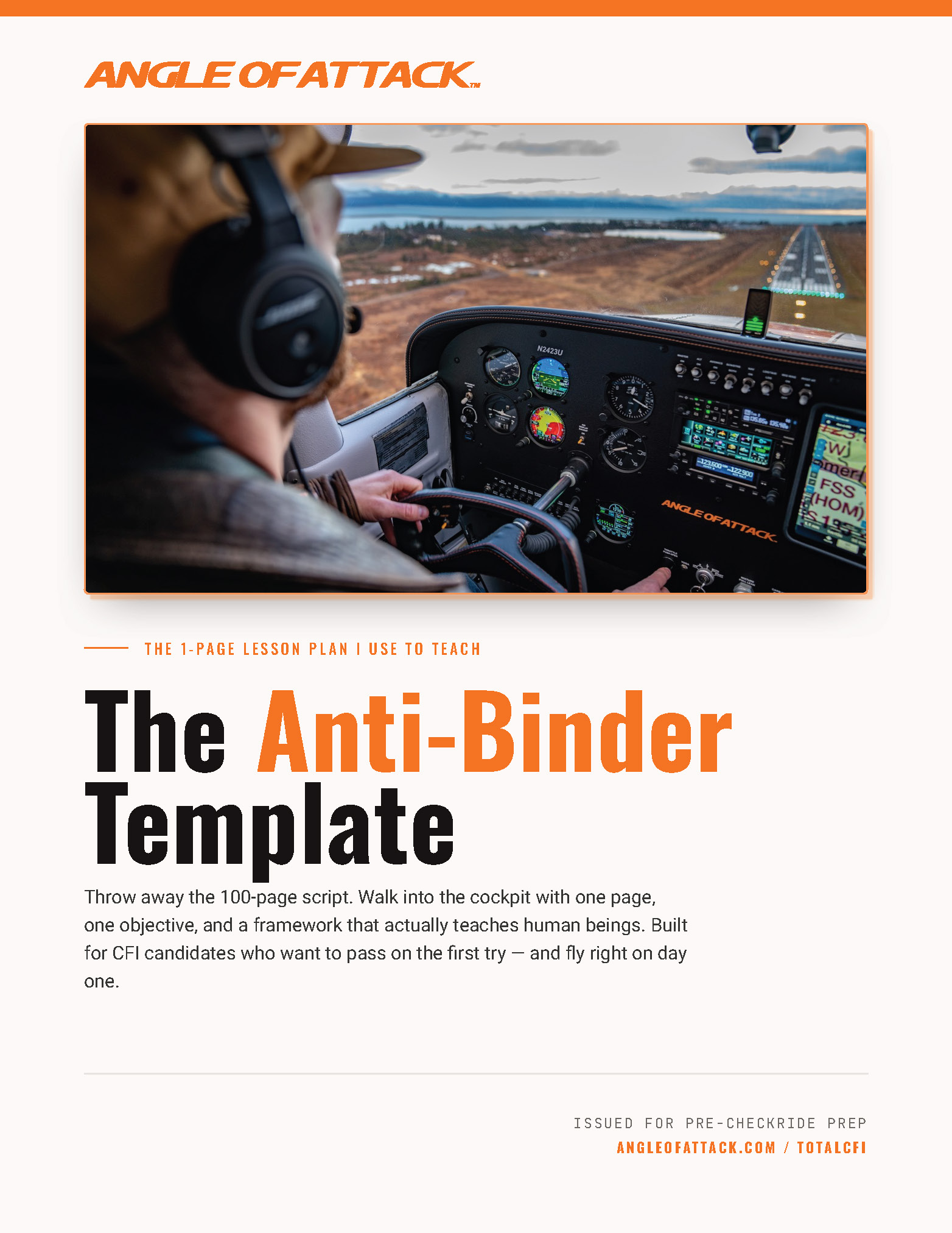
Most new CFIs build their airspace lesson from scratch: a binder of borrowed slides, a recycled whiteboard diagram, and a list of altitudes the student is supposed to memorize. The Anti-Binder Template is the one-page lesson framework I use to plan every lesson, including the airspace block. Scenario-first shape. Day-One focus. Same six-box plan you’ll see below.
Grab the Anti-Binder Template, Free →
Walking into your first lesson with a 50-page binder won't help you.
Get my Anti-Binder One-Page Lesson Plan Template free — the lesson plan tool I built for CFI candidates who want to be ready Day 1.
Get the Anti-Binder Template Free
WHAT'S IN THIS GUIDE
- 1Why Airspace Breaks Students (And Why Most CFIs Make It Worse)
- 2What Are the Six Classes of Airspace? (The Short Answer)
- 3How Do You Teach Airspace? (The “What’s Above / What’s Below” Drill)
- 4How Do You Read Airspace on a Sectional Chart?
- 5What Are Terrain, MEF, and the Chart Supplement?
- 6What Are the VFR Weather Minimums by Airspace Class?
- 7What Is the Mode C Veil?
- 8What Is Special Use Airspace?
- 9The Most Common Airspace Errors Students Make
- 10Frequently Asked Questions
Why Airspace Breaks Students (And Why Most CFIs Make It Worse)

Airspace is the single hardest concept a student pilot has to learn, and it’s the one most CFIs teach with a slide deck. Big mistake. Airspace is spatial. It bends around airports, it stacks above you and below you, it lives on a chart with terrain and obstacles and a 56-day update cycle. You don’t lecture airspace. You draw it.
Here’s the diagnostic. The student who can recite Class B ceilings and floors at the table can’t tell you, from the right seat with the windshield full of a Class B shelf, what airspace she’s about to enter. The vocabulary is intact. The spatial picture isn’t. That’s the gap that ruins primary students on cross-countries and the gap that wrecks new CFI candidates on the airspace teaching demonstration.
I had a student in the Wisconsin years who could write the Class B dimensions on the whiteboard better than I could. Specific altitudes, specific shelf rings, even the right phraseology for the Bravo clearance. We launched on her first cross-country toward a Bravo-shelf city. About fifteen miles out she looked at the windshield, looked at the chart on her kneeboard, looked back at the windshield, and said: “I don’t know which airspace I’m about to enter.” The recitation was perfect. The spatial picture was empty. That’s the difference between teaching airspace and training airspace.
Why does lecture fail here? Because airspace is a three-dimensional spatial relationship. What’s above you, what’s below you, what’s beside you, where the boundaries bend. Lecture is one-dimensional language. You can’t translate 3D space into a verbal list and expect the student to rebuild the geometry in her head. Especially not when she’s trying to fly the airplane at the same time.
The fix is structural. Every airspace lesson involves a sectional and a pencil. Not a slide. Not a whiteboard. A real, current, paper or iPad chart with terrain, airports, special use airspace, the Chart Supplement reference, and the airspace layered on top of all of it. The chart is the visual aid the FAA Aviation Instructor’s Handbook (FAA-H-8083-9B) discusses in its chapter on teaching aids (Chapter 8 in the 9B). The one designed to externalize a complex 3D environment so the student can manipulate it on a table.
Show the chart. Point at the chart. Make the student point at the chart. The recitation comes free.
What Are the Six Classes of Airspace? (The Short Answer)

Six classes. A through G, with F skipped because the U.S. doesn’t use it (ICAO does; it’s a regulatory detail that lives in 14 CFR Part 71). Here’s the short answer the student needs to be able to give in one breath.
- Class A. 18,000 MSL to FL600. IFR only. Pilot must be instrument-rated, aircraft must be IFR-equipped, transponder + ADS-B Out required.
- Class B. Generally surface to 10,000 MSL, sized like an upside-down wedding cake around the busiest airports — though dimensions are tailored to each airport (Denver tops out at 12,000 MSL, others lower). Always check the chart. ATC clearance required to enter per 14 CFR 91.131. Two-way radio, Mode C transponder, and ADS-B Out required. Private pilot certificate minimum. Students need a logbook endorsement per 14 CFR 61.94 / 61.95, valid 90 days, for a specific airport, and some Class B airports prohibit student solos entirely.
- Class C. Typically a 5 NM inner core from surface to 4,000 AGL plus a 10 NM outer shelf from roughly 1,200 to 4,000 AGL around mid-size towered airports. Two-way radio required before entry, Mode C transponder required, ADS-B Out required. You don’t need a “clearance,” you need a two-way communication.
- Class D. Surface to roughly 2,500 AGL around tower-controlled airports. Two-way radio required before entry. No equipment requirement specific to Class D, but Mode C and ADS-B Out still apply if you’re inside the Mode C / ADS-B veil or above 10,000 MSL (14 CFR 91.215 and 91.225).
- Class E. Controlled airspace below Class A and above Class G. The default en-route airspace and where most of your cross-country flying happens. No entry requirement for VFR. Depicted on the sectional three different ways (surface, 700 AGL, 1,200 AGL), and that’s where students get tangled. More in the next H2.
- Class G. Uncontrolled. From the surface up to the base of the overlying Class E. No ATC services. In remote areas it can extend up to 14,500 MSL (AIM 3-3-1).
The mental model: upside-down wedding cake. That’s the universal teaching analogy for Class B specifically. Concentric shelves stacking outward from the primary airport, each ring at a higher floor as you move farther out. Every student should be able to draw it from memory by the end of the second airspace lesson. The cake is the doorway. Walk the student through it on day one and the rest of the classes fit around the same idea.
How Do You Teach Airspace? (The “What’s Above / What’s Below” Drill)

This is the lesson. Six steps. Ten minutes. The student walks out seeing airspace instead of reciting it. I’ve run this drill with primary students, with CFI candidates, and with rusty private pilots who lost the chart in the years between their first checkride and their flight review. It works on all three.
Step 1: Spread a real, current sectional on the table. Not a slide. Not a whiteboard. Not a snapshot. A current paper chart or a current ForeFlight session on an iPad with the sectional layer up. One chart, one student, one pencil. Sit on the same side of the table as the student. Same orientation, same view of the chart. The chart between you is the airplane on the ramp. Treat it like one.
Step 2: Pick any airport on the chart. Point at it. Ask the student: “What class of airspace is the surface here?” She finds the answer in the chart legend: magenta dashed circle, solid magenta, solid blue, dashed blue, or no marking at all. The legend is the answer key. Make her use it.
Step 3: Go up. Once she’s named the surface airspace, ask: “What’s at 1,500 AGL above this point?” Then: “What’s at 5,000 MSL above this point?” Then: “What’s at 12,000 MSL above this point?” Three altitudes, three answers. She’s reading the chart for floors and ceilings. That’s the spatial picture being built right there on the table.
Step 4: Go down. Now move just outside the magenta line that surrounds the airport. “What’s at 500 AGL right here?” Then move back inside. “What’s at 800 AGL right here?” The student starts to see the line as a boundary that bends and changes the airspace stack on either side of it. That’s the moment Class E surface vs. Class E 700 AGL clicks. Visually, not verbally.
Step 5: Repeat across five different airports in ten minutes. Towered, non-towered, under a Class B shelf, isolated in Class G, near a special use area. Mix the geography. The pattern recognition has to generalize, not lock to one chart segment.
Step 6: Close with the visual coding check. Ask the student to circle a Class E surface area, a Class E 700 AGL area, and a Class E 1,200 AGL area on the chart, and explain how she knows which is which from the chart symbology alone. If she can do that, the lesson stuck.
I had a commercial student in California who had been “studying airspace” for two months and still couldn’t differentiate Class C from Class D on the sectional. Thirty minutes of this drill, five airports around the LA Basin, and right at the end she pointed at a spot two miles east of the Bravo and said: “The Class B shelf starts at 2,500 here. We’re in Class E surface, transitioning to Class B at 2,500.” That was the click. Once a student sees airspace as layers above a point on a chart, she’ll never lose it.
Why does this drill work? Because it’s spatial reasoning practice, the same skill the FAA tests on the airspace task in the Airman Certification Standards. The student isn’t recalling a list. She’s reading a 2D representation of a 3D environment and reconstructing the geometry. That’s the actual skill. Drill it ten times in ten minutes and you’ve trained it.
How Do You Read Airspace on a Sectional Chart?

A sectional is a 1:500,000 scale VFR chart. One inch on the paper is about 6.86 nautical miles in the air. Each chart covers roughly 340 by 340 NM and updates every 56 days. Everything you need to fly VFR through the airspace below 18,000 MSL is on it: airports, navaids, airspace, terrain, obstacles, special use areas, the Chart Supplement reference, and the legend that explains every symbol. The full symbol reference for AOA’s library is on our Sectional Symbols page. Read it once and reference it forever.
Here’s the visual coding for airspace specifically. Memorize the colors and line styles before you teach the lesson:
- Solid blue line. Class B boundary. The “upside-down cake” outer ring and shelf lines.
- Solid magenta line. Class C boundary. Two-ring concentric pattern (inner core + outer shelf).
- Dashed blue line. Class D boundary. Around tower-controlled airports.
- Dashed magenta line. Class E surface area extending to the surface at an airport (typically a non-towered field with instrument approaches).
- Magenta vignette. The soft “fuzzy edge” where Class E begins at 700 AGL.
- Blue zipper edge (the serrated blue line on the chart). Class E begins at a different charted altitude (often 1,200 AGL).
- Hatched borders (blue or magenta). Special use airspace, with the type and altitudes labeled inside.
Airport symbols are color-coded too, and the rule here is the opposite of airspace: blue airport symbol = towered, magenta airport symbol = non-towered. Around the symbol you’ll see the identifier, field elevation, longest runway length, CTAF or tower frequency, and pattern altitude. The “tick marks” around the circle mean fuel is available. The star above the identifier means the airport has a rotating beacon operating sunset to sunrise. A part-time tower is indicated separately by an asterisk on the tower frequency — check the Chart Supplement for hours.
Teach the chart by opening the legend on day one and walking the student through it. Don’t memorize the legend, read it. The legend is the documentation. The pilot who knows where the legend lives never has to memorize a symbol again. The new CFI who teaches “look at the legend first” gives her student a tool that outlasts every cross-country quiz.
The authoritative reference is the FAA Aeronautical Chart Users’ Guide, 16th Edition (effective 22 January 2026). It explains every symbol, every line style, every shading convention. You don’t memorize the ACUG. You teach the chart and reference the guide.
What Are Terrain, MEF, and the Chart Supplement?

Airspace lives on a chart with terrain, obstacles, and a companion document the student has probably never opened. Three pieces fit here, and they’re the parts of the sectional new CFIs most often skip.
Terrain depiction. The sectional shows elevation three ways. Contour lines at 500-foot intervals in most areas (1,000-foot intervals in mountainous regions). Color tints called hypsotints (light green for the lowest elevations, ramping through tan and brown for higher terrain). And shaded relief, a northwest light source painting shadows on the southeast sides of hills. Teach all three together. The student who only reads colors misses contour detail; the student who only reads contour lines misses the at-a-glance terrain picture.
Obstruction symbols. Two main symbols, one for obstructions under 1,000 AGL, one for obstructions 1,000 AGL and above. A small lightning-bolt or strobe icon beside the symbol means the obstruction is lighted. The number above the symbol is the obstruction’s top in MSL; the number in parentheses below is the height AGL.
Maximum Elevation Figure (MEF). The big blue number centered in each 30-minute lat/long quadrant on the sectional. It tells you the highest terrain or obstacle elevation in that quadrant, in hundreds of feet, rounded up, with a 100-foot vertical clearance buffer baked in. Not 1,000 feet. Not a minimum safe altitude. A planning aid with a 100-foot margin for unportrayed obstacles and chart error. The most common student misconception is that MEF is a “safe altitude.” It isn’t. It’s a figure. The pilot still has to apply 14 CFR 91.119 minimum safe altitudes on top of that: 1,000 feet over the highest obstacle within a 2,000-foot horizontal radius in congested areas; 500 feet above the surface elsewhere; emergency-landable altitude over open water and sparsely populated areas. Teach MEF and 91.119 together on day one.
Treating MEF as a minimum safe altitude is a CFIT setup. The 100-foot buffer is a chart-error margin, not a clearance margin. In mountainous terrain, teach the student to add at least 1,000 feet to the MEF for real-world planning. That’s the Restorative Airmanship frame: regulation tells you the floor; airmanship tells you what altitude actually keeps the airplane out of the rocks.
Chart Supplement. This is the 56-day pilot publication that used to be called the Airport/Facility Directory. It lives in seven regional volumes for the contiguous U.S. plus Puerto Rico and the U.S. Virgin Islands, and the digital version is updated more frequently. The Chart Supplement holds what won’t fit on a sectional: tower hours, runway dimensions and surface, fuel availability, frequencies, navaids, special procedures, airport sketches with taxiway layouts, and notes on noise abatement or one-way runways. 14 CFR 91.103 requires the PIC to become familiar with “all available information concerning that flight” before departure, and the Chart Supplement is one of the documents that rule pulls in. Teach the student to open it before every cross-country, every flight to an unfamiliar airport, and every solo to a non-home field. The Chart Supplement also feeds the pre-solo endorsement: under 14 CFR 61.87(b)(7) the student must demonstrate knowledge of airspace rules and procedures for the specific airport where the solo flight will be performed, and AC 61-65J provides the endorsement-template language.
What Are the VFR Weather Minimums by Airspace Class?
The minimums are in 14 CFR 91.155. They split at 10,000 MSL because at higher altitudes you need more visibility and more cloud clearance to detect and avoid faster traffic. The student who memorizes them as a table fails the application; the student who writes them from memory and then checks her work owns them.
| Airspace | Visibility | Distance From Clouds |
|---|---|---|
| Class B | 3 SM | Clear of clouds |
| Class C, D, E (less than 10,000 MSL) | 3 SM | 500 ft below / 1,000 ft above / 2,000 ft horizontal |
| Class E (10,000 MSL and above) | 5 SM | 1,000 ft below / 1,000 ft above / 1 SM horizontal |
| Class G, 1,200 AGL and below, day | 1 SM | Clear of clouds |
| Class G, 1,200 AGL and below, night | 3 SM | 500 / 1,000 / 2,000 |
| Class G, above 1,200 AGL, below 10,000 MSL, day | 1 SM | 500 / 1,000 / 2,000 |
| Class G, above 1,200 AGL, below 10,000 MSL, night | 3 SM | 500 / 1,000 / 2,000 |
| Class G, 10,000 MSL and above | 5 SM | 1,000 / 1,000 / 1 SM |
The mnemonic most CFIs teach is “3-152” for the Class C/D/E-below-10,000 row: 3 SM, 500 below, 1,000 above, 2,000 horizontal. Useful, but on its own it’s a phrase, not a frame. Pair it with the table and have the student write it from memory three days in a row.
Two things every student misses on the oral. First, student pilots have their own minimums in 14 CFR 61.89: 3 SM day, 5 SM night, regardless of the airspace they’re in. The student pilot minimum is always the higher of the airspace minimum or the personal minimum. Second, Class B is “clear of clouds,” not 500/1,000/2,000. Because you’re being separated by ATC, the cloud-clearance rules relax. Most students assume B is the strictest because the airspace is “big.” It’s actually the loosest on cloud clearance, but the strictest on entry.
Teach the table on a whiteboard once, then have the student rebuild it on paper every lesson for two weeks. Recognition comes from production, not consumption.
What Is the Mode C Veil?

The Mode C veil is the 30 NM circle around every primary Class B airport, surface to 10,000 MSL, inside which Mode C transponder is required by 14 CFR 91.215. It’s the most-missed concept on student-pilot oral exams. Here’s why.
The student looks at a Bravo on the chart, sees the shelf at 4,000 MSL, and plans her cross-country to fly under the shelf, say at 2,500 MSL, to avoid the airspace. Smart move on the airspace. Missed completely on the transponder. The veil still applies. The veil is a transponder requirement, not an airspace boundary. You can be in Class E underneath a Class B shelf and still be inside the Mode C veil, and Mode C is still required.
Show the student the veil on the chart. It’s depicted as a thin solid magenta circle 30 NM out from the primary Class B airport. Trace it with a finger. Then ask: “If you’re inside this circle at 2,500 MSL, what equipment do you need?” The answer is Mode C transponder and ADS-B Out (14 CFR 91.225). The ADS-B Out mandate has been in force since January 1, 2020, so for any post-2020 student pilot the two requirements travel together as a single “transponder + ADS-B Out” pair. The student who can answer that one question on the chart never misses it on the oral.
The exception that catches even careful students: if your aircraft was not originally certificated with an engine-driven electrical system (or it’s a balloon or glider), you can operate inside the veil without Mode C, provided you stay (a) outside Class A, B, or C airspace itself, and (b) below the Class B/C shelf ceiling or 10,000 MSL, whichever is lower (per 14 CFR 91.215(b)(3)). Narrow exception. Most trainers it doesn’t apply to. Teach it as the legal nuance, not the operational rule. This veil question is also a common pre-solo quiz topic — see our Pre-Solo Quiz Guide for the exact wording students see on the oral.
What Is Special Use Airspace?
Special use airspace is everything that isn’t class A-G but still has rules. The full reference is AIM Chapter 3, Section 4. The student needs to recognize each type on the chart and know what it does.
- Prohibited Area (P-XXX). Regulatory. Entry forbidden for national security or welfare. Example: the airspace over the White House (P-56). Don’t go in. Period.
- Restricted Area (R-XXX). Regulatory. Entry permitted only with permission from the controlling agency. Hazardous activities like artillery fire, aerial gunnery, or guided missile launches. If the area’s “hot,” you stay out.
- Warning Area (W-XXX). Nonregulatory. International airspace, generally more than 3 NM offshore, containing activity hazardous to non-participating aircraft. Treated like a restricted area in practice but enforced through “use at your own risk.”
- Military Operations Area (MOA). Nonregulatory. Named (e.g., BAGDAD MOA). High-speed maneuvering by military aircraft. VFR pilots may transit but should check with the controlling agency for status (“is it hot?”) and exercise extreme vigilance.
- Alert Area (A-XXX). Nonregulatory. High volume of pilot training or unusual aerial activity. Both transiting and participating pilots are responsible for collision avoidance.
- Controlled Firing Area (CFA). Not charted. Activity is suspended when aircraft are detected, so it doesn’t restrict pilots in practice.
- National Security Area (NSA). Nonregulatory. Pilots are requested to avoid; in some cases entry can be temporarily prohibited by regulatory action.
- TFR (Temporary Flight Restriction). Not pre-charted. Issued by NOTAM. The most common reason a pilot blunders into restricted airspace is a TFR she didn’t check before takeoff. Train the student to use 1800wxbrief.com or ForeFlight’s NOTAM filter to pull TFRs the morning of the flight, not the night before. TFRs pop up same-day. The CFI who teaches this on lesson one creates a pilot who never busts a presidential TFR.
Each type has a distinctive hatched border on the sectional. Color and pattern vary slightly by type. Teach the student to read the label inside the hatching: type (P, R, W, A, MOA, NSA), identifier, altitudes, and times of use. The label is the answer key. Make the student use it.
The Most Common Airspace Errors Students Make

Errors are data. Each one points you at the next teaching move. Here are the five I see most often.
1. Confusing Class C and Class D. Similar-looking magenta and blue circles, similar floors and ceilings, different requirements. Diagnostic: “What color is the boundary? What’s the entry rule?” Cue: solid magenta = Class C = Mode C required; dashed blue = Class D = no Mode C requirement specific to D.
2. Forgetting the Mode C veil under a Class B shelf. The “I’ll just go under the Bravo” trap. Diagnostic: “You’re at 2,500 MSL underneath the shelf, 25 NM from the primary airport. What equipment do you need?” Cue: Mode C and ADS-B Out. The veil doesn’t care about the shelf.
3. Misreading Class E (surface vs. 700 AGL vs. 1,200 AGL). Three different chart conventions: dashed magenta, magenta vignette, blue serrated edge. Diagnostic: “Show me a Class E surface area on this chart and tell me how you know.” Cue: dashed magenta = surface; vignette = 700 AGL; serrated blue edge = 1,200 AGL.
4. Mixing up VFR mins for Class E vs. Class G below 10,000 MSL. Diagnostic: “What’s the visibility minimum at 800 AGL in Class G at night?” Cue: the night Class G minimum jumps to 3 SM, 500/1,000/2,000. It’s the visibility and the cloud clearance that change at sunset.
5. Treating MEF as a minimum safe altitude. Diagnostic: “If MEF is 65 (6,500 MSL), can you fly at 6,500 MSL through that quadrant?” Cue: MEF is a planning aid with 100 feet of clearance buffer. Minimum safe altitude lives in 14 CFR 91.119, not on the chart number.
A CFI candidate I mentored in North Carolina planned to teach airspace in one 90-minute ground session. The session ran three hours, the student got more confused, and the candidate left the lesson convinced she’d “covered” everything. I broke it for the next student into three short sessions: the classes one day, the drill the next, the integration with weather mins and equipment the third. By lesson three the student could draw the airspace stack around any airport on the chart from memory. Same content. Same student profile. Three sessions instead of one. The difference was the spacing, not the words.
If you’re a new CFI working through how to build this airspace teaching sequence in your own lessons, the TotalCFI Course is where I lay out the full scenario-first method this lesson sits inside. Airspace is one application of the broader teaching frame in Lesson 4.1, Teaching to the ACS Without Teaching the ACS. Same Day-One focus, same scenario-first shape. Be the CFI your student trusts on the chart.
For the full sectional symbology reference and a deeper walkthrough of every chart marking, see our Sectional Symbols guide. And for the sibling teaching playbooks in this cluster, see How to Become a CFI (the pillar), How to Teach Radio Communications, the Pre-Solo Quiz Guide (airspace is one of the 14 CFR 61.87(b) pre-solo knowledge areas, with endorsement template language in AC 61-65J), the CFI Lesson Plan Template for the six-box format, and the CFI Oral Exam Questions deck. Airspace is a guaranteed oral topic on every CFI checkride.
Frequently Asked Questions
How do you remember the six classes of airspace?
Don't. Draw them instead. The student who chair-flies the "What's Above / What's Below" drill on a real sectional ten times in ten minutes outperforms the student who memorized a list. Pick five airports on a chart. For each one, name the airspace at the surface, at 1,500 AGL, at 5,000 MSL, and at 12,000 MSL. The pattern teaches itself. The mnemonic everyone repeats, "All B Cars Drive East Generally," is a memory peg, not a frame. Use it as scaffolding, not as the lesson.
What's the difference between Class B and Class C?
Class B requires an explicit ATC clearance ("Cleared into the Class Bravo") to enter. Class C requires only a two-way radio communication established before entry; the controller saying your callsign back to you is the threshold. Class B requires private pilot minimum (students need a 61.94/61.95 logbook endorsement, valid 90 days, for a specific airport). Class C has no certification minimum beyond student pilot. Class B is shaped like an upside-down wedding cake; Class C is typically two concentric rings, a 5 NM inner core to 4,000 AGL and a 10 NM outer shelf from roughly 1,200 to 4,000 AGL.
Can a student pilot fly through Class B airspace?
Yes, with a 61.94 or 61.95 logbook endorsement: ground and flight training at the specific Class B airport with an authorized instructor, endorsement valid for 90 days. Some Class B airports (listed in 14 CFR Part 91 Appendix D) prohibit student-pilot solo entirely. Always check the appendix and the Chart Supplement before planning a Bravo solo with a primary student.
What does the magenta shading on a sectional mean?
The soft "magenta vignette" (a fuzzy magenta edge) means Class E airspace begins at 700 AGL in that area, typical around non-towered airports with instrument approaches. A dashed magenta line means Class E surface area, typically a non-towered airport where Class E goes all the way down. A solid magenta line means a Class C boundary. Three different magenta conventions, three different airspace structures. The chart legend explains each one.
How often is a sectional chart updated?
Every 56 days, on the same cycle as the Chart Supplement. The expiration date is printed on the cover. Flying with an out-of-date sectional doesn't violate a regulation directly, but it does jeopardize the 14 CFR 91.103 "preflight action" obligation if a relevant chart change (new airspace, new tower, runway change) wasn't captured. Teach the student to check the cycle date as part of preflight.
What's the difference between MEF and minimum safe altitude?
MEF (Maximum Elevation Figure) is a planning aid printed in each 30-minute lat/long quadrant on the sectional. It shows the highest terrain or obstacle in that quadrant with a 100-foot vertical buffer baked in. Not 1,000 feet. It's not a clearance margin or a "safe" altitude. Minimum safe altitude lives in 14 CFR 91.119: 1,000 feet above the highest obstacle within 2,000 feet horizontally over congested areas, 500 feet over open areas (with additional distance from persons, vessels, vehicles, structures), and emergency-landable altitude over open water and sparsely populated areas. Teach both, and teach that they're different.
If the CFI checkride is keeping you up at night, you're prepping for the wrong thing.
TotalCFI teaches you to walk into the oral as a teacher, not a test-taker — the reframe most candidates only figure out after they've already failed once.

Don’t. Draw them instead. The student who chair-flies the “What’s Above / What’s Below” drill on a real sectional ten times in ten minutes outperforms the student who memorized a list. Pick five airports on a chart. For each one, name the airspace at the surface, at 1,500 AGL, at 5,000 MSL, and at 12,000 MSL. The pattern teaches itself. The mnemonic everyone repeats, “All B Cars Drive East Generally,” is a memory peg, not a frame. Use it as scaffolding, not as the lesson.
