
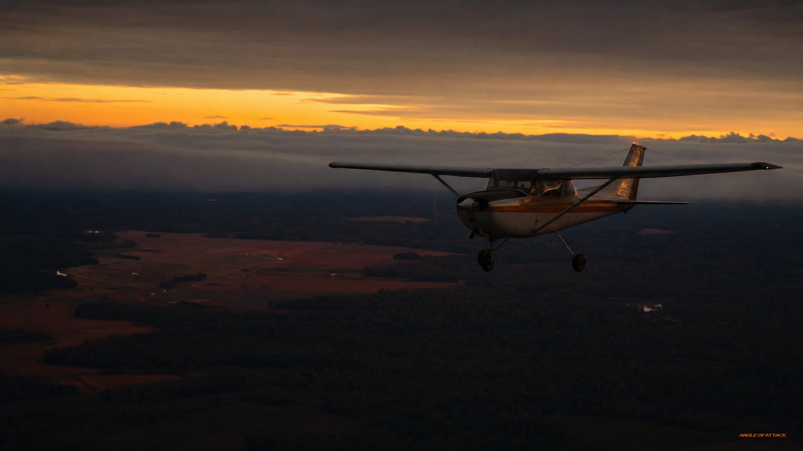
What Is a Warm Front? Weather, Clouds & Hazards for Pilots
A warm front is the boundary where an advancing mass of warm air rides up and over a retreating, denser mass of cold air. Because the warm air climbs that shallow slope gradually, it cools, condenses, and spreads wide layers of stratiform cloud, steady precipitation, and low visibility ahead of the surface front. For a Private Pilot, that means a warm front rarely arrives with a bang the way a cold front does. It creeps in. The ceiling lowers, the air smooths out, the rain turns to a steady drizzle, and the visibility quietly closes down on you over a couple hundred miles. Understanding that slow squeeze is the difference between a confident go/no-go call and getting trapped on top of a deck you can’t get back down through.
- Warm air overrides cold air. A warm front forms where lighter, warmer air slides up and over the wedge of cooler, denser air ahead of it on a very shallow slope.
- Stratiform clouds dominate. The gradual lift builds layered clouds in a predictable sequence — cirrus, then cirrostratus, altostratus, nimbostratus, and finally low stratus and fog near the surface front.
- Precipitation is steady, not violent. Expect continuous or intermittent rain, drizzle, or snow spread over a wide band ahead of the front, not the short, heavy downpours of a cold front.
- Low ceilings and poor visibility are the real hazard. The biggest danger to a VFR pilot is IFR conditions, widespread fog, and the freezing rain or icing that can hide in a winter warm front.
- Winds shift gradually. As a warm front passes, the wind veers (shifts clockwise) and the temperature and dewpoint rise as the warmer, more humid air mass takes over.
- It moves slowly. A warm front typically advances at roughly half the speed of a cold front, so the rotten weather lingers longer over any one airport.
WHAT’S IN THIS GUIDE
- 1What is a warm front in simple terms?
- 2How does a warm front form?
- 3What clouds and weather come with a warm front?
- 4What hazards should pilots watch for?
- 5Warm front vs. cold front: how do they differ?
- 6What happens to wind and temperature as it passes?
- 7A warm front squeeze over the Alaska coast
- 8PLT Study Guide
- 9Frequently Asked Questions
What is a warm front in simple terms?
A warm front is the leading edge of a warm air mass that is advancing into and replacing a cooler air mass. Warm air is less dense than cold air, so instead of plowing through, the warm air glides up and over the top of the cold air along a gentle, shallow slope. That long, lazy ramp is exactly why warm-front weather is spread out and layered rather than concentrated and violent.
On a surface analysis chart, a warm front is drawn as a red line studded with red half-circles (semicircles) pointing in the direction the front is moving. When you see those rounded bumps on a prog chart, picture warm, moist air sliding up a ramp — the bumps point the way the warm air is headed.
The key idea to lock in: the air ahead of the front is the cold air mass you are currently sitting in, and the warm air arrives aloft first, hours or even a day before the surface front reaches your airport. That is why the high cirrus shows up long before the rain does.
How does a warm front form?
A warm front forms when a moving mass of warm air overtakes and rides up over a slower, denser mass of cold air. As the warm air is forced to ascend that shallow slope, it expands and cools through the adiabatic process. When it cools to its dewpoint, the moisture condenses, and because the lift is gradual and stable, the result is broad sheets of stratiform cloud rather than tall, lumpy convection.
The slope of a warm front is shallow — often on the order of 1 mile of vertical rise for every 100 to 200 miles of horizontal distance. That gentle angle is why the cloud band can stretch hundreds of miles ahead of the surface position of the front. The weather you fly into is really a giant, tilted wedge of cloud lying over the cold air below.
How much weather you get depends on the moisture and stability of the warm air being lifted. Stable, moist warm air gives you that classic deck of layered stratus and steady rain. If the overriding warm air happens to be moist and unstable, you can get embedded cumulus and even thunderstorms hidden inside the stratiform layers — a nasty surprise you can’t see coming, and a good reason to take a thorough weather briefing seriously.
What clouds and weather come with a warm front?
Warm fronts produce a predictable, stacked sequence of stratiform clouds that thickens and lowers as the front approaches. The first sign aloft is high, wispy cirrus, followed by cirrostratus (often a halo around the sun or moon), then altostratus, then rain-bearing nimbostratus, and finally low stratus and fog right ahead of the surface front. Reading that sequence overhead is like reading a countdown clock.
Here is the typical progression a pilot sees as a warm front moves toward the airport:
| Stage (distance ahead of front) | Cloud type | Typical weather |
|---|---|---|
| Far ahead (~1,000 mi / 1+ day) | Cirrus | Clear and smooth; first high-cloud warning |
| Approaching (~600 mi) | Cirrostratus | Halo around sun/moon; high overcast forming |
| Closer (~300 mi) | Altostratus | Sky greys over; ceiling begins lowering |
| Near (~100 mi) | Nimbostratus | Steady, continuous rain or snow; low ceiling |
| At the front | Stratus / fog | Low IFR ceilings, drizzle, widespread fog |
The precipitation tied to a warm front is steady and continuous — light to moderate rain, drizzle, or snow falling over a wide band — not the short, heavy bursts you get with a cold front. Behind the front, once the warm air mass takes over at the surface, conditions usually improve: the rain tapers, the ceiling lifts, and the air becomes warmer and more humid.
One subtle point worth memorizing: if the warm air aloft is moist and stable, you get layered clouds and good but smooth flying once you’re on top. If that overriding air is moist and unstable, cumuliform clouds and embedded thunderstorms can grow inside the otherwise innocent-looking stratus — invisible until you’re in them.
What hazards should pilots watch for?
The primary warm-front hazard for a Private Pilot is the slow collapse of VFR conditions into low ceilings, poor visibility, and widespread fog. Unlike a cold front’s brief, violent line of weather, a warm front spreads marginal-to-IFR conditions over hundreds of miles. You can launch in decent VFR and, an hour later, find yourself boxed in by a lowering ceiling with nowhere good to land.
Fog is a signature warm-front problem. As steady rain falls through the cooler air below the front, it saturates that air, and widespread precipitation-induced fog and low stratus form across a broad area. That is the textbook recipe for getting trapped: clouds above, fog below, and a runway you can no longer see.
In winter, the real teeth come out. When rain from the warm air aloft falls through a layer of below-freezing air near the surface, you get freezing rain — and structural icing is one of the most dangerous things a light-airplane pilot can encounter. Freezing rain along a warm front is a hard no-go for a typical trainer. Ice destroys lift, adds weight, and can do it faster than you can climb out of it.
The takeaways for your go/no-go: respect the trend, not just the snapshot. A current METAR showing marginal VFR ahead of an approaching warm front is a ceiling that is going to keep dropping. Solid weather knowledge is the foundation of every good decision like this, and our free Total Student Pilot course walks you through reading these systems from the ground up so you can make that call with confidence.
Warm front vs. cold front: how do they differ?
A warm front and a cold front are opposites in almost every way that matters to a pilot. A warm front has warm air overriding cold air on a shallow slope, producing wide, layered clouds and steady precipitation that moves in slowly. A cold front has cold air shoving under warm air on a steep slope, producing tall cumulus, brief but violent storms, and a fast-moving line of weather.
| Feature | Warm front | Cold front |
|---|---|---|
| Air movement | Warm air rides up over cold air | Cold air wedges under warm air |
| Slope | Shallow (gradual lift) | Steep (abrupt lift) |
| Speed | Slower (~half a cold front) | Faster |
| Clouds | Stratiform (layered) | Cumuliform (towering) |
| Precipitation | Steady, continuous, widespread | Heavy, brief, narrow band |
| Visibility | Poor over a wide area | Poor briefly, then clears sharply |
| Symbol on chart | Red line, red half-circles | Blue line, blue triangles |
| Wind shift | Gradual veer | Abrupt veer |
| Hazard profile | Low ceilings, fog, icing/freezing rain | Turbulence, thunderstorms, wind shear |
The practical difference comes down to timing and texture. Cold-front weather is a punch — intense, short, and then it clears. Warm-front weather is a slow squeeze — milder in any one moment, but it lingers and spreads, and it is far more likely to quietly trap a VFR pilot under a lowering deck than to scare them off with a wall of black cloud.
What happens to wind and temperature as it passes?
As a warm front passes your position, the surface wind veers (shifts clockwise) and the temperature and dewpoint both climb as the warmer, more humid air mass settles in. In the Northern Hemisphere, you might see the wind back to a southerly or southeasterly flow ahead of the front, then veer to a more southwesterly direction after passage. The shift is gradual, matching the gentle slope of the front itself.
Before the front arrives, you are in the cooler air mass: cool temperatures, a smaller temperature-dewpoint spread as rain saturates the air, falling pressure, and that lowering overcast. After the warm front passes, the temperature rises noticeably, the dewpoint rises with it, pressure stops falling and steadies, and the precipitation usually tapers off to drizzle or clears.
A narrowing temperature-dewpoint spread is your fog and low-cloud warning. When the temperature and dewpoint converge — which is exactly what steady warm-front rain does to the air below — the air is at or near saturation, and that is when fog and low stratus form. Watching that spread close on the METARs ahead of a warm front tells you the visibility is about to go.
If you want to build the kind of weather instinct that turns these patterns into automatic go/no-go reasoning, our Private Pilot Ground School takes you deep into frontal systems, weather charts, and real-world decision-making well beyond what you’ll see on the knowledge test.
A warm front squeeze over the Alaska coast
I learned the warm-front lesson the slow, uncomfortable way flying a Cessna 172 along the Alaska coast. The morning briefing showed a warm front pushing in off the Gulf of Alaska — high cirrus already overhead, with the deck forecast to lower through the afternoon. On paper it looked benign. No storms, no convection, just “rain developing.” That word, developing, is the trap.
I launched VFR with what looked like a comfortable ceiling. An hour out, the cirrus had thickened to altostratus, the mountains ahead were softening into haze, and the rain had started — light, steady, the kind that doesn’t feel threatening. But the ceiling kept stepping down. By the time I started genuinely thinking about a turn-around, the visibility behind me had already closed up nearly as much as the visibility ahead. That is the warm-front squeeze: it tightens from both ends.
I made the right call — I turned around early enough and put it down at an intermediate strip while I still owned a real out — but only because I’d been raised to fly the trend, not the snapshot. The METAR I’d read at takeoff was already history; the front owned the real forecast.
Here is what I want every student to take from that flight: a warm front almost never says no out loud. It doesn’t throw a black wall at you. It just lowers the ceiling a little, and a little more, and waits for you to keep flying into it. The pilots who get caught aren’t the ones who saw a thunderstorm and went anyway — they’re the ones who saw “light rain, ceiling 2,500” and trusted the snapshot. Respect the slope, respect the trend, and always keep an out behind you.
PLT Study Guide
These are the FAA knowledge-test Learning Statement Codes (PLT codes) this topic maps to, in their official wording, translated into plain-English study points. (Note: the warm-front material does not fall under PLT031 — Recall isobars / associated winds — which deals with pressure-gradient winds, not frontal weather.)
- PLT511 — Recall weather associated with frontal activity / air masses. Know that a warm front is warm air overriding retreating cold air on a shallow slope, producing widespread stratiform cloud and steady precipitation. Behind the front, warmer, more humid air takes over and conditions generally improve.
- PLT192 — Recall clouds: types / formation / resulting weather. Be able to name the warm-front cloud sequence — cirrus, cirrostratus, altostratus, nimbostratus, then low stratus/fog — and connect stratiform (layered) clouds to stable air and steady rain.
- PLT344 — Recall precipitation: types / characteristics. Warm fronts bring continuous or intermittent rain, drizzle, or snow over a wide band. Know that freezing rain forms when precipitation from the warm air aloft falls through a below-freezing layer near the surface.
- PLT512 — Recall weather conditions: temperature / moisture / dewpoint. Understand that as steady rain falls into the cooler air ahead of the front, the temperature-dewpoint spread narrows toward saturation, and that the temperature and dewpoint both rise after the warm front passes.
- PLT226 — Recall fog: types / formation / resulting weather. Recognize that widespread precipitation-induced fog and low stratus form when steady warm-front rain saturates the cooler air beneath the front — a classic low-visibility hazard.
Frequently Asked Questions
What is a warm front in aviation weather?
A warm front is the boundary where an advancing warm air mass rides up and over a retreating, denser cold air mass on a shallow slope. The gradual lift cools the warm air to its dewpoint, producing wide layers of stratiform cloud, steady precipitation, and lowering ceilings ahead of the surface front.
What kind of clouds does a warm front produce?
Warm fronts produce stratiform (layered) clouds in a thickening, lowering sequence: high cirrus first, then cirrostratus, altostratus, nimbostratus, and finally low stratus and fog near the surface front. Because the lift is gradual and stable, the clouds spread out flat rather than building into tall cumulus.
Is a warm front dangerous for VFR pilots?
Yes, primarily because it spreads low ceilings, poor visibility, and widespread fog over hundreds of miles. The danger is the slow squeeze — conditions lower gradually and can trap a VFR pilot under a deck. In winter, freezing rain along a warm front creates serious structural icing and is a hard no-go for a typical trainer.
How fast does a warm front move?
A warm front generally moves more slowly than a cold front, often at roughly half the speed. Because it advances slowly and its cloud band stretches far ahead of the surface position, warm-front weather lingers over any one airport longer, keeping ceilings low and visibility poor for an extended period.
How is a warm front shown on a weather chart?
A warm front is drawn as a solid red line with red half-circles (semicircles) along it. The rounded bumps point in the direction the warm air is moving. By contrast, a cold front is a blue line with blue triangles, and a stationary front alternates half-circles and triangles on opposite sides.
What happens to the wind when a warm front passes?
As a warm front passes, the surface wind veers — it shifts clockwise — and both temperature and dewpoint rise as warmer, more humid air takes over. Ahead of the front the wind often flows from a southerly direction; after passage it typically veers toward the southwest, with the shift being gradual rather than abrupt.
What is the difference between a warm front and a cold front?
A warm front has warm air gliding up over cold air on a shallow slope, making wide layered clouds and steady, widespread rain that moves in slowly. A cold front has cold air wedging under warm air on a steep slope, making towering clouds, brief violent storms, and a fast-moving, narrow band of weather.
Why does fog form ahead of a warm front?
Steady rain falling from the warm air aloft saturates the cooler air below the front, narrowing the temperature-dewpoint spread until the air reaches saturation. That widespread saturation produces precipitation-induced fog and low stratus across a broad area, which is a major reason warm fronts cause such persistent low-visibility conditions.
Master every system on your checkride — and on day one.
The Private Pilot Ground School breaks down every FAA subject area in the same plain-English, real-world way you just read — with quizzes, scenarios, and the explanations that finally make it click.
Warm fronts won’t announce themselves with drama. They lower the ceiling quietly, spread fog over the whole region, and reward the pilot who reads the trend instead of the snapshot. Learn the cloud sequence, watch the temperature-dewpoint spread, and treat “light rain developing” as the warning it really is. Do that, and a warm front becomes a system you plan around with confidence — not one that surprises you in the air.


ON THE SAME TOPIC
What Is Aircraft Stability? Static, Dynamic & Why It Keeps You Flying Straight
What Is Aircraft Stability? Static, Dynamic & Why It Keeps You Flying Straight 16 min read Last updated June 2026 · Chris Palmer Aircraft stability is an airplane’s built-in tendency to return to its original flight attitude after a disturbance — a gust, a control input, a bump — without the pilot having to fight […]
 Read more
What Is Aircraft De-Icing? A Student Pilot’s Guide to Ice Removal and Prevention
What Is Aircraft De-Icing? A Student Pilot’s Guide to Ice Removal and Prevention 17 min read Last updated June 2026 · Chris Palmer Aircraft de-icing is the process of removing ice, frost, and snow that has already formed on an airplane’s surfaces — usually with heated fluid sprayed on the ground or with onboard systems […]
Read more 
What Is Adverse Yaw? The Reason Your Nose Swings the Wrong Way in a Turn
What Is Adverse Yaw? The Reason Your Nose Swings the Wrong Way in a Turn 32 min read Last updated June 2026 · Chris Palmer Adverse yaw is the tendency of an airplane’s nose to swing toward the outside of a turn — the opposite direction you’re rolling — at the moment you deflect the […]
Read more 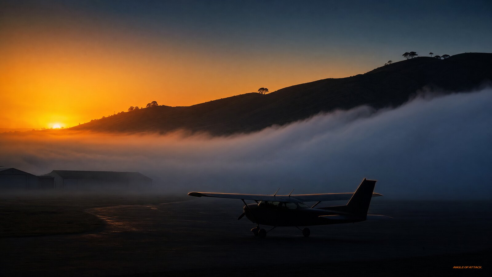
Advection Fog Explained: The Moving Fog That Blankets Coastlines and Catches Pilots Off Guard
Advection Fog Explained: The Moving Fog That Blankets Coastlines and Catches Pilots Off Guard 25 min read Last updated June 2026 · Chris Palmer Advection fog forms when warm, moist air moves horizontally on the wind over a colder surface, such as cool ocean water or chilled ground, cooling from below until the air reaches […]
Read more 
Stay Connected
Be the very first to get notified when we publish new flying videos, free lessons, and special offers on our courses.
